Suggested Searches

1 min read

Typhoon Mawar

Instruments:
2005-08-24 00:00:00
August 24, 2005

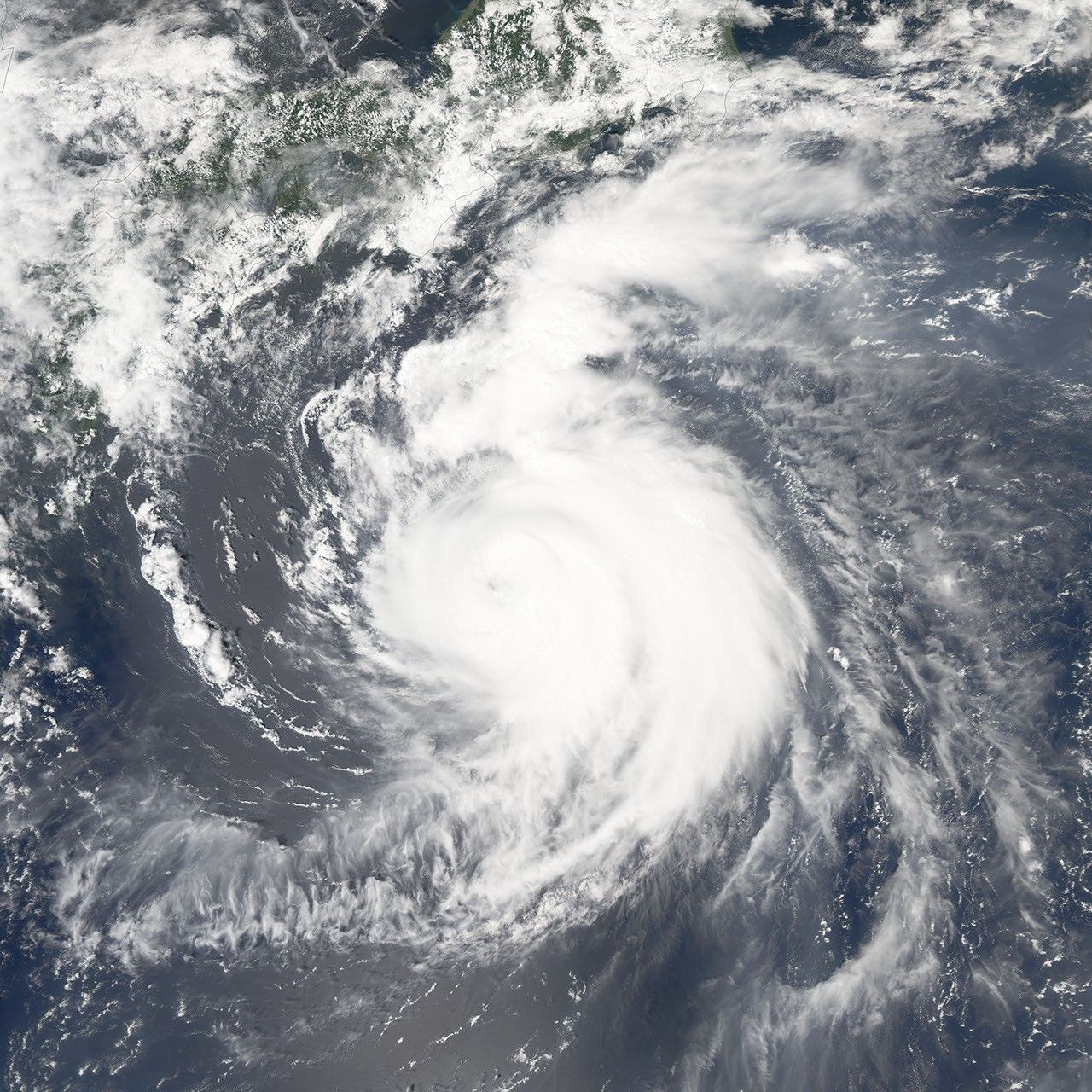
Typhoon Mawar was approaching the coast of Japan on the afternoon of August 24, 2005. The Moderate Resolution Imaging Spectroradiometer (MODIS) on NASA’s Aqua satellite captured this image at 1:05 p.m. local time. At this time, Mawar had peak winds around 195 km/hr (120 mph). It is a few hundred kilometres south of Tokyo and heading north at around 12 mph. Forecasters call for it to come ashore in southern Honshu (the largest of the islands that make up Japan) in the afternoon of August 25, 2005.

References & Resources

NASA image created by Jesse Allen, Earth Observatory, using data obtained courtesy of the MODIS Rapid Response team.

You may also be interested in:

Stay up-to-date with the latest content from NASA as we explore the universe and discover more about our home planet.

Snow in the Shadow of the Andes
2 min read

An early autumn storm left higher elevations in southern Argentina with a fresh and fleeting coat of white.

Article
Winter Grips Japan
3 min read

The country's northern regions are accustomed to snow, but unrelenting storms have snarled transportation and caused other challenges this winter.

Article
Showy Swirls Around Jeju Island
2 min read

Winds blowing past the volcanic landmass near the Korean Peninsula created a trail of spiraling clouds, while murky water churned…

Article