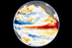
This color-coded image shows sea surface temperature data from August 29, 2005, in the Pacific Ocean south of Japan. Warmer temperatures are in orange and gold; cooler temperautres are in blue. Among the most obvious features in this visualization are isolated trails of cooler water (blue) leading southward from Japan. These two cold-water features match the tracks of Typhoon Mawar (the larger, more distinct feature) and Tropical Cyclone Guchol.
Hurricanes (which are known as typhoons in the western Pacific) are powerful storm systems that draw heat from the surface water of the ocean and transfer it to the air through evaporation and then condensation. Not only do those processes draw heat from the ocean, but once the storm system becomes strong enough, the powerful winds stir up the ocean water. Cooler water deeper down mixes with the warmer surface water. As a result, powerful storm systems like Typhoon Mawar can leave a measureable trail of cooler ocean water in their wake.
The color bar used here emphasizes the transition from water that is cooler than 28° Celcius (blue) to water that is warmer (orange). Scientists have noted that this temperature is a critical theshold for hurricanes and typhoons to build strength. In some cases, hurricanes can lose strength as they cross a cold water wake created by a previous storm.
This image was created from data gathered by the Advanced Microwave Scanning Radiometer-EOS (AMSR-E) on NASA’s Aqua satellite on August29, 2005. AMSR-E was provided to the Aqua program by the Japanese Aerospace Exploration Agency (JAXA).
References & Resources
Sea Surface Temperature data from the Advanced Microwave Radiometer for EOS (AMSR-E), provided courtesy of Remote Sensing Systems