


September 26, 2016
For the third time in a month, a powerful tropical cyclone is bearing down on Taiwan.
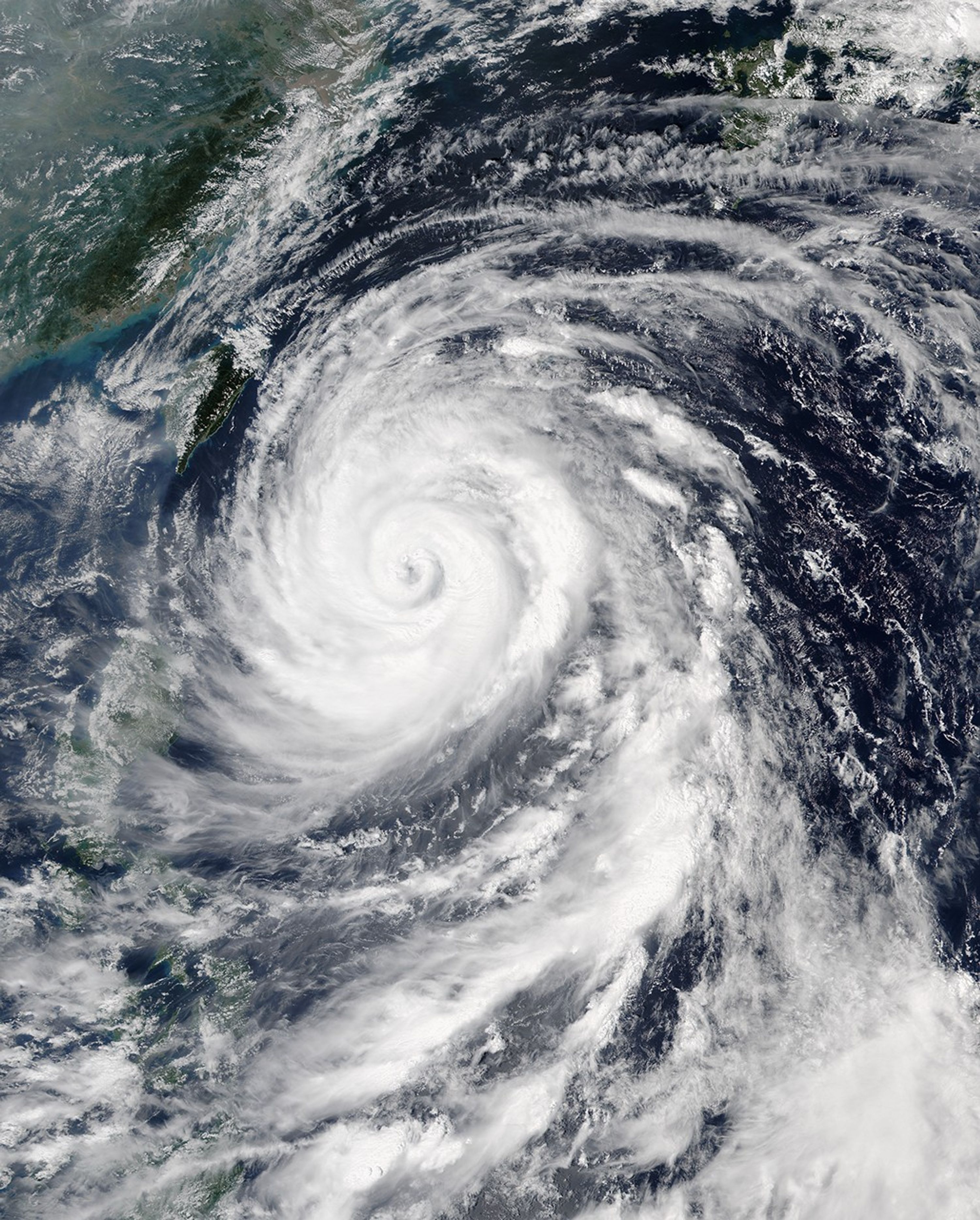
On September 26, 2016, at 12:25 p.m. local time (04:25 Universal Time), the Visible Infrared Imaging Radiometer Suite (VIIRS) on the Suomi NPP satellite acquired this image of Typhoon Megi. At the time, the storm had maximum sustained winds of 90 knots (167 kilometers per hour; 104 miles per hour). Forecasters expect the storm to make landfall on Taiwan’s southeast coast on September 27.
Megi is the fourth storm to affect Taiwan this summer. Nepartak struck the island in July. Meranti and Malakas hit in September.
Further Reading
- NASA Earth Observatory (2016) 2016 Typhoon Seasons in the Western Pacific.
References & Resources
- AccuWeather (2016, September 26) Typhoon Megi to blast Taiwan with damaging winds and flooding rain. Accessed September 26, 2016.
- Joint Typhoon Warning Center (2016, September 26) Megi. Accessed September 26, 2016.
- Unisys Weather (2016, September 26) 2016 Hurricane/Tropical Data for Western Pacific. Accessed September 26, 2016.
NASA image by Jeff Schmaltz, LANCE/EOSDIS Rapid Response . Caption by Adam Voiland.


