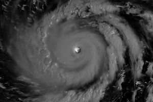
This image shows Typhoon Nanmadol after it crossed the Philippines. The image was taken at 22:29 UTC on December 2, 2004, and shows the horizontal distribution of rain intensity as seen from above by the TRMM satellite. Rain rates in the center swath are from the TRMM Precipitation Radar (PR), the first precipitation radar in space, while rain rates in the outer swath are from the TRMM Microwave Imager (TMI). The rain rates are overlaid on infrared (IR) data from the TRMM Visible Infrared Scanner (VIRS). TRMM shows that Nanmadol has weakened significantly after crossing Luzon. Heavy convection is absent near the center, and a closed eyewall is not visible. At this time, Nanmadol was still classified as a strong Category 3 storm with winds estimated at 204 kilometers per hour (127 mph) by the Joint Typhoon Warning Center but would continue to weaken. The storm made landfall as a more powerful Category 4 storm earlier on December 2, with maximum sustained winds estimated at 222 kph (138 mph).
TRMM is a joint mission between NASA and the Japanese space agency JAXA.
References & Resources
Images produced by Hal Pierce (SSAI/NASA GSFC) and caption by Steve Lang (SSAI/NASA GSFC).