
Located about 70 kilometers (40 miles) southeast of Mexico City, Popocatépetl (pronounced poh-poh-kah-TEH-peh-til) is one of Mexico’s most active volcanoes. The towering stratovolcano has been erupting since January 2005, with near constant venting from fumaroles, punctuated by minor steam, gas, and ash emissions.
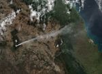
The Visible Infrared Imaging Radiometer Suite (VIIRS) on the Suomi NPP satellite captured this view of Popocatépetl at 1:30 p.m. local time (19:30 Universal Time) on January 25, 2016.
Popocatépetl sits between two large population centers: Mexico City (19 million) and Puebla (2.6 million). According to news reports, the eruption temporarily closed an airport in Puebla, as workers cleared ash from the runway.
References & Resources
- CENAPRED (2016, January 28) Activity Report. Accessed January 28, 2016.
- Global Volcanism Program (2016) Popocatépetl Summary. Accessed January 28, 2016.
- Volcano Discovery (2016) Popocatépetl Volcano. Accessed January 28, 2016.
NASA image by Jeff Schmaltz, LANCE/EOSDIS Rapid Response using VIIRS data from the Suomi National Polar-orbiting Partnership. Suomi NPP is the result of a partnership between NASA, the National Oceanic and Atmospheric Administration, and the Department of Defense. Caption by Adam Voiland.