


Smoke from hundreds of wildland fires burning in Canada created hazy skies and poor air quality across multiple provinces and northern U.S. states in late July and early August 2025. Air pollution affected areas of the Northwest Territories, Alberta, Saskatchewan, Manitoba, and Ontario, according to news reports, as well as parts of the U.S. Upper Midwest and Northeast.
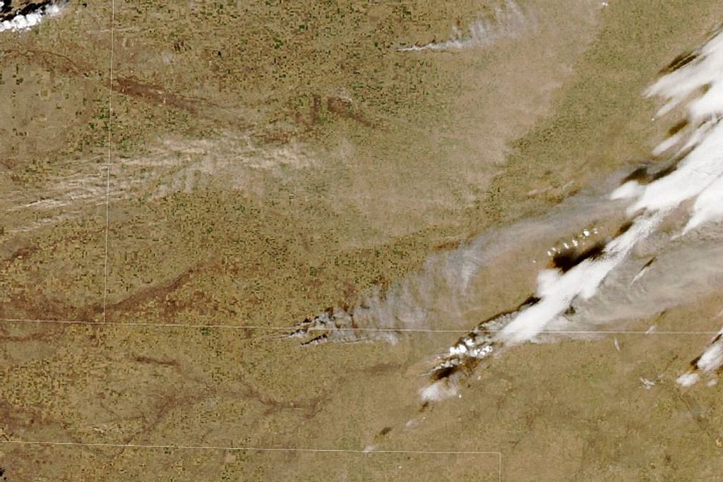
The animation above depicts the concentration and movement of wildfire smoke from July 30 to August 3, 2025. It shows black carbon particles—commonly called soot—from Canadian fires drifting across North American skies during that period. Black carbon is a component of fine particulate matter (PM2.5) air pollution, which can aggravate cardiovascular and respiratory conditions and create other health issues.
The black carbon data come from NASA’s GEOS forward processing (GEOS-FP) model, which assimilates data from satellites, aircraft, and ground-based observing systems. In addition to satellite observations of aerosols and fires, GEOS-FP also incorporates meteorological data such as air temperature, moisture, and winds to project the plume’s behavior.
The animation shows how smoke plumes in northern Canada spread and drifted to the east. On August 2 and 3, parts of multiple provinces were under air quality warnings. These are issued when Canada’s Air Quality Health Index (AQHI) reaches level 10 or above, indicating a very high health risk. Visibility was reduced to 200 meters (660 feet) in Fort McMurray, Alberta, on August 3.
Poor air quality also affected areas farther from the fires as a high-pressure system pushed smoke from higher in the atmosphere back toward the surface, meteorologists said. For instance, authorities in Minnesota issued an air quality alert for the entire state for nearly a week. People in several Northeastern states were advised to limit outdoor activity because of the smoke on August 3, according to news reports, and the AQHI in Toronto, Ontario, reached level 7 that day, denoting high health risk.
Canada is facing one of its worst fire seasons on record in terms of area burned. As of August 3, more than 6.6 million hectares (16.3 million acres) had burned, according to the Canadian Interagency Forest Fire Center. That exceeds the 25-year average of about 2.2 million hectares but trails the more than 12.3 million hectares burned by this date in 2023, a record-setting year. On August 3, 2025, 159 and 81 fires were burning in Manitoba and Saskatchewan, respectively, many of which were classified as out of control. Another 106 were active in the Northwest Territories.
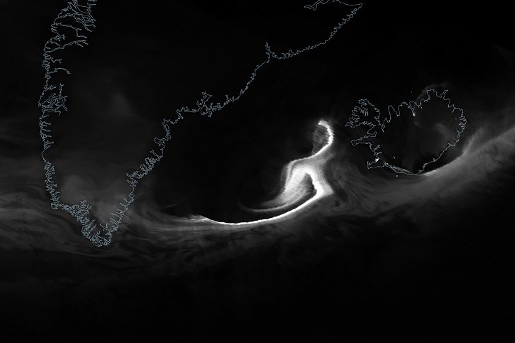
For at least the second time this season, smoke from these blazes traveled across the Atlantic Ocean bound for Europe. Carried by a strong jet stream, it was expected to reach Western European skies between August 5 and 7. In mid-June 2025, another smoke plume from Canada degraded air quality and reddened skies in Central and Southern Europe.
References & Resources
- Canadian Interagency Forest Fire Center (2025, August 3) National Fire Situation Report. Accessed August 5, 2025.
- CBC (2025, August 2) Air quality notices issued for provinces across Canada over Prairie wildfire smoke. Accessed August 5, 2025.
- Environment and Climate Change Canada (2021, April 28) About the Air Quality Health Index. Accessed August 5, 2025.
- IQAir (2025, August 3) Wildfire Smoke Air Quality Alert: Toronto among top 10 most polluted cities in the world. Accessed August 5, 2025.
- NPR (2025, August 3) Canada wildfires cause poor air quality in the midwest and northeast U.S. Accessed August 5, 2025.
- The Washington Post (2025, August 5) Where skies will be smoky this week — and where the haze is coming from. Accessed August 5, 2025.
NASA Earth Observatory video by Lauren Dauphin, using GEOS-5 data from the Global Modeling and Assimilation Office at NASA GSFC. Story by Lindsey Doermann .


