Several large wildland fires burned in Northern California in mid-July 2025 amid exceptional heat and low humidity. Notable blazes included the Green and Butler fires, visible in images captured by the OLI (Operational Land Imager) on the Landsat 8 satellite on July 13.
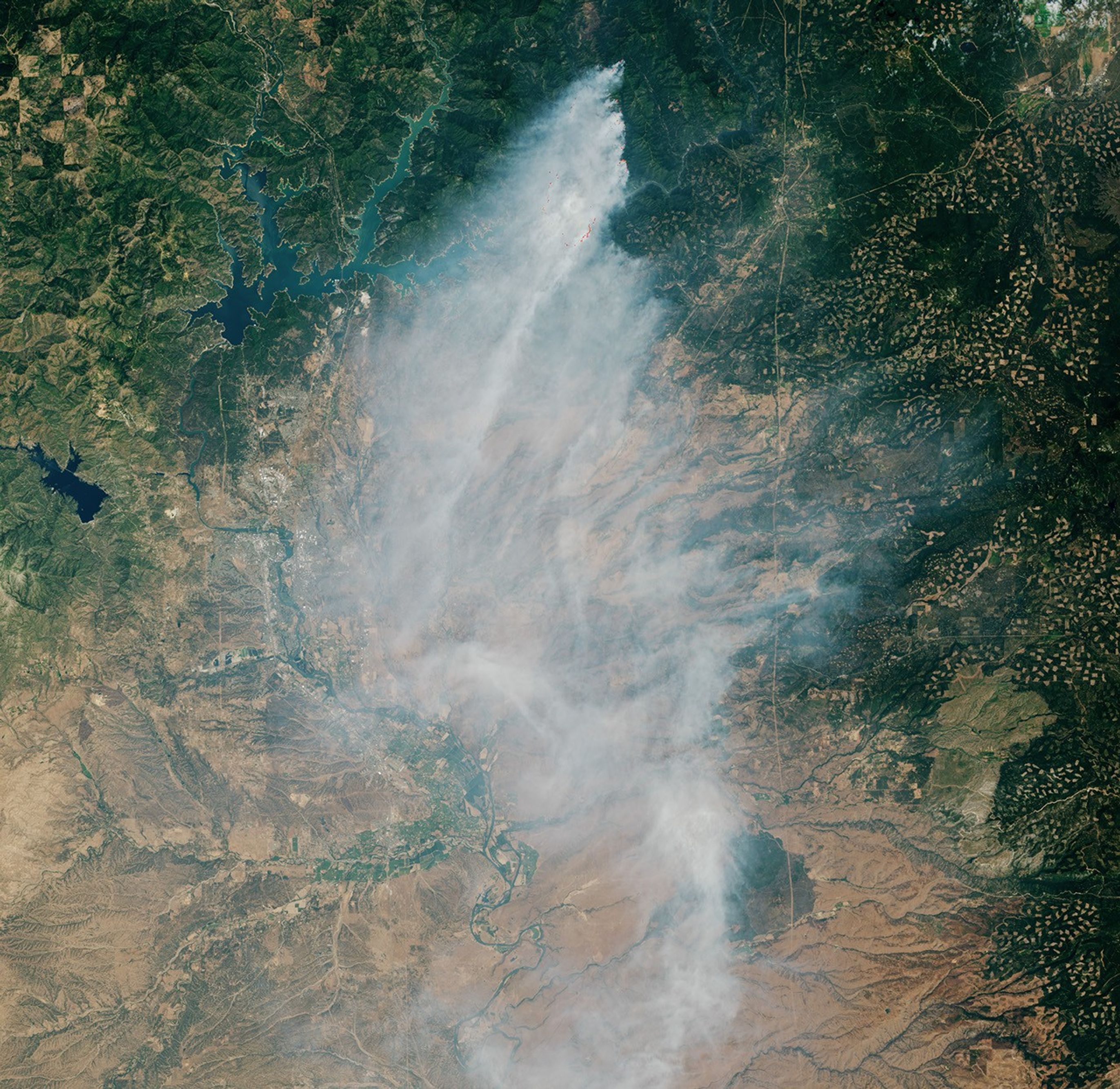
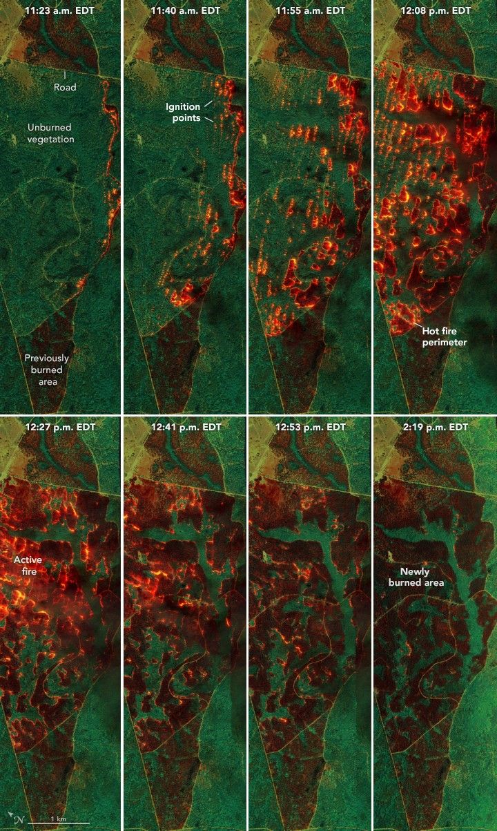
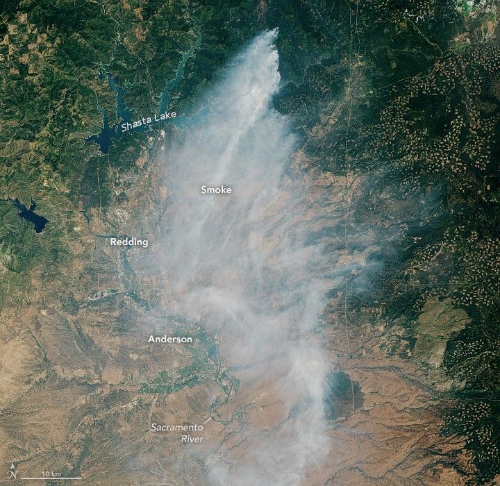
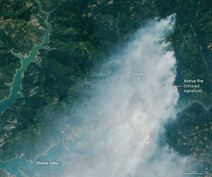
On July 1, lightning ignited the Green fire north of the Pit River arm of Shasta Lake. By the date Landsat acquired these images, the blaze had grown to 10,334 acres (4,182 hectares), according to the U.S. Forest Service. The wide view above shows smoke billowing south, contributing to unhealthy air quality around the lake and in communities along the Sacramento River from Redding to Anderson, according to the interagency air quality monitoring tool AirNow. The second image below shows a detailed view of the active fire area; bright orange indicates the infrared signature of actively burning fires.
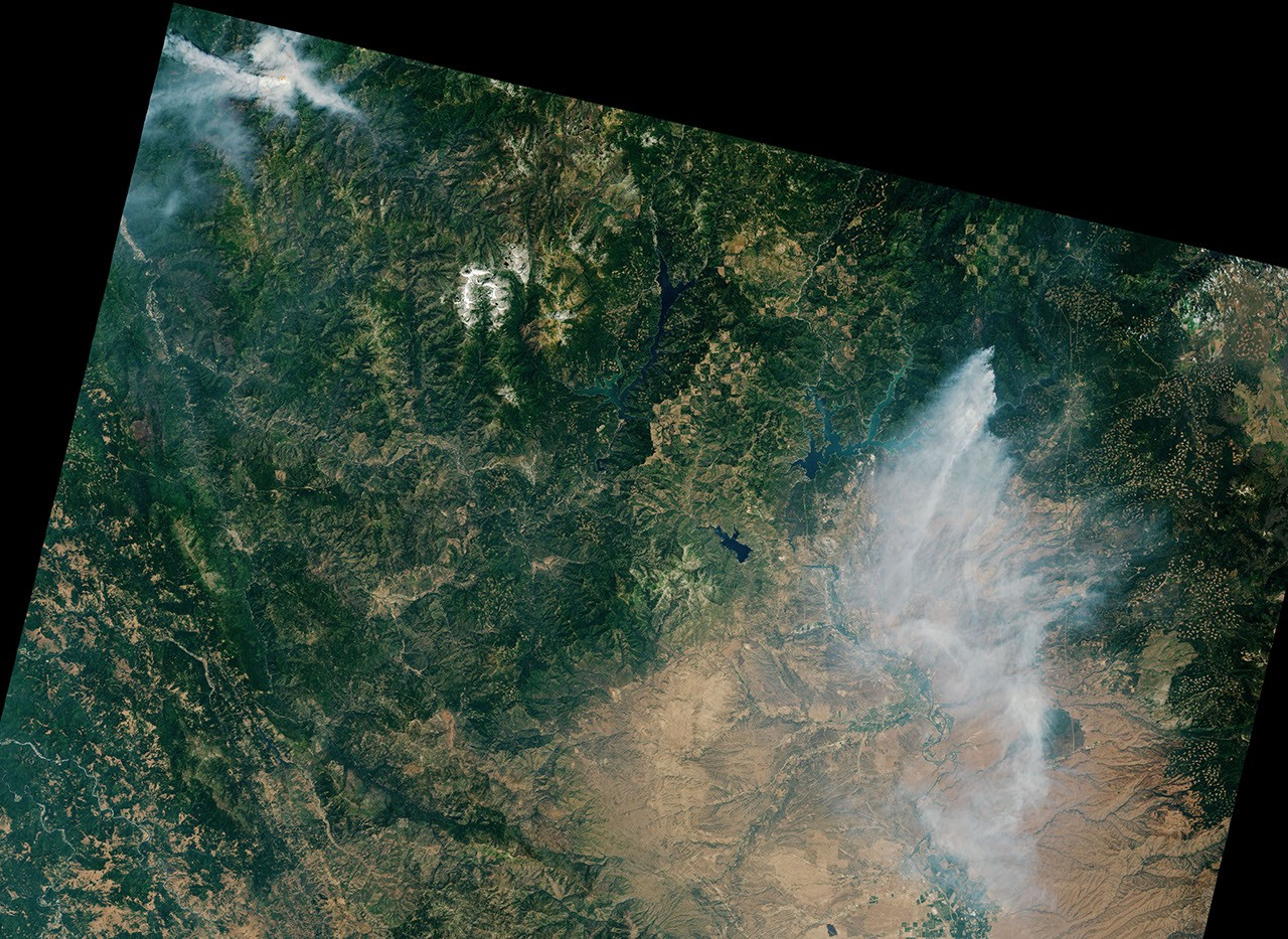
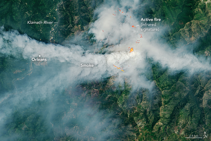
Meanwhile, approximately 120 kilometers (75 miles) to the northwest, the Butler fire was burning in the Six Rivers National Forest east of Orleans. When Landsat 8 captured this image (below) on July 13, the blaze had burned 7,203 acres, according to the U.S. Forest Service. Smoke plumes billowed toward the west over Orleans and had also wafted over regions east of the blaze. NASA’s TEMPO (Tropospheric Emissions: Monitoring of Pollution) sensor also observed nitrogen dioxide air pollution from the fire throughout the day.
The weather conditions around the time of these images were favorable for fire, according to U.S. Forest Service reports, with temperatures climbing over 100 degrees Fahrenheit and humidity dropping below 20 percent. By mid-week, conditions improved somewhat as temperatures dropped below 100 degrees and humidity increased slightly.
As of July 16, the fires had expanded to 15,438 acres (Green) and 9,191 acres (Butler) and were 13 percent and zero percent contained, respectively. Evacuation orders and warnings persisted in several zones in Shasta County near the Green fire and expanded to include several new zones, such as the area around Forks of Salmon, near the Butler fire.
These fires and others can be tracked using NASA tools such as the Fire Information for Resource Management System (FIRMS), Worldview, and the Fire Events Explorer.
References & Resources
- AirNow (2025, July 13) Interactive Map of Air Quality, Archived Dates: July 13, 2025. Accessed July 16, 2025.
- Cal Fire (2025, July 16) Green Fire. Accessed July 16, 2025.
- Cal Fire (2025, July 16) Orleans Complex. Accessed July 16, 2025.
- U.S. Forest Service (2025, July 16) Green Fire Update for 7-16-25. Accessed July 16, 2025.
- U.S. Forest Service (2025, July 13) Green Fire Daily Update for 7-13-2025. Accessed July 16, 2025.
- U.S. Forest Service - Six Rivers National Forest, via Facebook (2025, July 16) Orleans Complex Butler and Red Fire Update: July 16, 2025. Accessed July 16, 2025.
- U.S. Forest Service - Six Rivers National Forest, via Facebook (2025, July 13) Orleans Complex Butler and Red Fire Update: July 13, 2025. Accessed July 16, 2025.
NASA Earth Observatory images by Lauren Dauphin, using Landsat data from the U.S. Geological Survey . Story by Kathryn Hansen.