![Request for Information – Potential [Placeholder for Prize]](https://assets.science.nasa.gov/dynamicimage/assets/science/psd/solar/2023/09/s/solarsystem_0.jpg?w=1024)


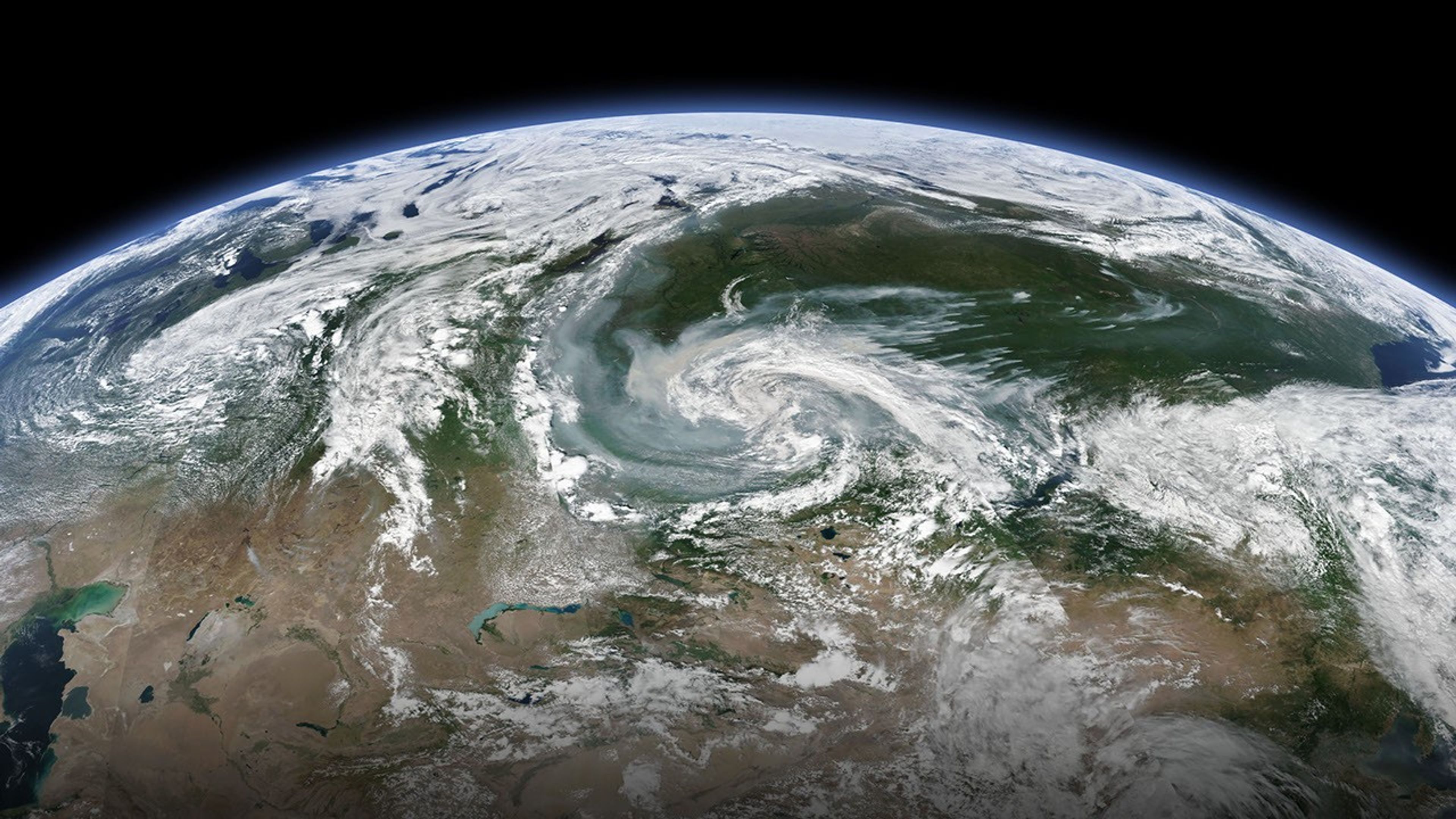
Wildfires are burning across 11 regions of Russia amid a hot, dry summer. Even regions free from fire are feeling its effects, as air masses have spread the smoke plumes across a wide area.
The Visible Infrared Imaging Radiometer Suite (VIIRS) on the Suomi NPP satellite acquired this natural-color image on July 21, 2019. Note the distinct plumes stemming from fires on the right side of the image. Winds carried the smoke toward the southwest where you can see it mixing with a storm system .
The largest fires—thought to be triggered by lightning—were located in the regions of Irkutsk, Krasnoyarsk, and Buryatia. As of July 22, the blazes had burned 89,076 hectares (320 square miles), 38,930 hectares (150 square miles), and 10,600 hectares (41 square miles) in these regions, respectively.
News reports show Krasnoyark under a blanket of haze. No fires were reported to be burning in the vicinity of Novosibirsk, Siberia’s largest city, but winds carried in enough smoke to cause the city’s air quality to plummet.
References & Resources
- The Independent (2019, July 22) Huge swathes of the Arctic on fire, âunprecedentedâ satellite images show. Accessed July 22, 2019.
- NASA Earth Observatory (2019, July 12) Wildfires in Krasnoyarsk.
- The Siberian Times (2019, July 22) Major Siberian cities choking from strong wildfires. Accessed July 22, 2019.
- TASS Russian News Agency (2019, July 22) Wildfires sweep through 140,600 hectares in Russian regions. Accessed July 22, 2019.
NASA Earth Observatory image by Joshua Stevens, using VIIRS data from NASA EOSDIS/LANCE and GIBS/Worldview, and the Suomi National Polar-orbiting Partnership. Caption by Kathryn Hansen.