


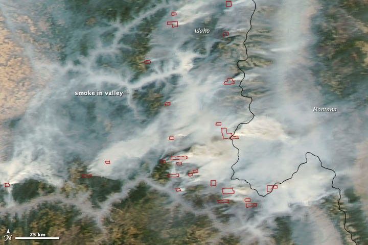
Numerous wildfires raged in central Idaho when the Moderate Resolution Imaging Spectroradiometer (MODIS) aboard the Aqua satellite acquired this image on September 13, 2012. Smoke lingered within steep valleys throughout the region, and numerous thick plumes of smoke streamed east toward Montana. Actively burning areas, detected by MODIS’s thermal bands, are outlined in red.
By September 11, more than 1,529,715 acres (619,054 hectares) had burned in Idaho—more than any other state in the nation. By August 29, more than 8,392,209 acres (3,396,206 hectares) had burned throughout the United States in what has proven to be one of the most severe wildfire seasons in the last decade.
Further Reading
- Idaho Forest Products Comission. (n.d.) Forest Fires in Idaho. Accessed August 29, 2012.
References & Resources
- Inciweb. (2012, August 29). Idaho. Accessed September 14, 2012.
- National Interagency Fire Center. (2012, August 29). Year-to-Date Statistics. Accessed September 14, 2012.
- National Interagency Fire Center. (2012, August 29). National Year-to-Date Statistics on Fires and Acres Burned by State. Accessed September 14, 2012.
NASA image courtesy Jeff Schmaltz, LANCE MODIS Rapid Response Team at NASA GSFC. Caption by Adam Voiland.


