

March 26, 2025
Wildland Fires Char U.S. Southeast Forests
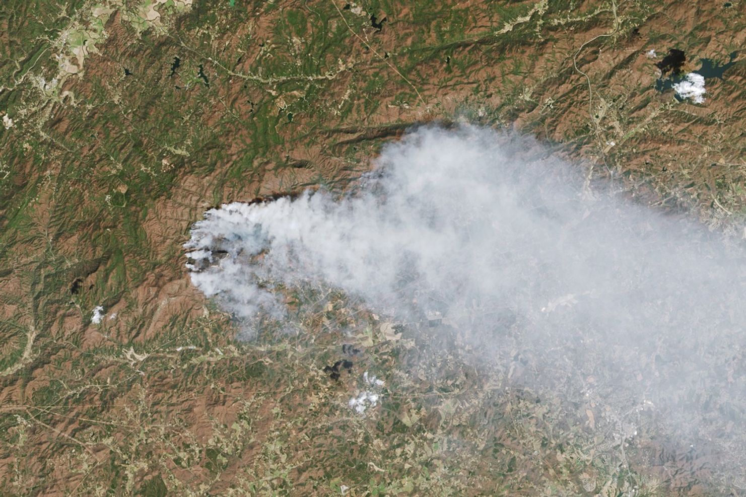
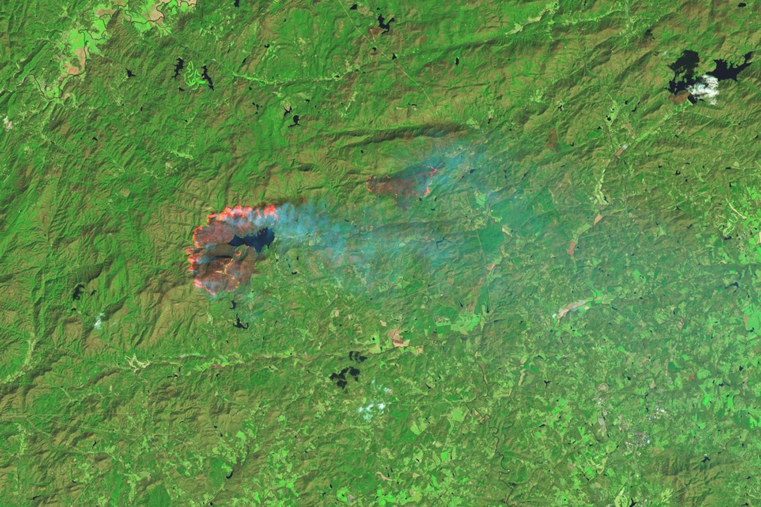
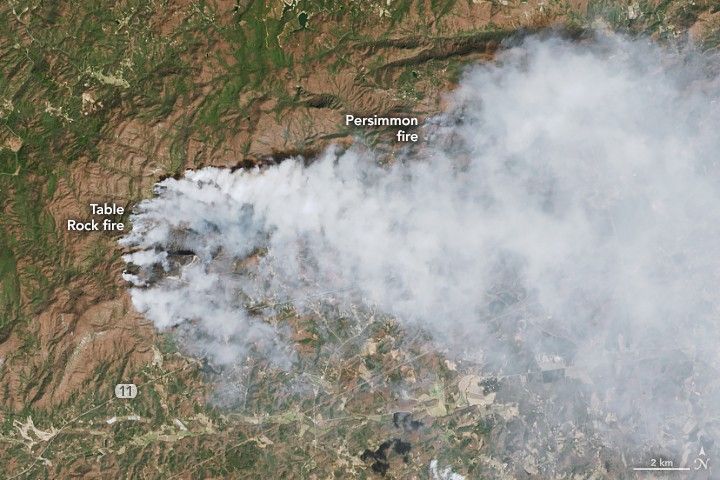
On March 26, 2025, satellites observed several wildland fires in the western Carolinas and northeastern Georgia. Two prominent fires burning in the forested, mountainous terrain of western South Carolina are shown in these images (above) captured that day by the OLI (Operational Land Imager) on the Landsat 8 satellite.
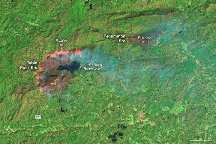
The natural-color image (left) shows smoke pouring east-southeast toward Greenville and Spartanburg at around 12 p.m. local time (16:00 Universal Time). The right image shows the same area in false color, which combines shortwave infrared, near infrared, and visible components (OLI bands 7-5-4) of the electromagnetic spectrum. This band combination makes it easier to identify unburned vegetation (green) and recently burned landscape (dark brown).
The South Carolina Forestry Commission (SCFC) reported that around the time of these images, the Table Rock fire had burned nearly 4,600 acres (18.6 square kilometers), doubling in size since the day before. Meanwhile, the Persimmon Ridge fire had burned 1,600 acres (6.5 square kilometers). By the evening of March 27, the burned areas had grown to nearly 8,700 acres and 2,000 acres, respectively, as efforts continued toward securing the fire’s perimeter and protecting structures.
An incident report issued on March 28 indicated that evacuation orders remained in place in parts of Greenville and Pickens counties. At the time, there were no reports of damages to homes.
SCFC called the fire weather on March 26 “extreme,” with low humidity and gusty winds. The fire commission also pointed to the abundance of dry fuels as a factor in the fire’s spread. In autumn 2024, Hurricane Helene downed trees and caused landslides in the region. A lack of significant rainfall has since allowed the tree debris to dry, which can contribute to the amount of combustible materials.
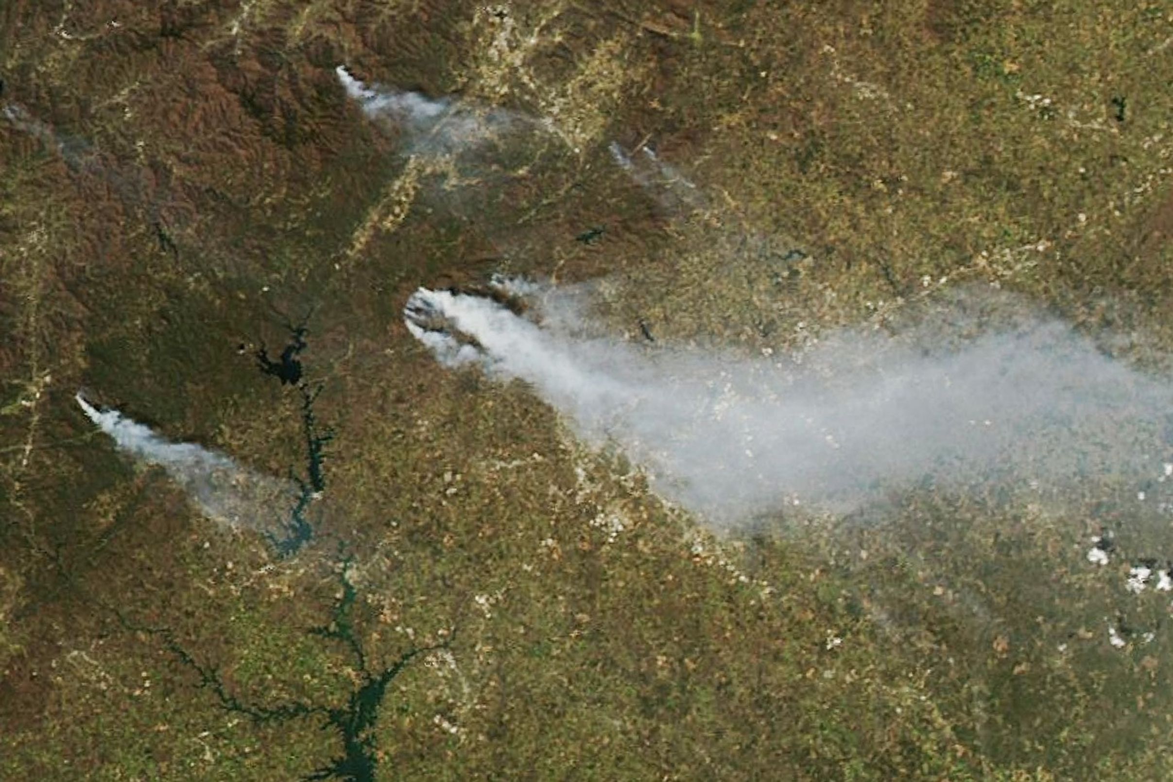
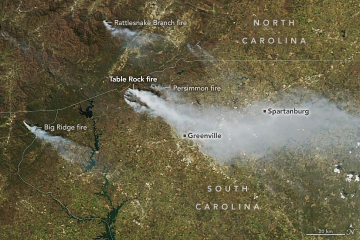
Notable fires also burned elsewhere in the region, visible in the wide view above. This image, captured by the MODIS (Moderate Resolution Imaging Spectroradiometer) on NASA’s Aqua satellite on the afternoon of March 26, shows the Big Ridge fire in northeastern Georgia and the Rattlesnake Branch fire in North Carolina. According to InciWeb, those fires had burned 1,936 acres (7.8 square kilometers) and 630 acres (2.5 square kilometers), respectively, as of March 28.
References & Resources
- The Associated Press (2025, March 26) Wildfires in North and South Carolina fueled by drought, wind and fallen trees from Hurricane Helene. Accessed March 28, 2025.
- InciWeb (2025, March 28) Big Ridge Fire. Accessed March 28, 2025.
- InciWeb (2025, March 28) Rattlesnake Branch Fire. Accessed March 28, 2025.
- South Carolina Forestry Commission via X (2025, March 26) TABLE ROCK COMPLEX UPDATE—PICKENS COUNTY SC—09:30:00—MARCH 26, 2025. Accessed March 28, 2025.
NASA Earth Observatory images by Michala Garrison, using Landsat data from the U.S. Geological Survey and MODIS data from NASA EOSDIS LANCE and GIBS/Worldview . Story by Kathryn Hansen.