

March 3, 2017-February 27, 2020
Winter Flooding in Mississippi and Louisiana
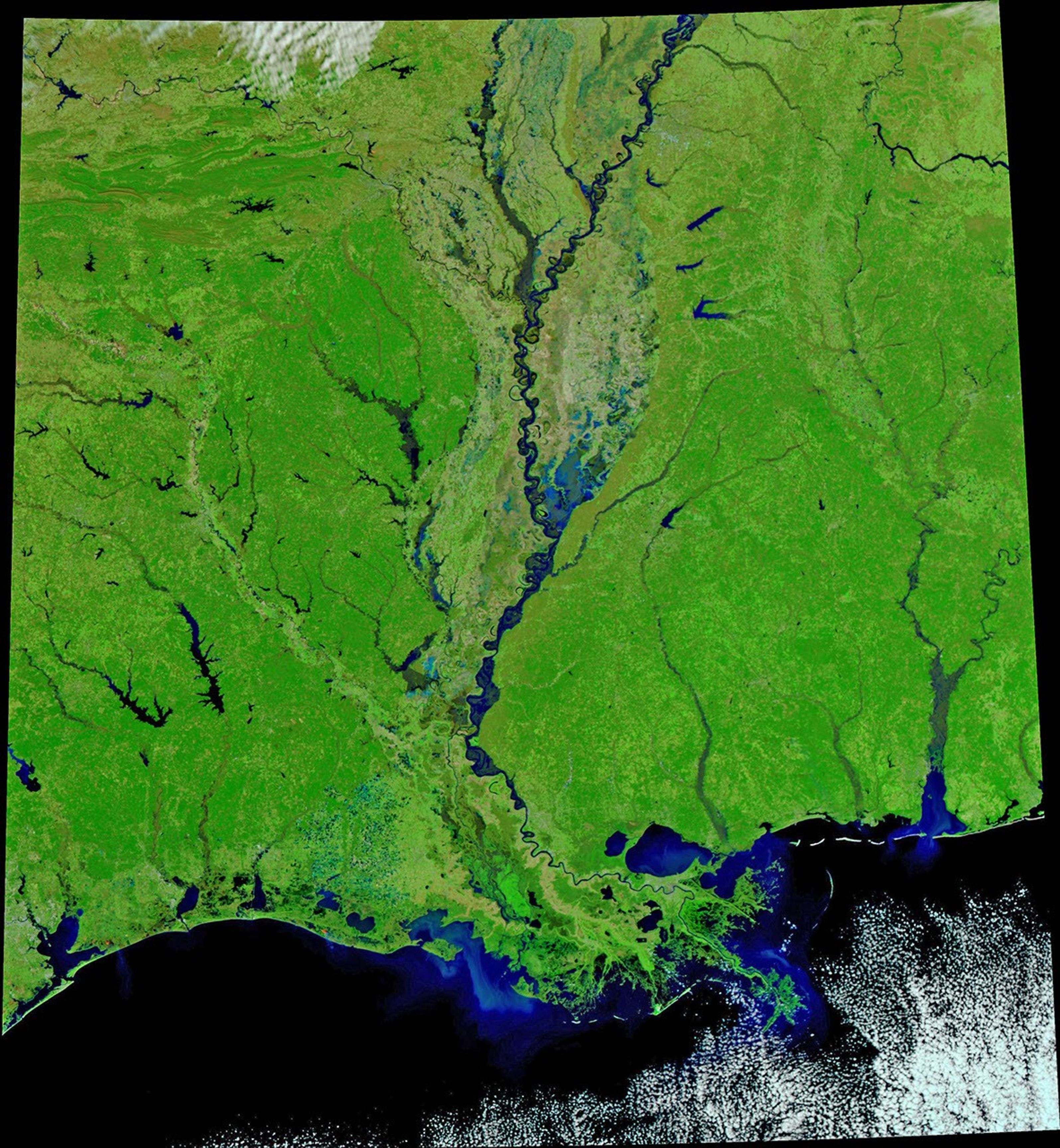
Persistent heavy rains soaked the Mississippi River watershed in the first two months of 2020. The result has been bulging rivers from Missouri to the Gulf of Mexico. Near-record flooding has brought two weeks of misery to the states of Mississippi and Tennessee, and high water is expected to arrive next week in New Orleans.
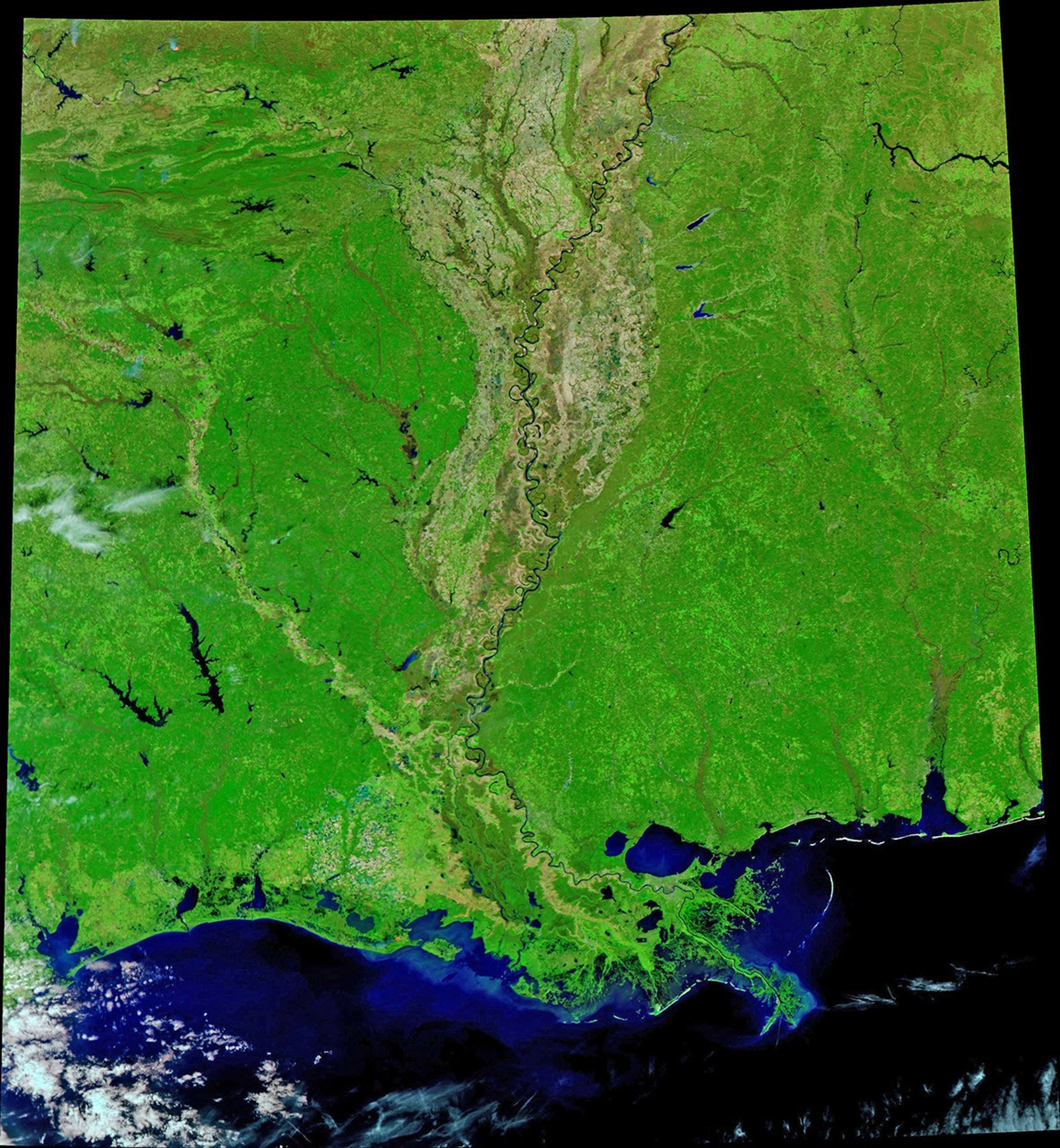
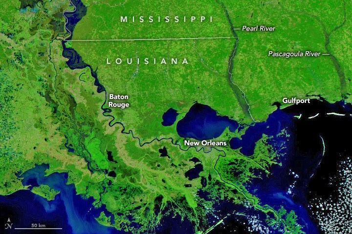
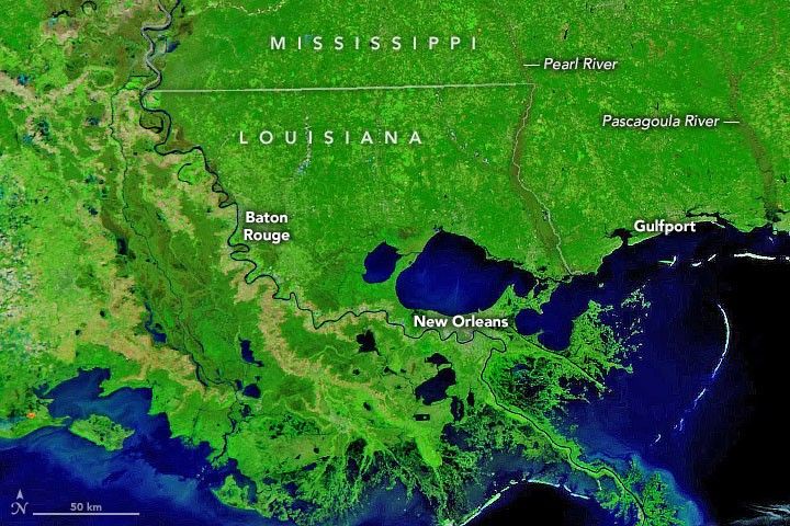
On February 27, 2020, the Visible Infrared Imaging Radiometer Suite (VIIRS) on the NOAA-NASA Suomi NPP satellite acquired an image showing high water along the lower Mississippi, Pearl, and Pascagoula rivers, among others. The second image shows more typical river conditions as they appeared on March 3, 2017. Both images use a combination of near-infrared and visible light to make it easier to see where rivers are out of their banks and spread across the floodplains. Since thick cloud cover obscured the area for the past 10 days, visible flooding had subsided somewhat before the satellite could get a clear view.
On February 17, the Pearl River near Jackson, Mississippi, crested at 36.8 feet (11.2 meters), the third highest level on record for the city and the highest since 1983. At least 1,000 homes in the area were inundated. The flood misery then spread downstream into Copiah, Marion, Hancock, and Lawrence counties. On February 29, the Pearl River stood at 17.86 feet (5.44 meters) near the town of the same name; the water level had dropped from major to moderate flooding the previous day.
Forecasters in Louisiana are expecting the Mississippi River to approach 17 feet (5.2 meters)—just below flood stage—in New Orleans by March 4. On February 29, the river had risen to 41.65 feet (12.69 meters) at Baton Rouge, a major flood stage for that area.
At midday on February 29, at least 17 river gauges along the Mississippi River south of Missouri were above flood stage (mostly minor to moderate), with five more in flood along the Pearl River.
References & Resources
- The Clarion Ledger (2020, February 24) Mississippi flooding: Emergency officials monitoring counties along rivers. Accessed February 29, 2020.
- The Clarion Ledger (2020, February 21) Mississippi flooding: Pearl River south of Jackson affecting roads, homes. Accessed February 29, 2020.
- The Clarion Ledger (2020, February 17) A long weekend for Mississippi. The flooding Pearl River has crested. Hereâs whatâs next. Accessed February 29, 2020.
- CNN (2020, February 16) Pearl River is nearing historic flood levels as Mississippi residents flee their homes. Accessed February 29, 2020.
- Earther (2020, February 20) Floods have devastated Mississippi ,and more rain is on the way. Accessed February 29, 2020.
- NASA Earth Observatory (2019) Flooding in the Mississippi Watershed 2019.
- NBC News (2020, February 17) Mississippi flooding: Helpless feeling as up to 1,000 homes feared affected. Accessed February 29, 2020.
- The Times-Picayune (2020, February 26) Mississippi to near 17-foot flood stage in New Orleans next week, but no plan to open the spillway. Accessed February 29, 2020.
- USA Today (2020, February 17) Historic, unprecedented swamps southern USA; Mississippi and Tennessee hardest hit. Accessed February 29, 2020.
- The Washington Post (2020, February 18) Severe flooding is underway along the Mississippi River, with more heavy rains in the forecast. Accessed February 29, 2020.
- WLBT (2020, February 28) Many left homeless in Copiah Co. after major flooding from Pearl River. Accessed February 29, 2020.
NASA Earth Observatory images by Joshua Stevens, using VIIRS data from NASA EOSDIS/LANCE and GIBS/Worldview and the Suomi National Polar-orbiting Partnership.Story by Michael Carlowicz.