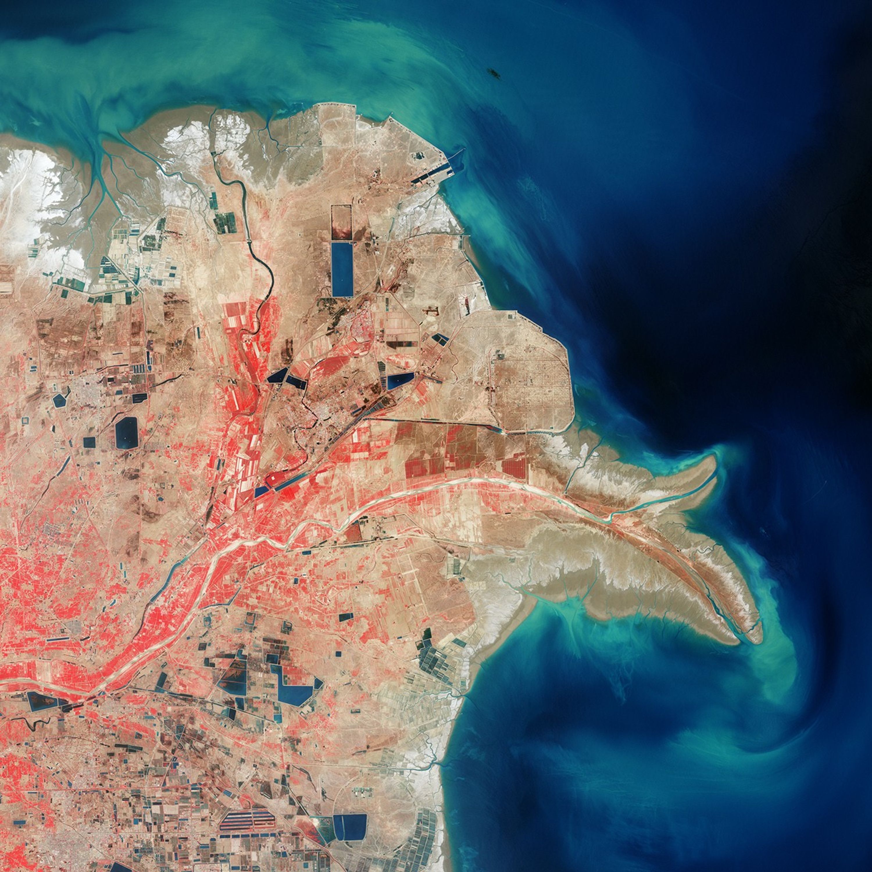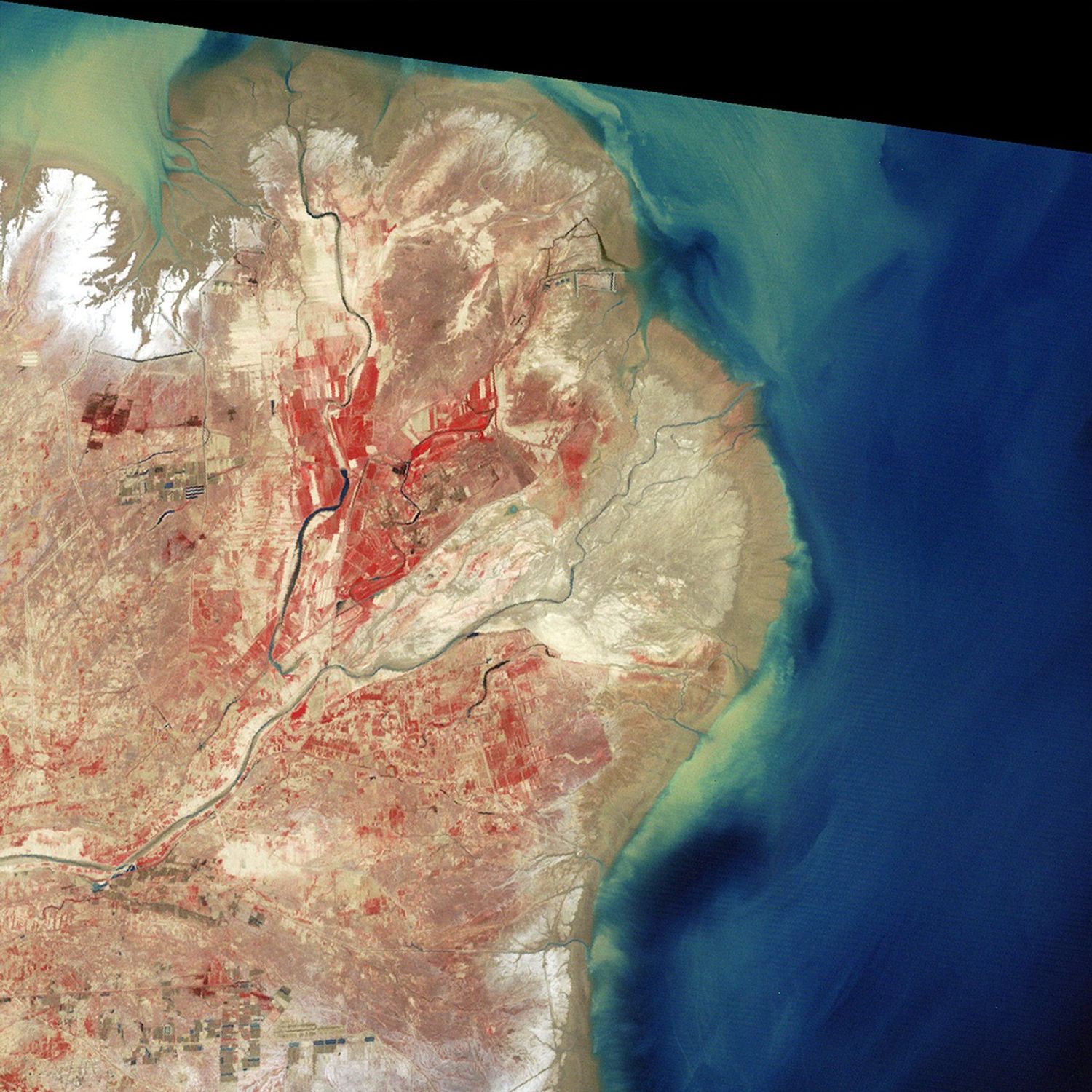

China’s Yellow River, or Huang He, is the world’s muddiest. Stretching some 5,475 kilometers (3,395 miles) from eastern Tibet to Bo Hai, the river travels through soft plateaus of silt, picking up a massive sediment load on its journey. The river derives its yellow color from fine particles of mica, quartz, and feldspar.
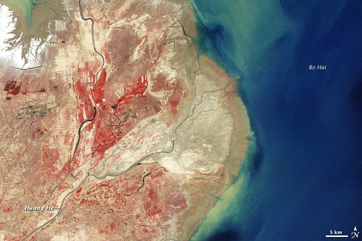
Besides coloring the river yellow, the sediments have reshaped the coast. The Enhanced Thematic Mapper Plus on NASA’s Landsat 7 satellite acquired the top image on May 2, 2000. The Multispectral Scanner on NASA’s Landsat 3 satellite took the bottom image on May 27, 1979. In these false-color images, red indicates vegetation, blue indicates water, and beige indicates bare ground.
Compared to the earlier image, the 2000 shot shows an increase in developed land and a slight decrease in vegetation. The most striking difference between the two images, however, is the shape of the coastline. A steady supply of sediment expanded the Yellow River delta until it pushed into Bo Hai like a giant hook. Sediment colored the coastal waters bright blue. This delta-building process has added several hundred square kilometers of land to China’s coast.
References & Resources
- United Nations Environment Programme. (2005). One Planet Many People. Division of Early Warning and Assessment, United Nations Environment Programme, Sioux Falls, ND.
NASA image created by Jesse Allen, using Landsat data provided by the United States Geological Survey. Caption by Michon Scott.