


Today’s caption is the answer to our January 2018 puzzler.
Here’s a bit of trivia to challenge your geography knowledge: Which country is closest to the continental United States without sharing a land border?
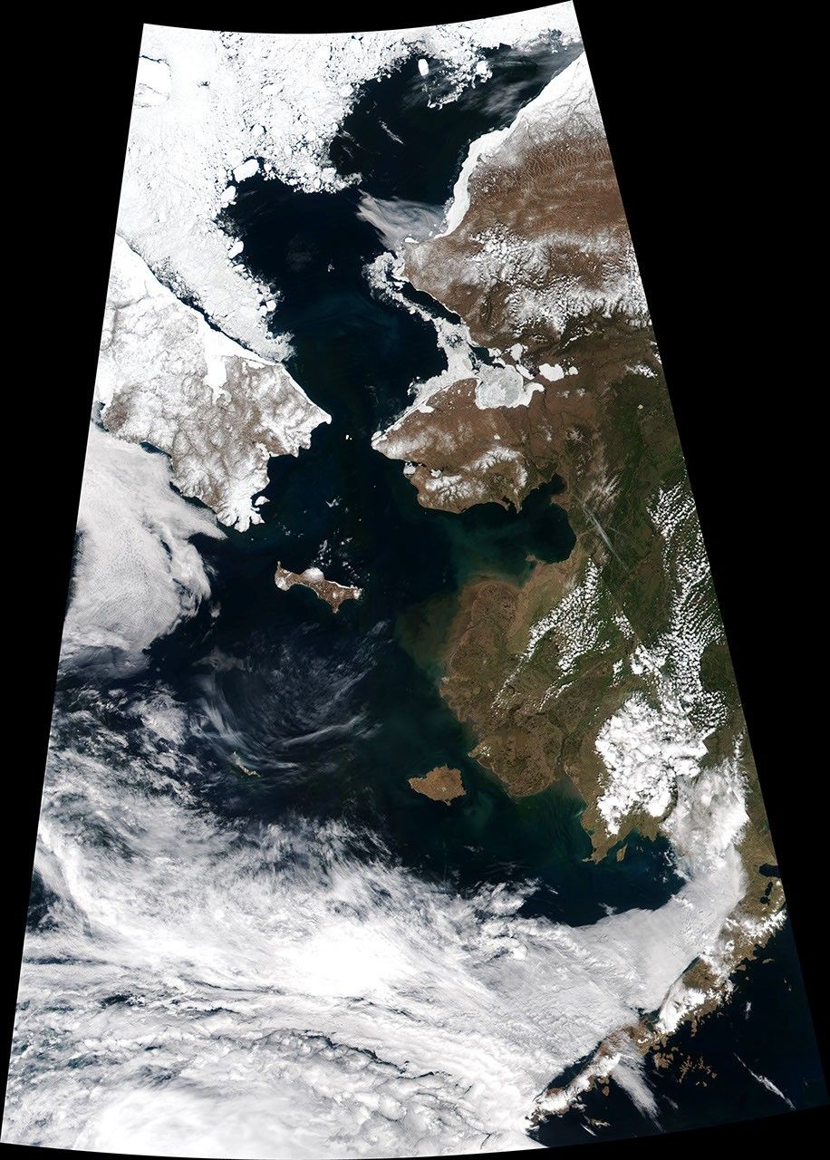
The answer is revealed in the top image, which shows the eastern part of Russia and western part of the United States. This image was acquired on June 2, 2017, by the Visible Infrared Imaging Radiometer Suite (VIIRS) on the NASA-NOAA Suomi NPP satellite. At the narrowest part of the Bering Strait, about 82 kilometers (51 miles) is all that separates Cape Dezhnev on the Chukotka Peninsula and Cape Prince of Wales on mainland Alaska. But Russia’s Big Diomede Island is even closer to mainland Alaska, about 40 kilometers (25 miles) away, making it the closest non-border-sharing country to the continental U.S.
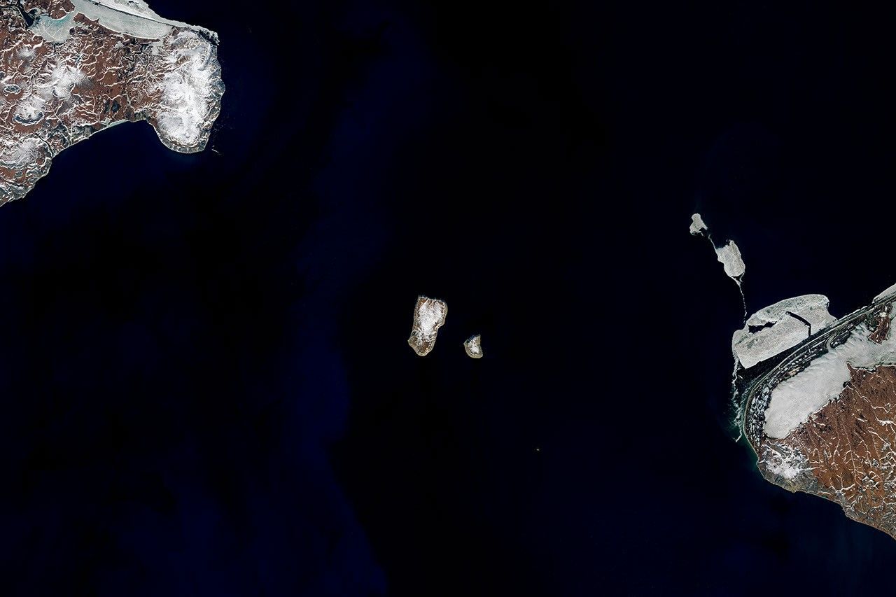
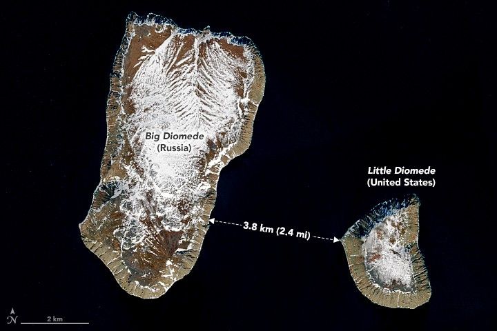
The distance between the two countries is actually much smaller. Just 3.8 kilometers (2.4 miles) separate Big Diomede Island (Russia) and Little Diomede Island (U.S.). The island pair is visible in the detailed image, acquired on June 6, 2017, by the Operational Land Imager (OLI) on Landsat 8.
Summer temperatures on the islands average about 40 to 50 degrees Fahrenheit. Wintertime is even colder, averaging between 6 and 10°F. Each year, Arctic sea ice extends southward into the strait from the Bering and Chukchi seas. By June, however, melting usually causes the ice edge to retreat northward, leaving open water that appears black in these images.
The water between the two islands is bisected by the maritime border of the two countries. The passage was historically nicknamed the “ice curtain,” which had more to do with Cold War tensions than climate. Today, Little Diomede has a small permanent community—about 115 people according to the 2010 U.S. census. The town is located on a small beach on the island’s western side, meaning that Russia’s Big Diomede and even the mainland are visible from the homes.
Another invisible line runs between the islands and inspired the nicknames “Yesterday” and “Tomorrow” islands. Big Diomede and Little Diomede sit on opposite sides of the International Date Line. As Earth Observatory reader Jim Andersen commented on our blog: “When you look at the Big Diomede Island, you’re looking into the future!”
References & Resources
- Douglas, D.C. (2010) Arctic sea ice decline: Projected changes in timing and extent of sea ice in the Bering and Chukchi Seas. U.S. Geological Survey Open-File Report, 2010-1176, 32 p.
- Kawerak, Inc. (2013) Diomede Local Economic Development Plan 2012-2017. Accessed January 26, 2018.
- The New York Times (1988, October 23) Lifting the Ice Curtain. Accessed January 26, 2018.
NASA Earth Observatory images by Joshua Stevens, using Landsat data from the U.S. Geological Survey and VIIRS data from the Suomi National Polar-orbiting Partnership . Story by Kathryn Hansen.