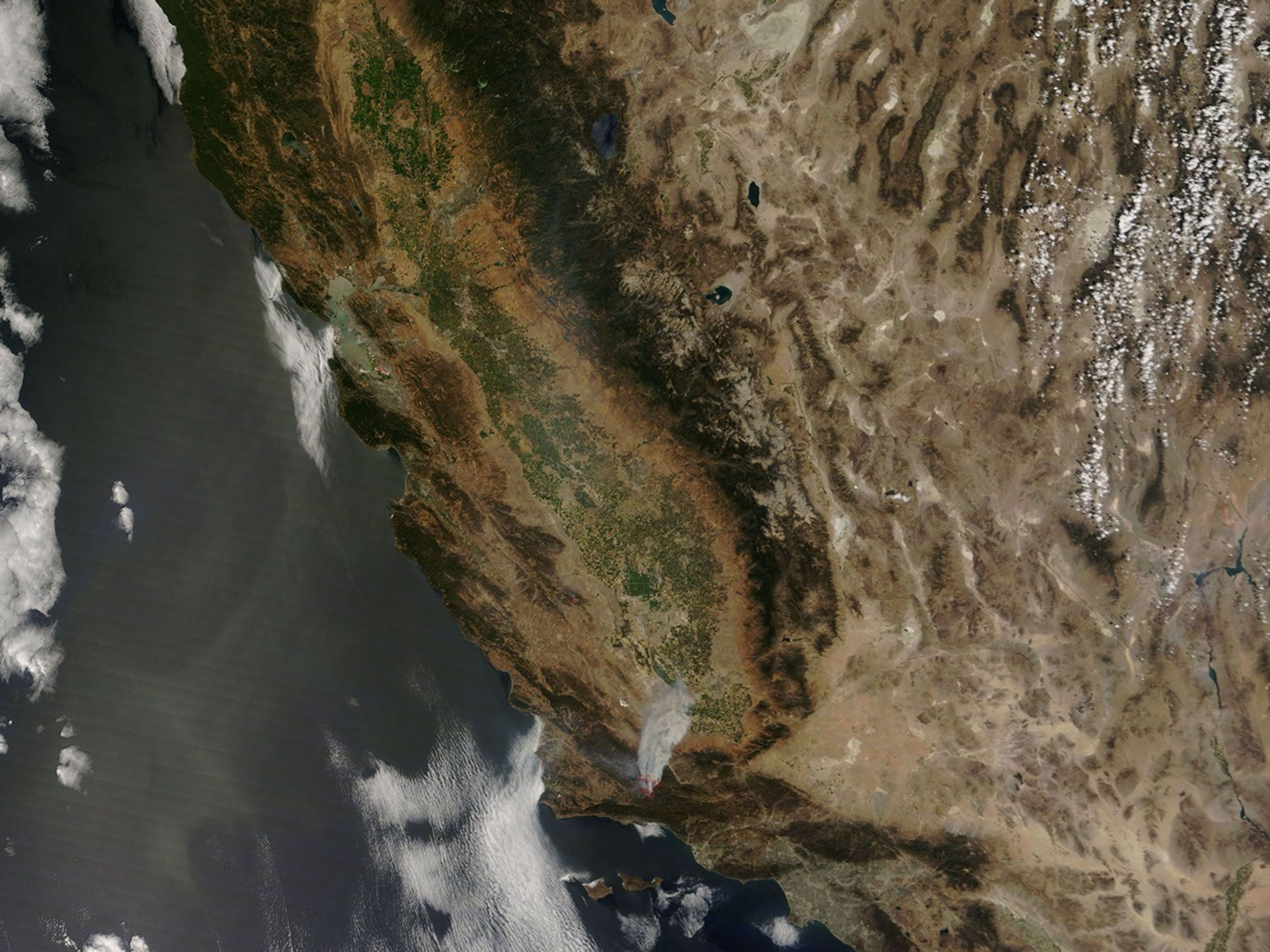
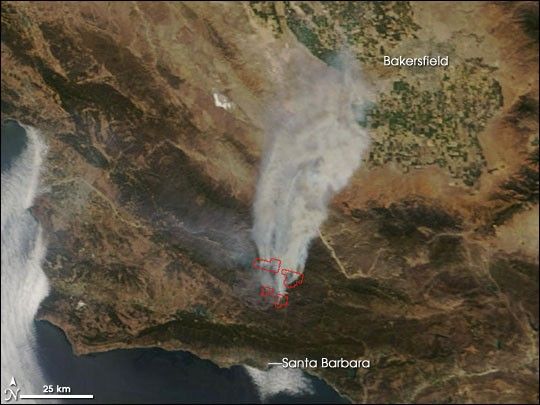
North of Santa Barbara, California, the Zaca Fire continued to rage though the Los Padres National Forest on Sunday, August 12, 2007. Started on a private ranch in early July, the fire died back in mid-July, only to roar back to life late in the month. As of August 12, the National Interagency Fire Center estimated the fire was about 84,000 acres and 68 percent contained.
This image of the Zaca Fire was captured by the Moderate Resolution Imaging Spectroradiometer (MODIS) on NASA’s Terra satellite on Sunday, August 12, at 12:15 p.m. local time (U.S. Pacific Daylight Time). Thick smoke blows nearly due north, and MODIS detected several actively burning areas, which are outlined in red. The chaparral landscape of Southern California appears dull greenish-brown, while irrigated croplands in the San Joaquin Valley near Bakersfield are lush green.
The large image provided above has a spatial resolution (level of detail) of 250 meters per pixel. The MODIS Rapid Response Team provides twice-daily images of the region in additional resolutions.
References & Resources
NASA image courtesy the MODIS Rapid Response Team, Goddard Space Flight Center