


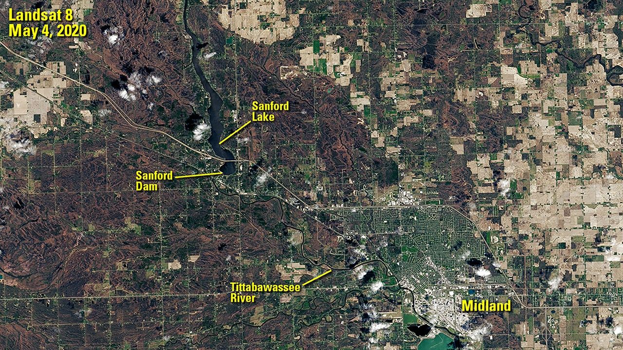
before
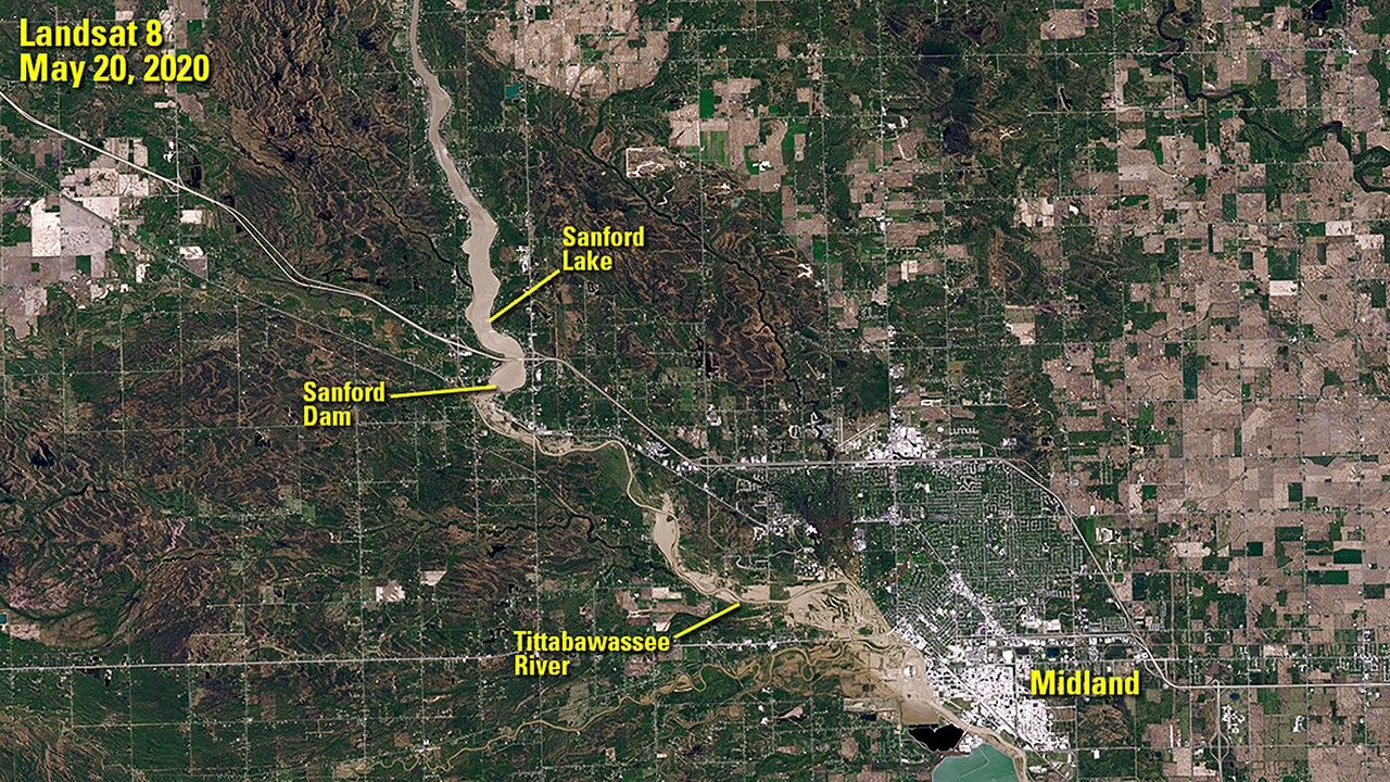
after

Sanford Dam failed on May 19, 2020, flooding the area downstream. The image on the right was taken the following day, when the Tittabawassee River peaked some 10 feet above flood stage at Midland, Michigan. Muddy floodwater is visible spilling onto land near the river. The image on the left shows the region before the flooding, when the dam still held back the waters of Sanford Lake. Images taken by the Landsat 8 satellite. Source: U.S. Geological Survey’s Earth Resources Observation and Science Center

Sanford Dam failed on May 19, 2020, flooding the area downstream. The image on the right was taken the following day, when the Tittabawassee River peaked some 10 feet above flood stage at Midland, Michigan. Muddy floodwater is visible spilling onto land near the river. The image on the left shows the region before the flooding, when the dam still held back the waters of Sanford Lake. Images taken by the Landsat 8 satellite. Source: U.S. Geological Survey’s Earth Resources Observation and Science Center
Before and After
Flooding from Tittabawassee River, Michigan Dam Failure
May 4, 2020 - May 20, 2020
Sanford Dam failed on May 19, 2020, flooding the area downstream. The image on the right was taken the following day, when the Tittabawassee River peaked some 10 feet above flood stage at Midland, Michigan. Muddy floodwater is visible spilling onto land near the river. The image on the left shows the region before the flooding, when the dam still held back the waters of Sanford Lake. Images taken by the Landsat 8 satellite. Source: U.S. Geological Survey’s Earth Resources Observation and Science Center


