


before
after

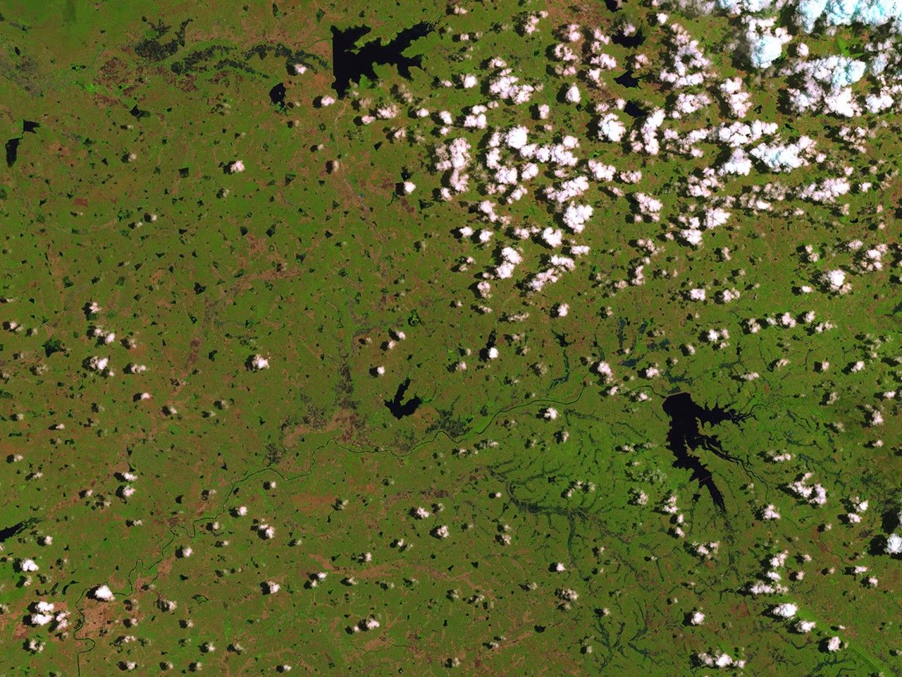
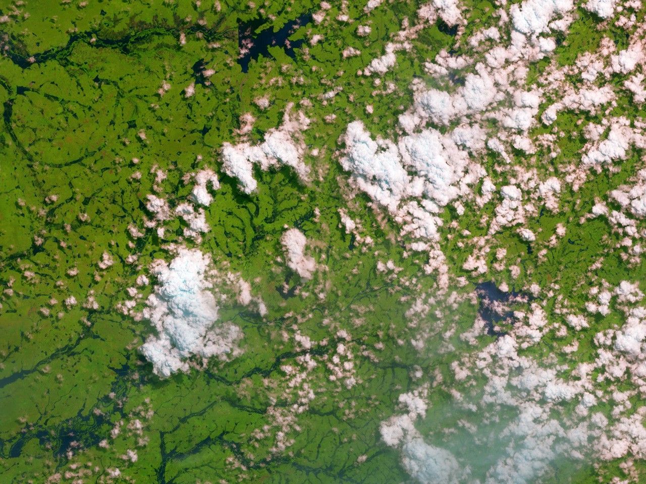
Flooding from the heaviest rains in a quarter century forced 200,000 people out of the low-lying parts of the Sri Lankan capital of Colombo, sent 400,000 fleeing to state-run relief camps and covered entire villages in walls of mud, according to officials in the country’s Disaster Management Center. Per international treaty, Sri Lanka’s government was provided rapid access to Landsat and other satellite data for assessing the extent of damage and helping with disaster response. Images taken by the Operational Land Imager onboard Landsat 8. Source: U.S. Geological Survey (USGS) Landsat Missions Gallery; Landsat 8 Imagery Reveals Heavy Flooding in Sri Lanka; U.S. Department of the Interior / USGS and NASA.

Flooding from the heaviest rains in a quarter century forced 200,000 people out of the low-lying parts of the Sri Lankan capital of Colombo, sent 400,000 fleeing to state-run relief camps and covered entire villages in walls of mud, according to officials in the country’s Disaster Management Center. Per international treaty, Sri Lanka’s government was provided rapid access to Landsat and other satellite data for assessing the extent of damage and helping with disaster response. Images taken by the Operational Land Imager onboard Landsat 8. Source: U.S. Geological Survey (USGS) Landsat Missions Gallery; Landsat 8 Imagery Reveals Heavy Flooding in Sri Lanka; U.S. Department of the Interior / USGS and NASA.
Flooding from the heaviest rains in a quarter century forced 200,000 people out of the low-lying parts of the Sri Lankan capital of Colombo, sent 400,000 fleeing to state-run relief camps and covered entire villages in walls of mud, according to officials in the country’s Disaster Management Center. Per international treaty, Sri Lanka’s government was provided rapid access to Landsat and other satellite data for assessing the extent of damage and helping with disaster response. Images taken by the Operational Land Imager onboard Landsat 8. Source: U.S. Geological Survey (USGS) Landsat Missions Gallery; Landsat 8 Imagery Reveals Heavy Flooding in Sri Lanka; U.S. Department of the Interior / USGS and NASA.
Flooding from the heaviest rains in a quarter century forced 200,000 people out of the low-lying parts of the Sri Lankan capital of Colombo, sent 400,000 fleeing to state-run relief camps and covered entire villages in walls of mud, according to officials in the country’s Disaster Management Center. Per international treaty, Sri Lanka’s government was provided rapid access to Landsat and other satellite data for assessing the extent of damage and helping with disaster response. Images taken by the Operational Land Imager onboard Landsat 8. Source: U.S. Geological Survey (USGS) Landsat Missions Gallery; Landsat 8 Imagery Reveals Heavy Flooding in Sri Lanka; U.S. Department of the Interior / USGS and NASA.
before
after
Before and After
Flooding, Sri Lanka
March 31, 2016 - May 18, 2016
Flooding from the heaviest rains in a quarter century forced 200,000 people out of the low-lying parts of the Sri Lankan capital of Colombo, sent 400,000 fleeing to state-run relief camps and covered entire villages in walls of mud, according to officials in the country’s Disaster Management Center. Per international treaty, Sri Lanka’s government was provided rapid access to Landsat and other satellite data for assessing the extent of damage and helping with disaster response. Images taken by the Operational Land Imager onboard Landsat 8. Source: U.S. Geological Survey (USGS) Landsat Missions Gallery; Landsat 8 Imagery Reveals Heavy Flooding in Sri Lanka; U.S. Department of the Interior / USGS and NASA


