






























APOD
Astronomy Picture of the Day
Discover the cosmos! Each day a different image or photograph of our fascinating universe is featured, along with a brief explanation written by a professional astronomer.
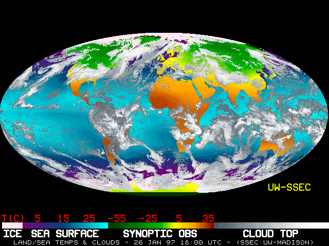
Earth's Temperature
Explanation: Explanation : What's the temperature outside? No matter where you are on Earth , the above map can tell you. This global montage was created using the temperature data from numerous satellites orbiting the Earth. This map indicates temperatures recorded early on January 26 th , 1997, but an even more recent map -- updated every 6 hours -- is usually available . For ocean colors on the map, lighter shades of blue indicate warmer temperatures, while for the land, red hues indicate relative warmth. Just looking at the map one can see that summer warms Earth's southern hemisphere , while winter chills Earth's northern hemisphere. The key at the bottom lists temperatures in degrees Centigrade that can be easily converted to degrees Fahrenheit .
| Date | January 30, 1997 |
|---|---|
| Credit |
Earth's Temperature Credit: GMS, GOES-8, Meteosat, SSEC, NCDC, U. Wisc., NOAA |
| Authors & editors: | Robert Nemiroff (MTU) & Jerry Bonnell (UMCP) |
| A service of: |
ASD at NASA / GSFC, NASA Science Activation & Michigan Tech. U. |