NISAR News & Updates
Description This image captured by U.S.-Indian Earth satellite NISAR on Nov. 10, 2025, shows Washington’s Mount Rainier. The image is cropped from a much larger swath spanning the Pacific Northwest on a cloudy day; NISAR’s L-band SAR instrument is able…
Description This image captured by U.S.-Indian Earth satellite NISAR on Nov. 10, 2025, shows Washington’s Mount St. Helens. The image is cropped from a much larger swath spanning the Pacific Northwest on a cloudy day; NISAR’s L-band SAR instrument is…
Seattle and Portland, Oregon, are among the cloudiest cities in the United States. But that infamous cloud cover is no match for the U.S.-Indian Earth satellite NISAR (NASA-ISRO Synthetic Aperture Radar), which is designed to peer straight through clouds. Doing…

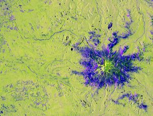
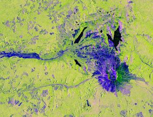
Satellite-based radar images show where a powerful earthquake in the Yukon, Canada, sent rock, snow, and ice spilling across the frozen landscapes of the St. Elias Mountains.
We are currently seeking reviewers for NISAR Data, Applications, Research, and Technology (ROSES A.3). Please note that signing up does not commit you to serve, nor is NASA obligated to invite you to serve. Here are the rules:
NISAR Mission Data, Applications, Research, and Technology Team (A.3 NISAR DART) solicits proposals to join NISAR’s DART team. Introduced in FY26, the DART structure replaces traditional Science and Applications Teams (SATs) across all NASA Earth Science missions in prime operations,…
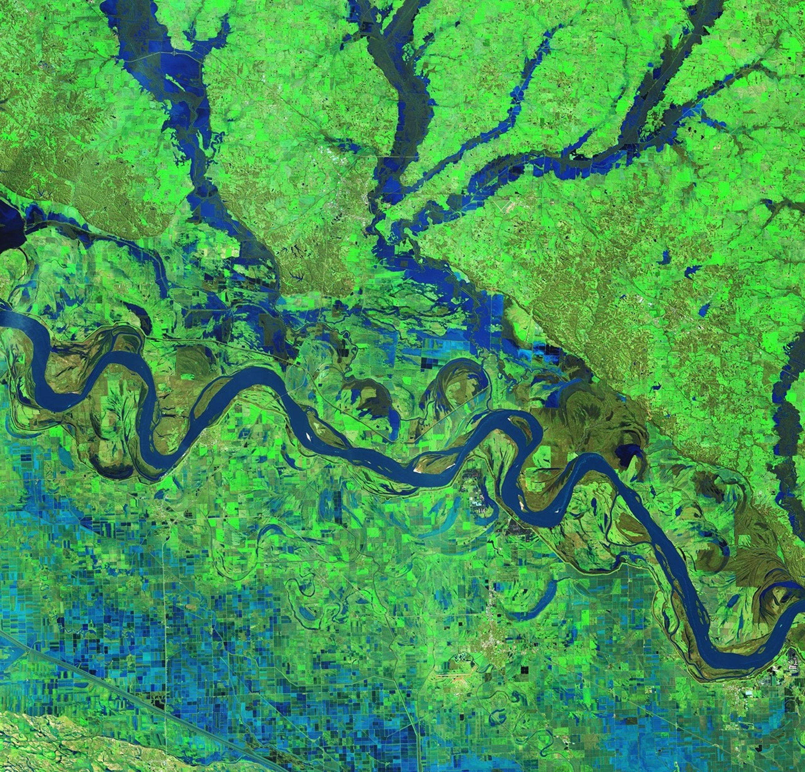
Description The NISAR (NASA-ISRO Synthetic Aperture Radar) Earth-observing satellite’s L-band synthetic aperture radar (SAR) instrument captured this image of the Mississippi River Delta region in southeastern Louisiana on Nov. 29, 2025. The colors in the image represent varying types of…
A new image from the NISAR mission shows off the satellite’s ability to reveal details of Earth’s surfaces. The science team also released new sample data. A U.S.-Indian Earth satellite’s ability to see through clouds, revealing insights and characteristics of our planet’s surface, is on display in a…

Researchers are turning to satellite data to monitor the world’s longest bridges. Due to high costs and logistical challenges, fewer than 1 in 5 bridges extending 492 feet (150 meters) or more have systems installed to track structural changes that…
Captured on Aug. 21, 2025, this image from NISAR's L-band radar shows Maine's Mount Desert Island.