


Description
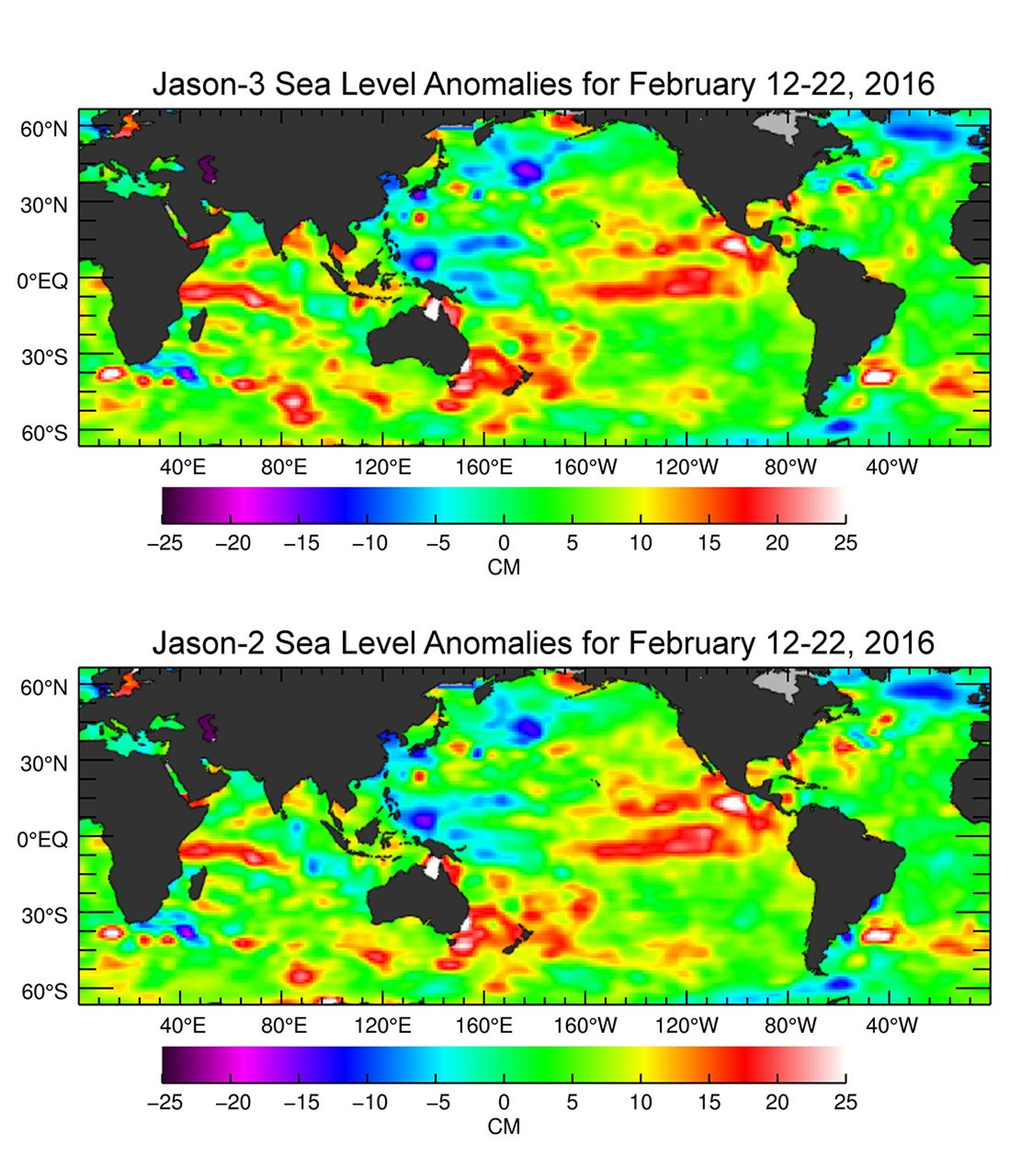
The U.S./European Jason-3 satellite has produced its first map of sea surface height, which corresponds well to data from its predecessor, Jason-2. Higher-than-normal sea levels are red; lower-than-normal sea levels are blue. El Niño is visible as the red blob in the eastern equatorial Pacific.
Extending the timeline of ocean surface topography measurements begun by the Topex/Poseidon and Jason 1 and 2 satellites, Jason 3 will make highly detailed measurements of sea-level on Earth to gain insight into ocean circulation and climate change.
The satellite successfully launched on January 17, 2016, and like its predecessors (Jason 1 and 2, and Topex/Poseidon), is a cooperative of agencies and organizations around the world.
For more information on Jason-3, visit: http://sealevel.jpl.nasa.gov/missions/jason3/.


