Atmospheric Pressure Patterns Before and During Dust Storm
November 27, 2012
| Credit | NASA/JPL-Caltech/CAB(CSIC-INTA)/FMI/Ashima Research |
|---|---|
| Language |
|
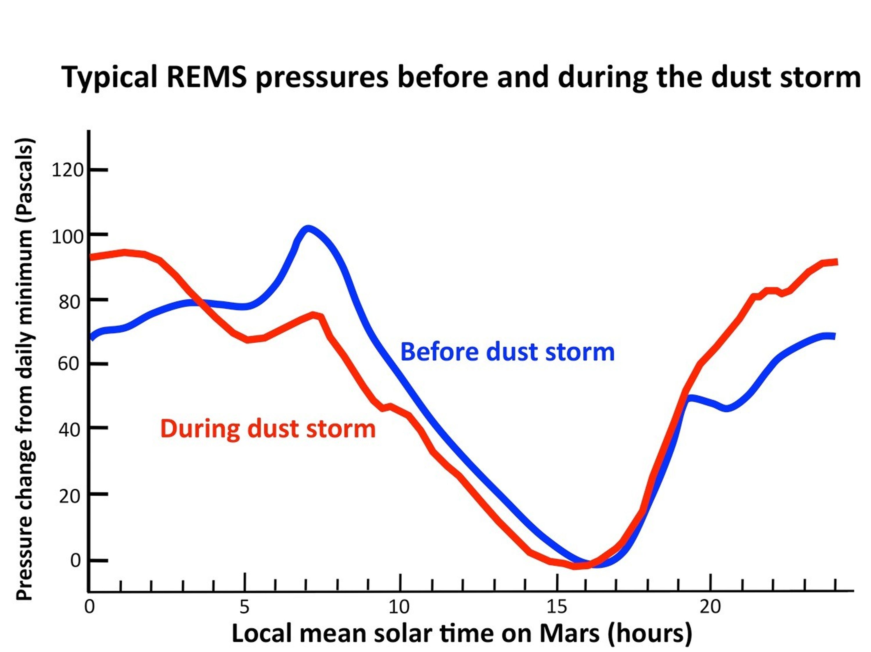
This graph compares a typical daily pattern of changing atmospheric pressure (blue) with the pattern during a regional dust storm hundreds of miles away (red). The data are by the Rover Environmental Monitoring Station (REMS) on NASA's Curiosity rover. Pressure is a measure of the amount of air in the whole column of atmosphere sitting above the rover.
The altered pattern in pressure variation during the storm results from changes both in large-scale atmospheric heating due to dust in the air and from more local atmospheric heating due to an increase in local dustiness.

