


Latest NASA Science News
Stay up-to-date with the latest news from NASA Science as we explore the universe, solar system, sun and our home planet Earth.
Filters
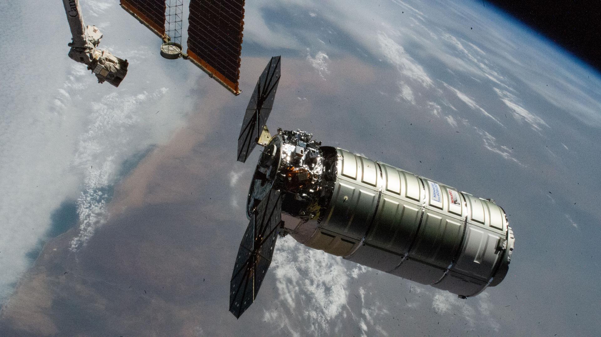
NASA, Northrop Grumman, and SpaceX now are targeting no earlier than 7:41 a.m. EDT Saturday, April 11, for the next Cygnus XL and Falcon 9 launch opportunity to resupply the International Space Station. Teams adjusted the Friday, April 10, launch opportunity due to forecasted inclement…
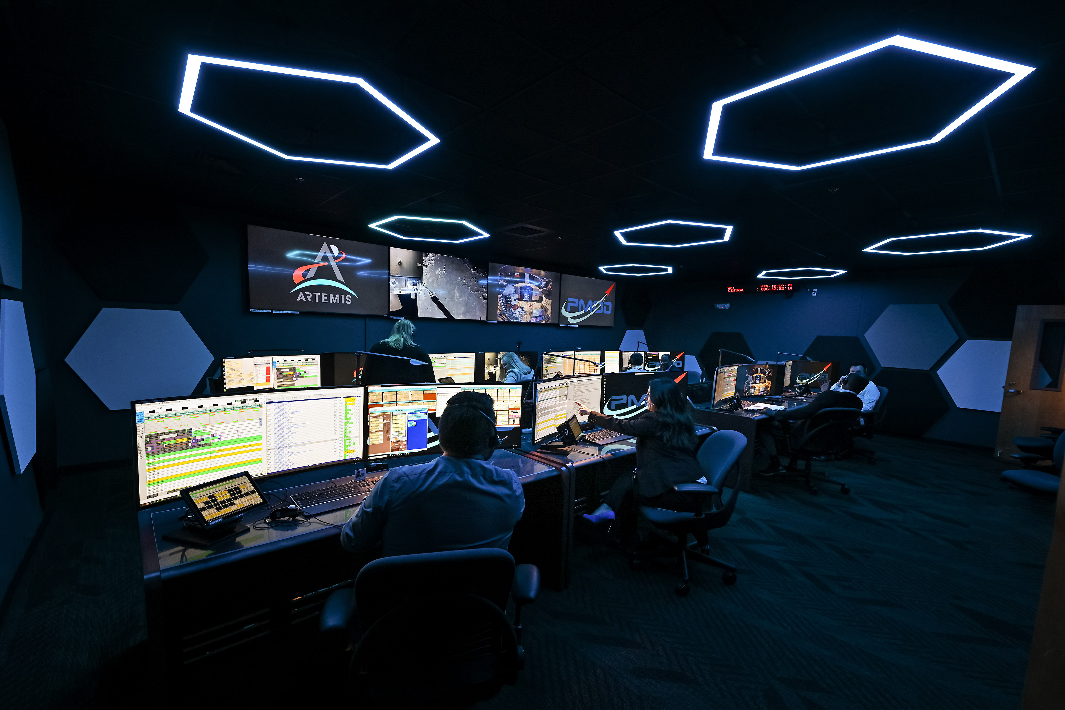
Twin control rooms at NASA’s Marshall Space Flight Center in Huntsville, Alabama, are actively supporting real-time mission operations in lunar orbit as part of the agency’s Artemis II mission, helping ensure astronaut safety and mission success as the crew prepares…
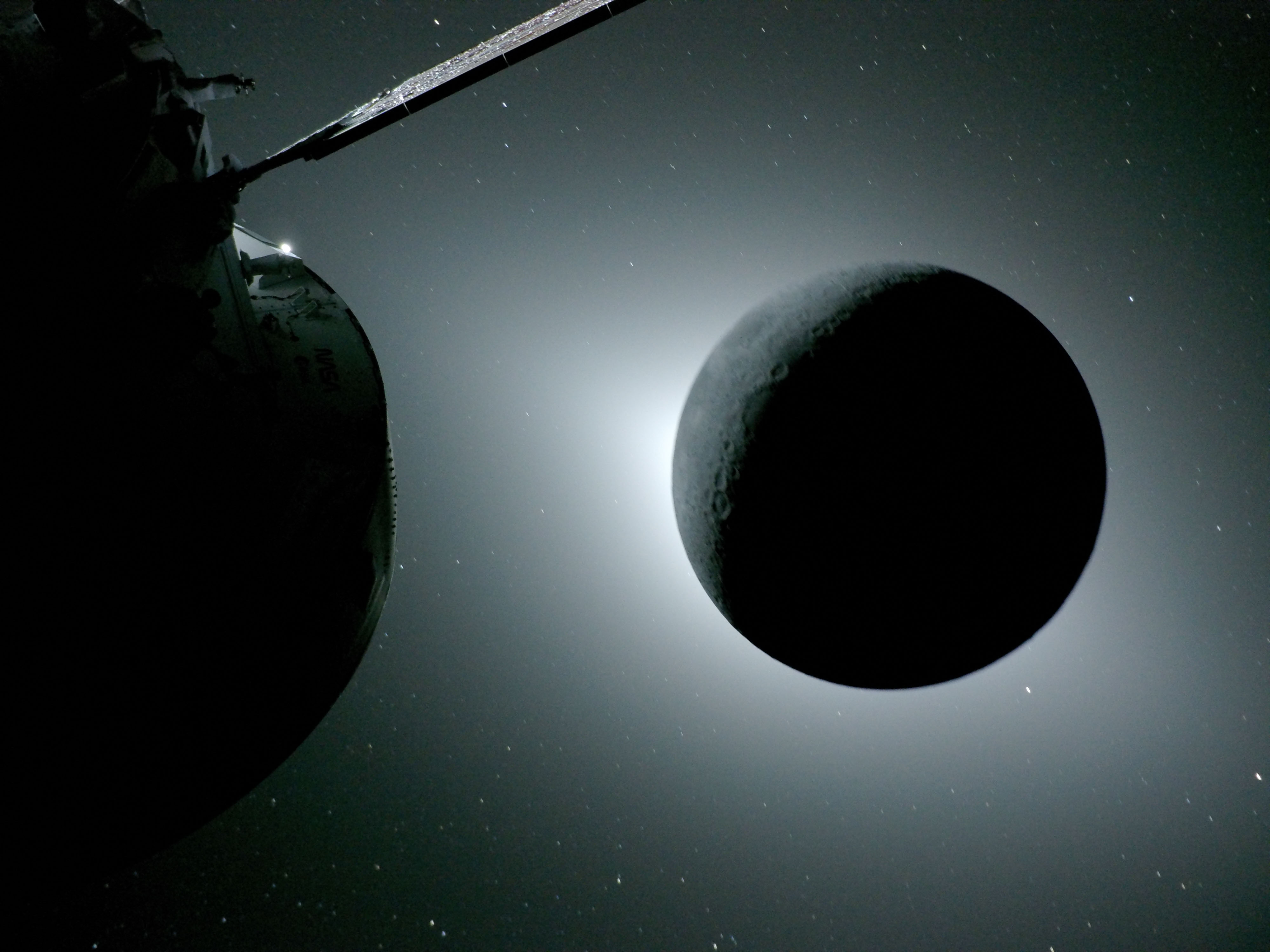
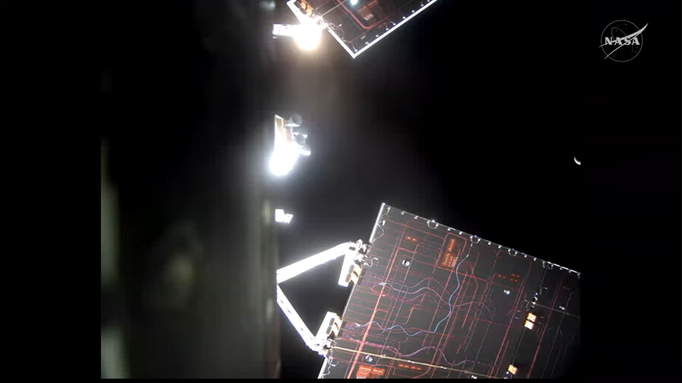
The Moon, seen here backlit by the Sun during a solar eclipse on April 6, 2026, is photographed by one of the cameras on the Orion spacecraft’s solar array wings. During lunar flyby, the Artemis II astronauts observed a solar…
Editor’s Note: This blog was updated on April 8, 2026, to update the time for the crew news conference. In addition, flight controllers elected to forgo the 10:55 p.m. EDT manual piloting demo. Editor’s Note: This blog was updated to…

A massive, old caldera and more recently formed craters shape the landscape in the eastern Sierra Nevada.

Leo is a prominent sight for stargazers in April. Its famous sickle, punctuated by the bright star Regulus, draws many a beginning stargazer’s eyes, inviting deeper looks into some of Leo’s celestial delights, including a great double star and a…
At 8:03 p.m. EDT, the Orion spacecraft, named Integrity, ignited its thrusters for 15 seconds, producing a change in velocity of 1.6 feet-per-second and guiding the Artemis II crew toward Earth. NASA astronaut Christina Koch and CSA (Canadian Space Agency) astronaut Jeremy Hansen reviewed procedures and monitored the spacecraft’s configuration and navigation data. During today’s mission status briefing,…

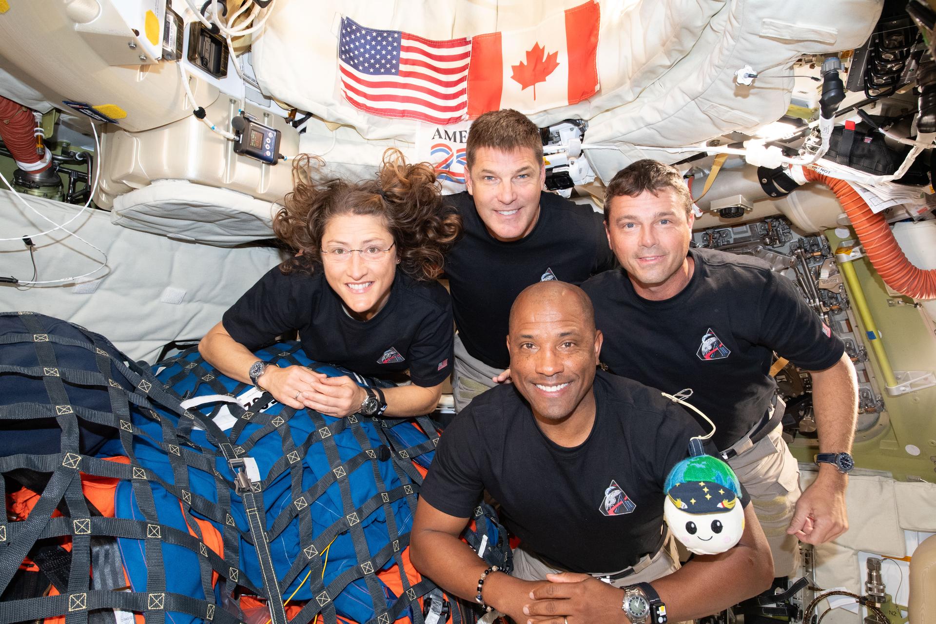
Four Expedition 74 astronauts had a ship-to-ship call with the four Artemis II astronauts on Tuesday after they flew around the Moon in a historic first for NASA and its international partners. The International Space Station residents also continued their…
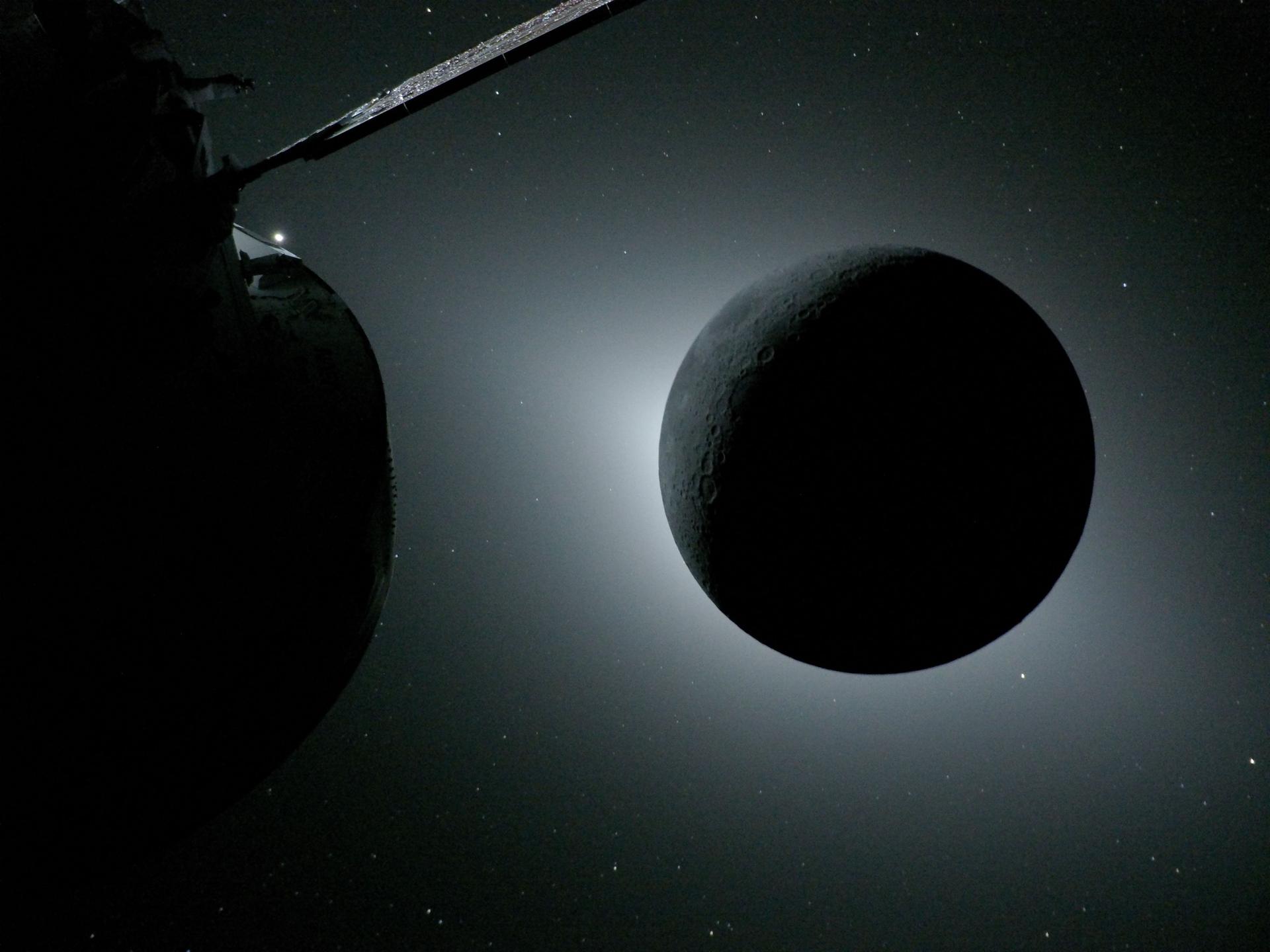
Editor’s note: Some photo captions were updated on April 8, 2026, to reflect ongoing scientific observations and discussion about the images. The first flyby images of the Moon captured by NASA’s Artemis II astronauts during their historic test flight reveal…
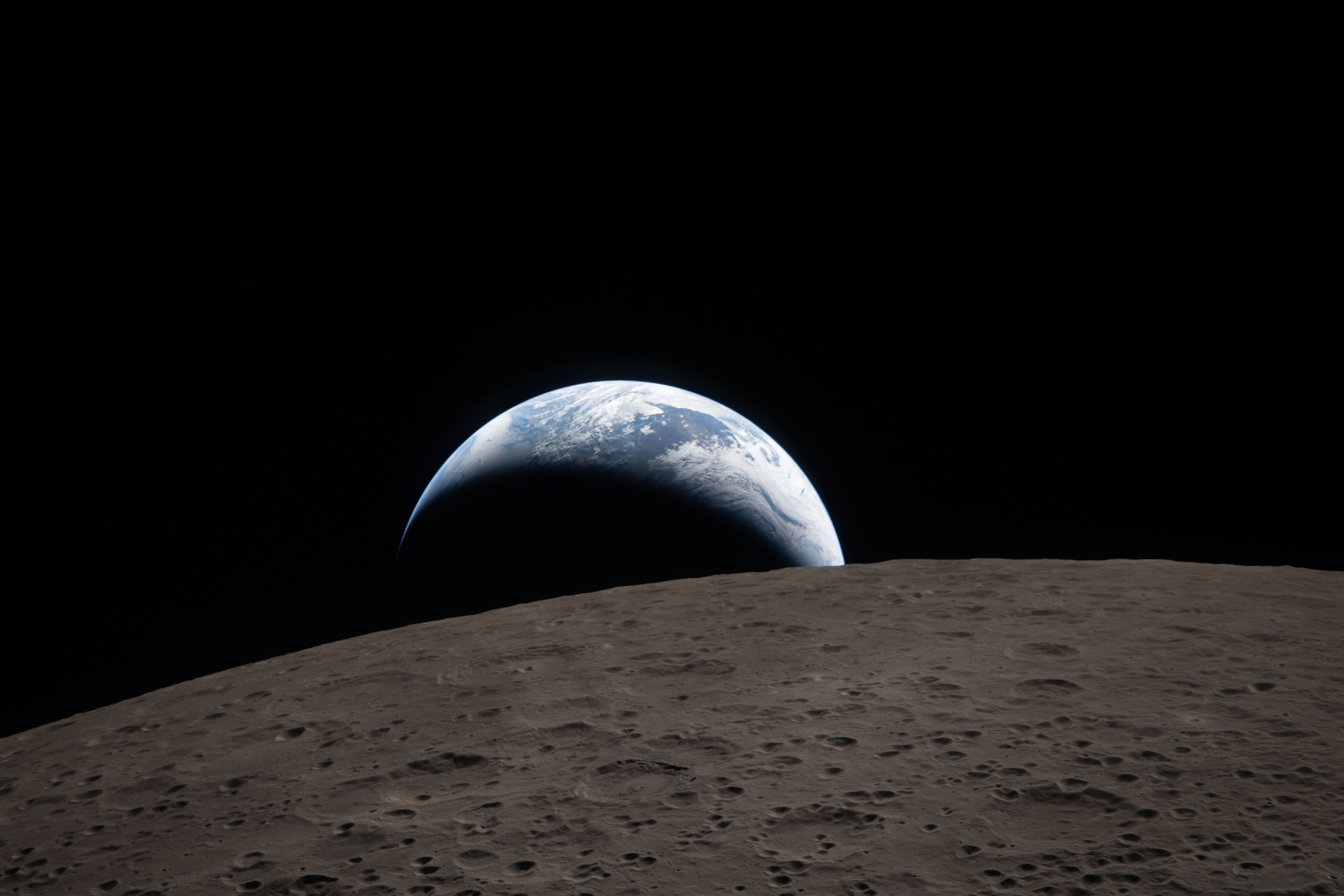
The Artemis II crew captured this view of Earth setting on April 6, 2026, as they flew around the Moon. As the astronauts flew over the Moon’s far side, the crew photographed and described terrain features including impact craters, ancient…


