


Earth
Your home. Our mission.
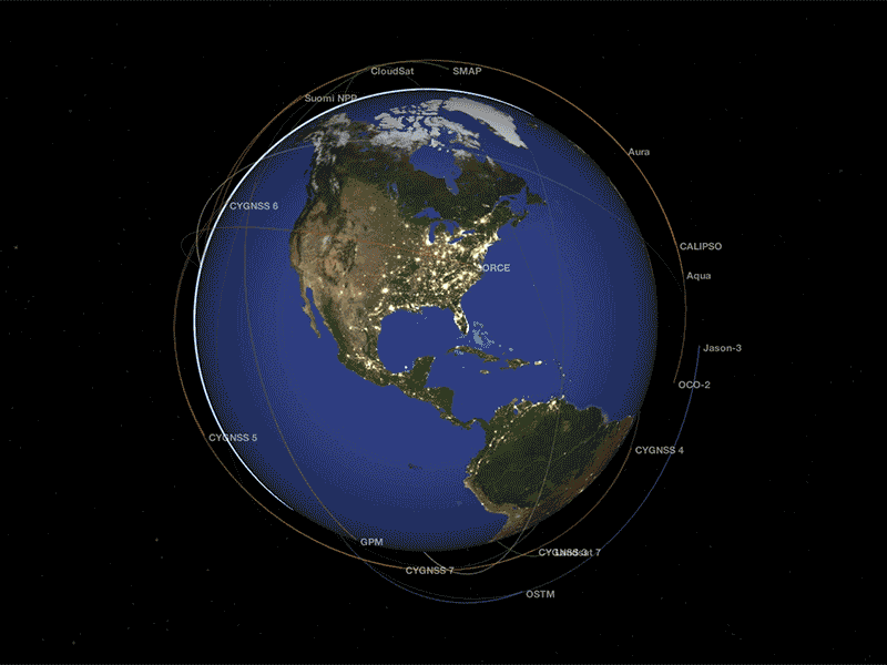
NASA is an exploration agency, and one of our missions is to know our home. We develop novel tools and techniques for understanding how our planet works -- for the benefit of humanity and for insights we need to explore other moons and planets. NASA's Earth Science Division operates more than 20 satellites in orbit, sponsors hundreds of research programs and studies, and funds opportunities to put data to use for societal needs. We develop new ways to observe the oceans, land cover, ice, atmosphere, and life, and we measure how changes in one drive changes in others over the short and long term. While listening to and collaborating with industry leaders, international partners, academic institutions, and other users of our data, we drive innovations and deliver science to help inform decisions that benefit the nation and the world.
Recent News and Articles
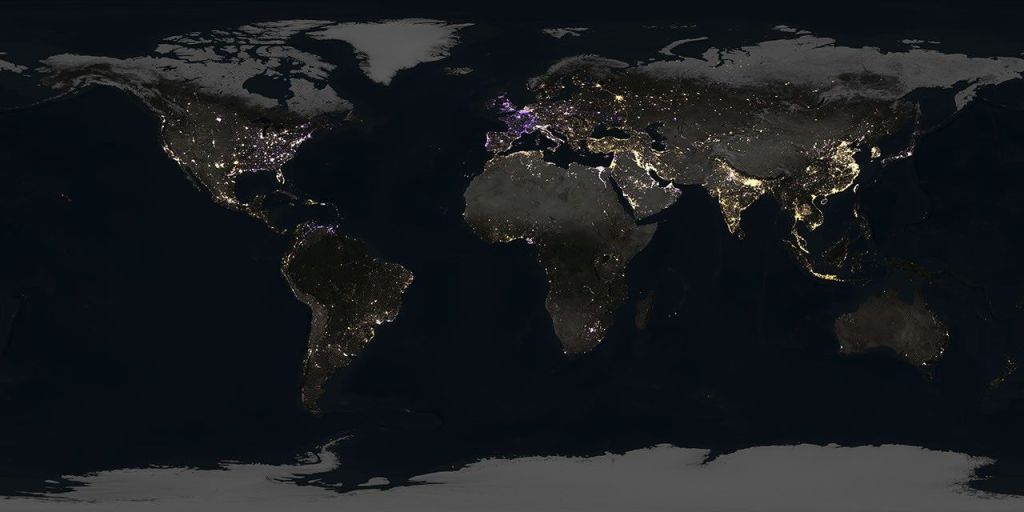
NASA Night-light Imagery Tracks US Energy Transition, Global Volatility

Arctic Winter Sea Ice Ties Record Low, NASA, NSIDC Scientists Find
US-French Satellite Takes Stock of World’s River Water

NASA Looks to Advance Dengue Preparedness in Puerto Rico
Earth Observatory Image of the Day

Above-normal precipitation has swollen rivers and damaged infrastructure statewide.

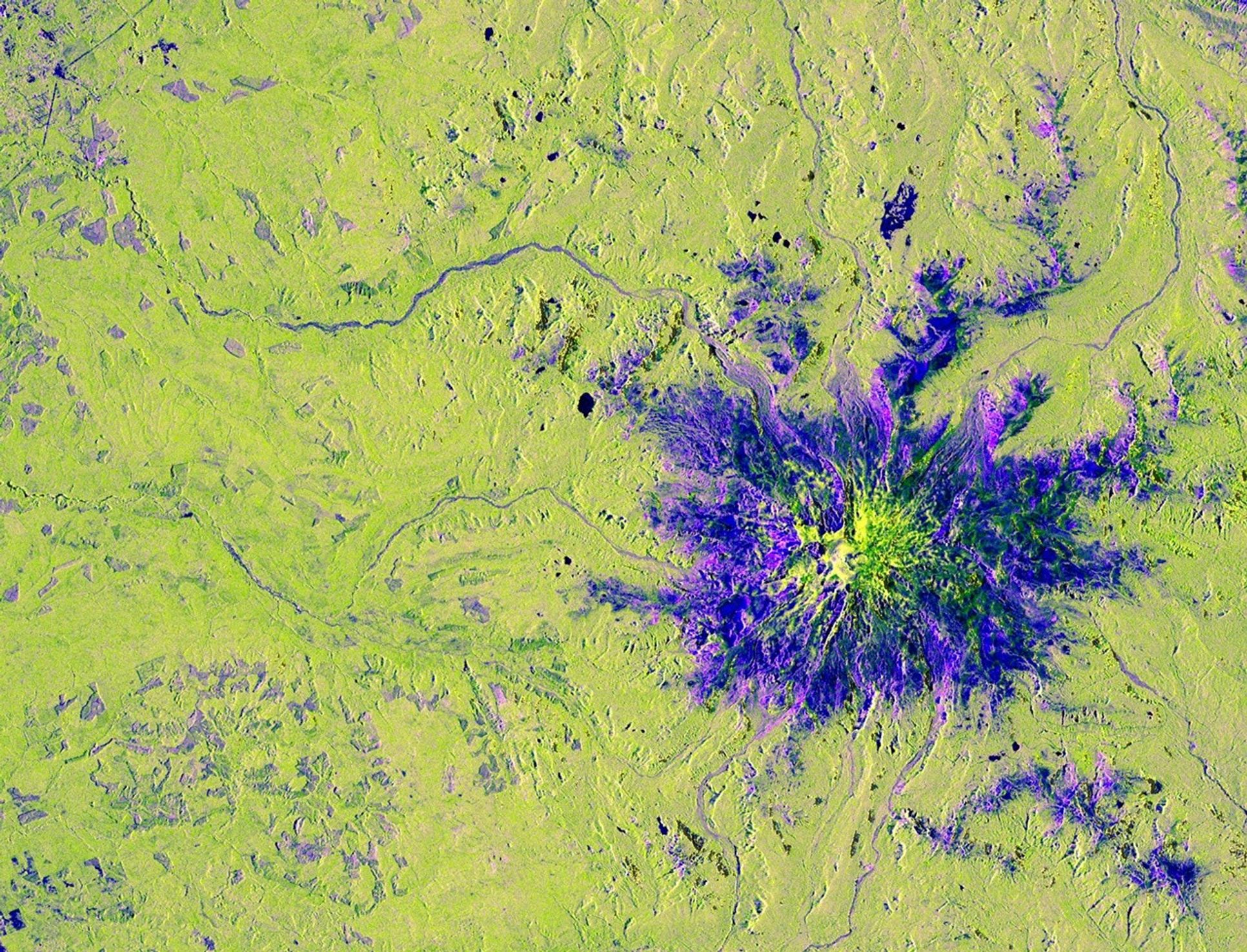
The circular geologic feature in northwestern Africa can be hard to recognize from the ground, but it is obvious when…

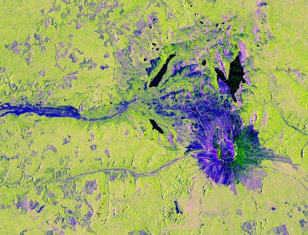
After the Laurentide Ice Sheet retreated from present-day Hudson Bay, rebounding land has revealed striking nearshore topography.
SWOT Mission Unlocks a New View of Our Waterways
Using data from the SWOT (Surface Water and Ocean Topography) mission, jointly developed by the NASA/JPL and the Centre National d'Études Spatiales with contributions from the Canadian Space Agency and the United Kingdom Space Agency, scientists can now measure rivers continuously and across the entire globe for the first time in human history.
From the Mississippi River to the Amazon, these observations reveal how rivers flow, how they change over time, and how they support ecosystems, economies, and communities worldwide like never before.
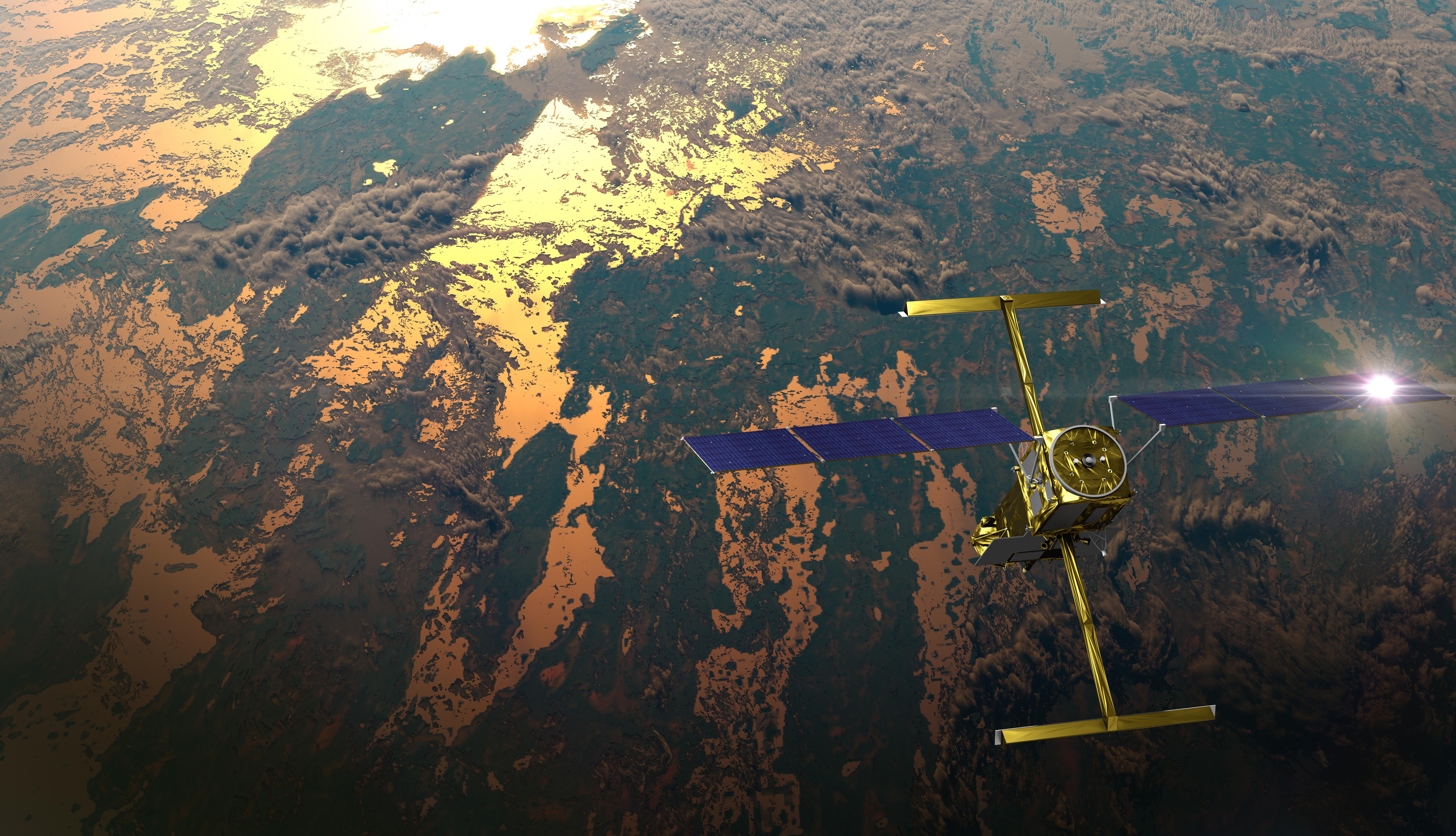
NISAR
Carrying an advanced radar system that will produce a dynamic, three-dimensional view of Earth in unprecedented detail, the NISAR (NASA-ISRO Synthetic Aperture Radar) satellite was launched from India on July 30, 2025. Jointly developed by NASA and the Indian Space Research Organisation (ISRO), the satellite can detect the movement of land and ice surfaces down to the centimeter. The mission will help protect communities by providing unique, actionable information to decision-makers in a diverse range of areas, including disaster response, infrastructure monitoring, and agricultural management.
Landsat 9: More Than Just A Picture
For over 50 years, the Landsat program has provided the longest continuous satellite record of Earth's land surface from space. Landsat 9, launched in 2021, is the latest mission in this remarkable legacy — building on decades of Earth observation with upgraded technology, including enhanced radiometric resolution, improved signal-to-noise performance, and polar night thermal imaging. Working in tandem with Landsat 8 to map the entire planet every eight days, Landsat 9's data is being fused with the European Space Agency's Sentinel-2 satellites to enable near-daily global observations, delivering sharper, more detailed observations that help scientists and communities monitor a changing planet.
The full storyScience in Action for Society
Learn how NASA’s studies of Earth bring benefits to the nation and world.

NASA Data Helps Maine Oyster Farmers Choose Where to Grow

Meet Mineral Mappers Flying NASA Tech Out West
How NASA Is Testing AI to Make Earth-Observing Satellites Smarter

NASA Data Powers New Tool to Protect Water Supply After Fires

NASA Mission Monitoring Air Quality from Space Extended

NASA Tech to Use Moonlight to Enhance Measurements from Space

NASA Aircraft, Sensor Technology, Aid in Texas Flood Recovery Efforts

NASA Sensor on Space Station Eyes Contamination off California Coast
NASA’s Hurricane Science, Tech, Data Help American Communities
NASA's cutting-edge research, technology, and tools bolster the nation’s readiness and response to severe weather.
Read Article
Sensing the Seas
For more than forty years, NASA has found unique ways to study the surface layers of the ocean from the tropics to the poles. With three new missions since 2020 – PACE, SWOT, and Sentinel 6-Michael Freilich – we are now ushering in a new era of ocean studies.

NASA’s PACE Mission Reveals a Year of Terrestrial Data on Plant Health

NASA, French SWOT Satellite Offers Big View of Small Ocean Features
Next-Generation Water Satellite Maps Seafloor From Space
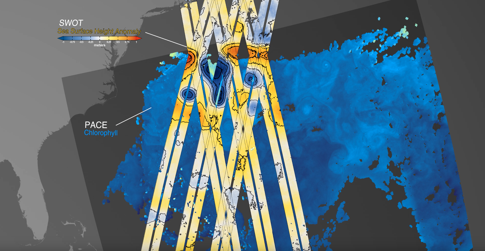
NASA’s PACE, US-European SWOT Satellites Offer Combined Look at Ocean

NASA Analysis Shows Irreversible Sea Level Rise for Pacific Islands

Earth Information Center
For more than 50 years, NASA satellites have provided data on Earth's land, water, air, temperature, and climate. NASA's Earth Information Center allows visitors to see how our planet is changing in six key areas: sea level rise and coastal impacts, health and air quality, wildfires, greenhouse gases, sustainable energy, and agriculture.
Explore