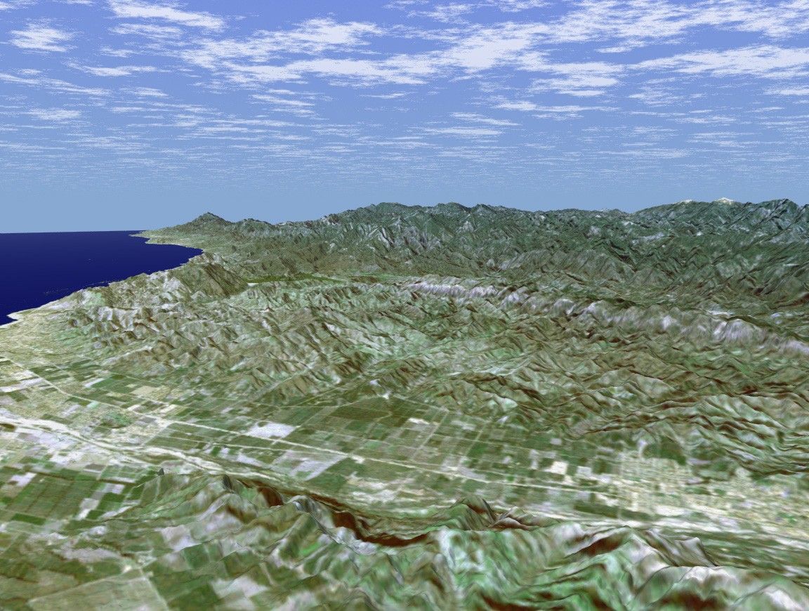

Rectangular fields of the agriculturally rich Santa Clara River Valleyare visible in this perspective view generated using data from theShuttle Radar Topography Mission (SRTM) and an enhanced Landsat image. TheSanta Clara River, which lends its name to this valley, flows fromheadwaters near Acton, California, 160 km (100 miles) to the PacificOcean, and is one of only two natural river systems remaining insouthern California. In the foreground of this image, the largely dryriverbed can be seen as a bright feature as it winds its way along thebase of South Mountain. The bright region at the right end of thisportion of the valley is the city of Santa Paula, California. Founded in1902, this small, picturesque town at the geographic center of VenturaCounty is referred to as the "Citrus Capital of the World." The city issurrounded by orange, lemon, and avocado groves and is a majordistribution point for citrus fruits in the United States. The bright,linear feature in the center of the valley is State Highway 126, thevalley's "main drag." For visualization purposes, topographic heightsdisplayed in this image are exaggerated two times. Colors, from Landsatdata, approximate natural color.
Location: 34.42 deg. North lat., 119.17 deg. West lon.
View: Toward the North
Scale: Scale Varies in this Perspective
Date Acquired: February 16, 2000 SRTM, December 14, 1984 Landsat
References & Resources
Image courtesy NASA/JPL/NIMA/USGS