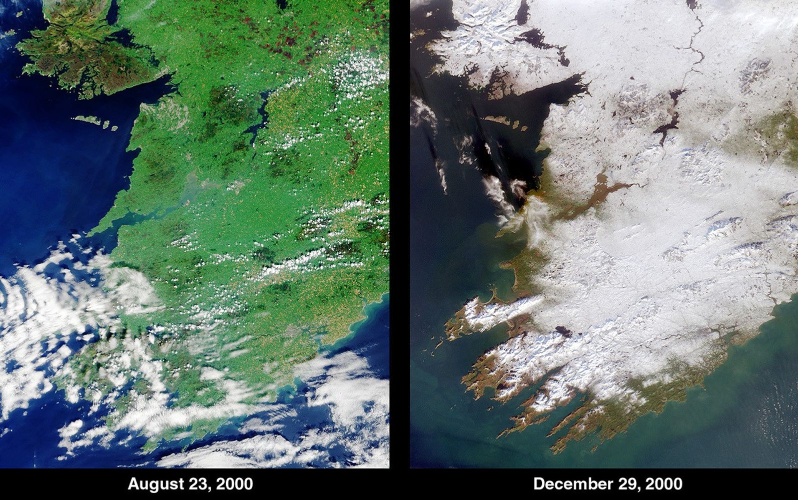
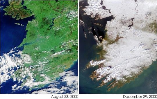
Ireland’s climate is normally mild due to the nearby Gulf Stream, butthe waning days of 2000 saw the Emerald Isle’s green fields swathed inan uncommon blanket of white. The contrast between summer and winter isapparent in this pair of images of southwestern Ireland acquired by theMulti-angle Imaging Spectroradiometer’s(MISR's) vertical-viewing (nadir) camera on August 23, 2000 (left) andDecember 29, 2000 (right).
The year 2000 brought record-breaking weather to the British Isles.England and Wales experienced the wettest spring and autumn months since1766. Despite being one of the warmest years in recent history, a coldsnap arrived between Christmas and New Year’s Day. According to the UKMeteorological Office, the 18 centimeters (7 inches) of snow recorded atAldergrove, Northern Ireland, on December 27-28 was the deepest dailyfall since 1930.
Prominent geographical features visible in the MISR images includeGalway Bay near the top left. Further south, the mouth of the RiverShannon, the largest river in the British Isles, meets the AtlanticOcean. In the lower portions of the images are the counties of Limerick,Kerry and Cork.
References & Resources
Image NASA/GSFC/JPL, MISR Team.