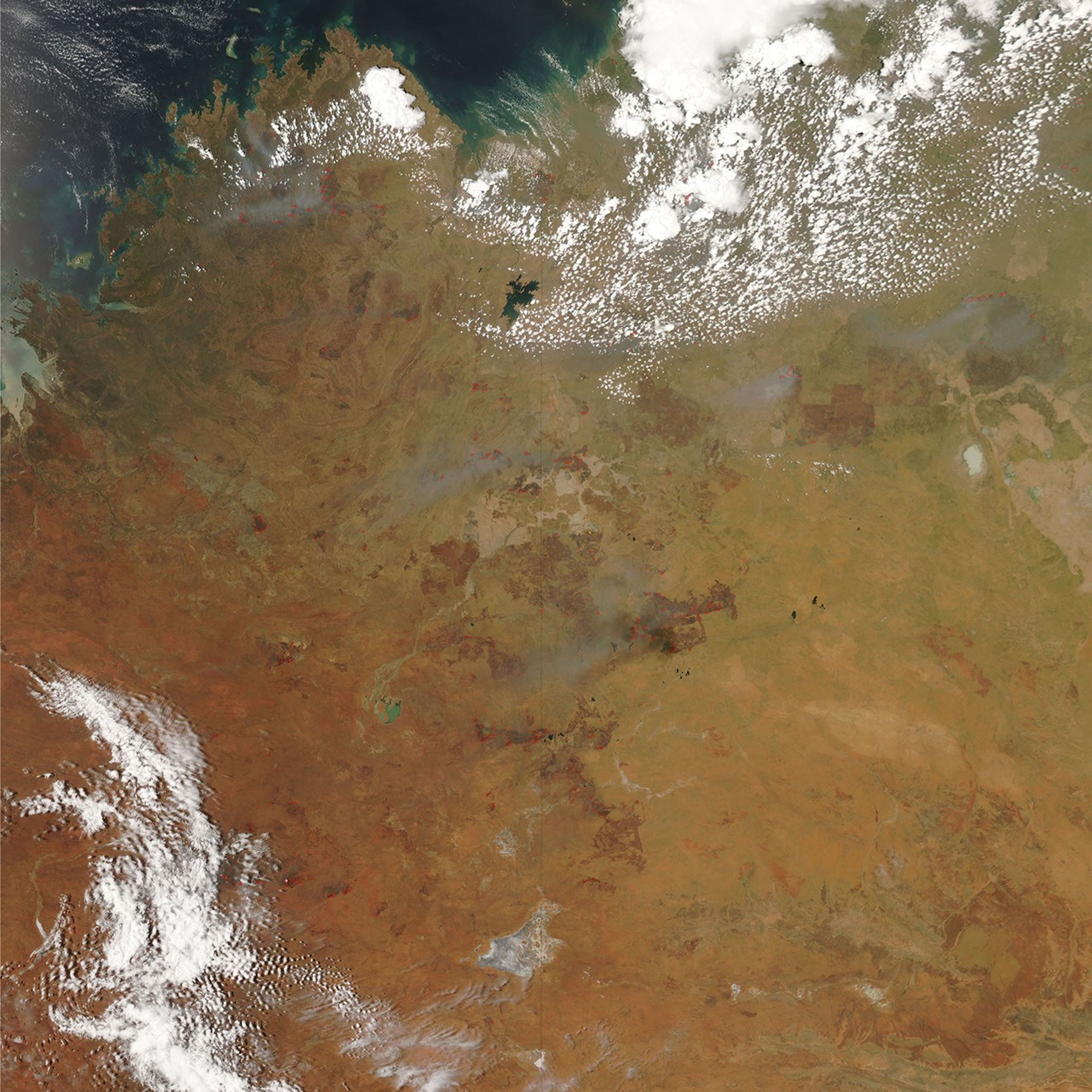
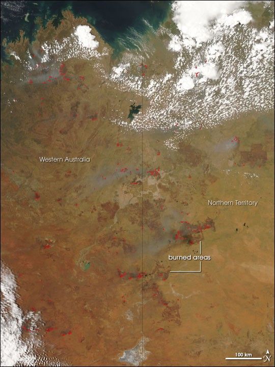
Dozens of large fires were burning across the semi-arid landscape of northwestern Australia on November 17, 2006, when the Moderate Resolution Imaging Spectroradiometer (MODIS) on NASA’s Aqua satellite passed overhead and captured this image. Places where MODIS detected actively burning fires are marked in red. Burn scars, which stand out in deep brown against the tan and faint green background of the unburned savanna and grasslands, are evident in many locations. Many of the fires are creating plumes of gray smoke that contrast sharply with the bright white clouds.
The high-resolution image provided above has a spatial resolution of 250 meters per pixel. The MODIS Rapid Response System provides twice-daily images of Australia in additional resolutions via a clickable map.
References & Resources
NASA image courtesy the MODIS Rapid Response Team, Goddard Space Flight Center