- April 24, 2004 (Aqua MODIS; 1.5 Mb JPEG)
- April 17, 2004 (Terra MODIS; 1.3 Mb JPEG)
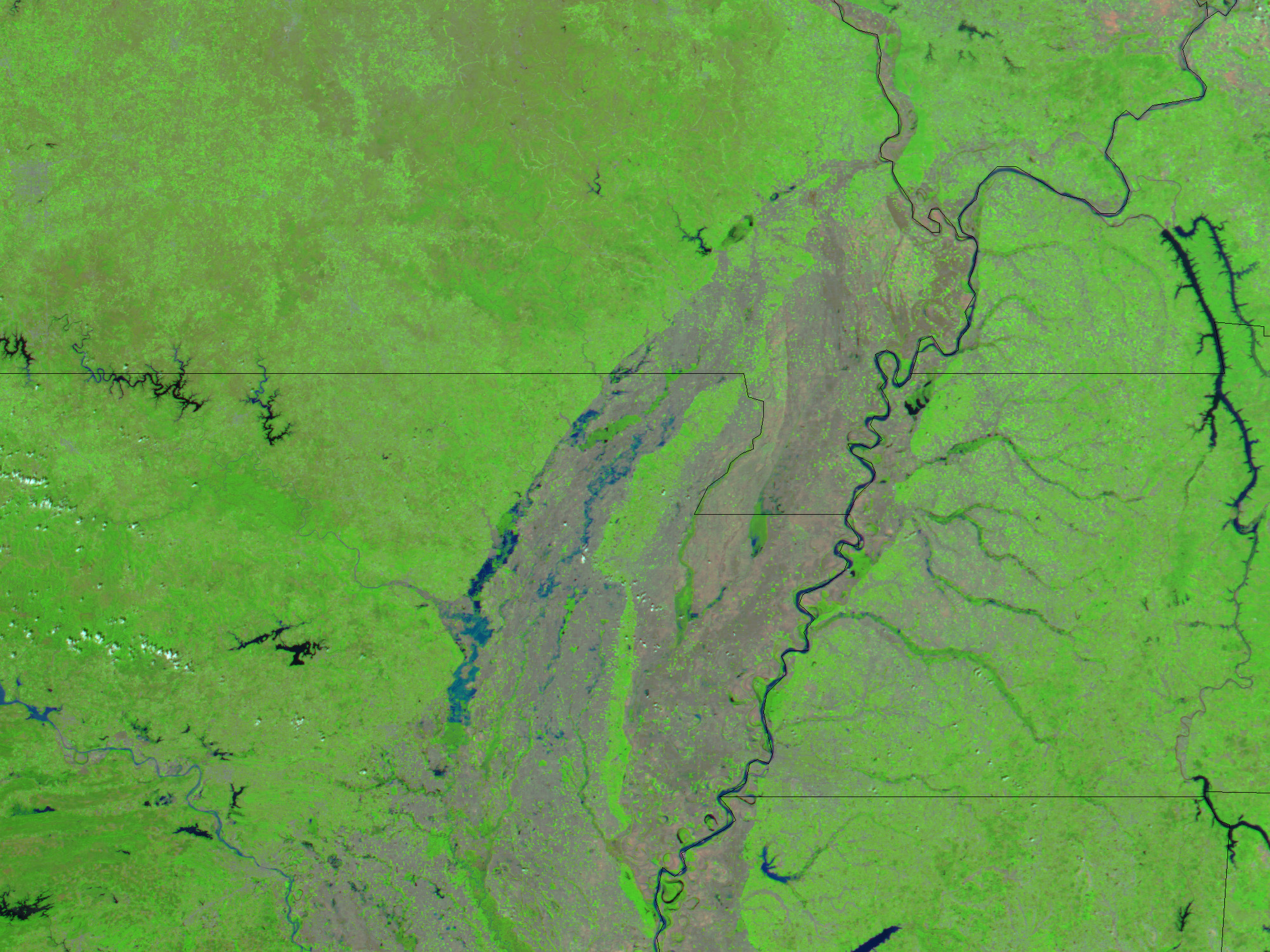
Heavy rains in northwestern Arkansas are beginning to cause flooding downstream in northeastern Arkansas. The White River, a tributary of the Mississippi River, appeared flooded in this Moderate Resolution Imaging Spectroradiometer (MODIS) image, acquired by the Aqua satellite on April 27, 2004. Blue patches of water line the river, which is barely visible in an image acquired just ten days earlier. On the right side of the image, the Mississippi River forms Arkansas’ eastern border with Tennessee. A narrow strip of Missouri is visible along the top of the images.
The high resolution images are at MODIS’ maximum resolution of 250 meters per pixel. Both the April 27 and the April 17 images are available in additional resolutions. Vegetation colors these false color images bright green. Clouds appear light blue.
References & Resources
Image courtesy Jesse Allen, based on data from the MODIS Rapid Response Team at NASA GSFC