September 5, 2004
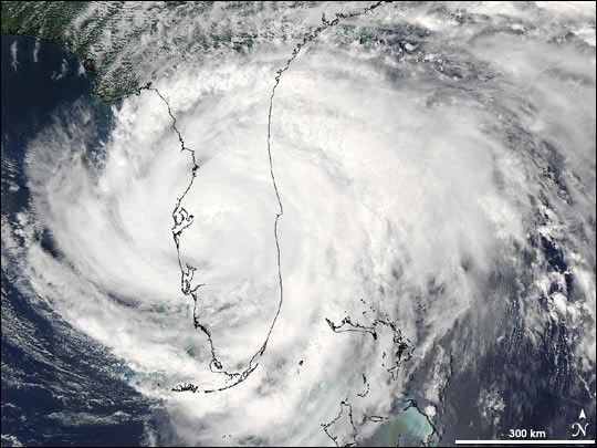
Slow-moving Hurricane Frances crept across Florida on Sunday, September 5, 2004, producing hour after hour of heavy rains. This image of Frances was captured by the Moderate Resolution Imaging Spectroradiometer (MODIS) on NASAâs Aqua satellite at 2:15 in the afternoon (EDT). The stormâs eye is barely visible to the east of Tampa bay, in the middle of Floridaâs western coast. Frances was predicted to strengthen once again as the storm moved into the warm waters of the Gulf of Mexico on Monday.
The high-resolution image provided above is 500 meters per pixel. The MODIS Rapid Response System provides this image at
References & Resources
NASA image courtesy Jacques Descloitres, MODIS Rapid Response Team, NASA-Goddard Space Flight Center