


![Request for Information – Potential [Placeholder for Prize]](https://assets.science.nasa.gov/dynamicimage/assets/science/psd/solar/2023/09/s/solarsystem_0.jpg?w=1024)


January 7, 2005
- High-resolution images:
- January 7, 2005 (5.1 MB JPEG)
- May 18, 2004 (5.3 MB JPEG)
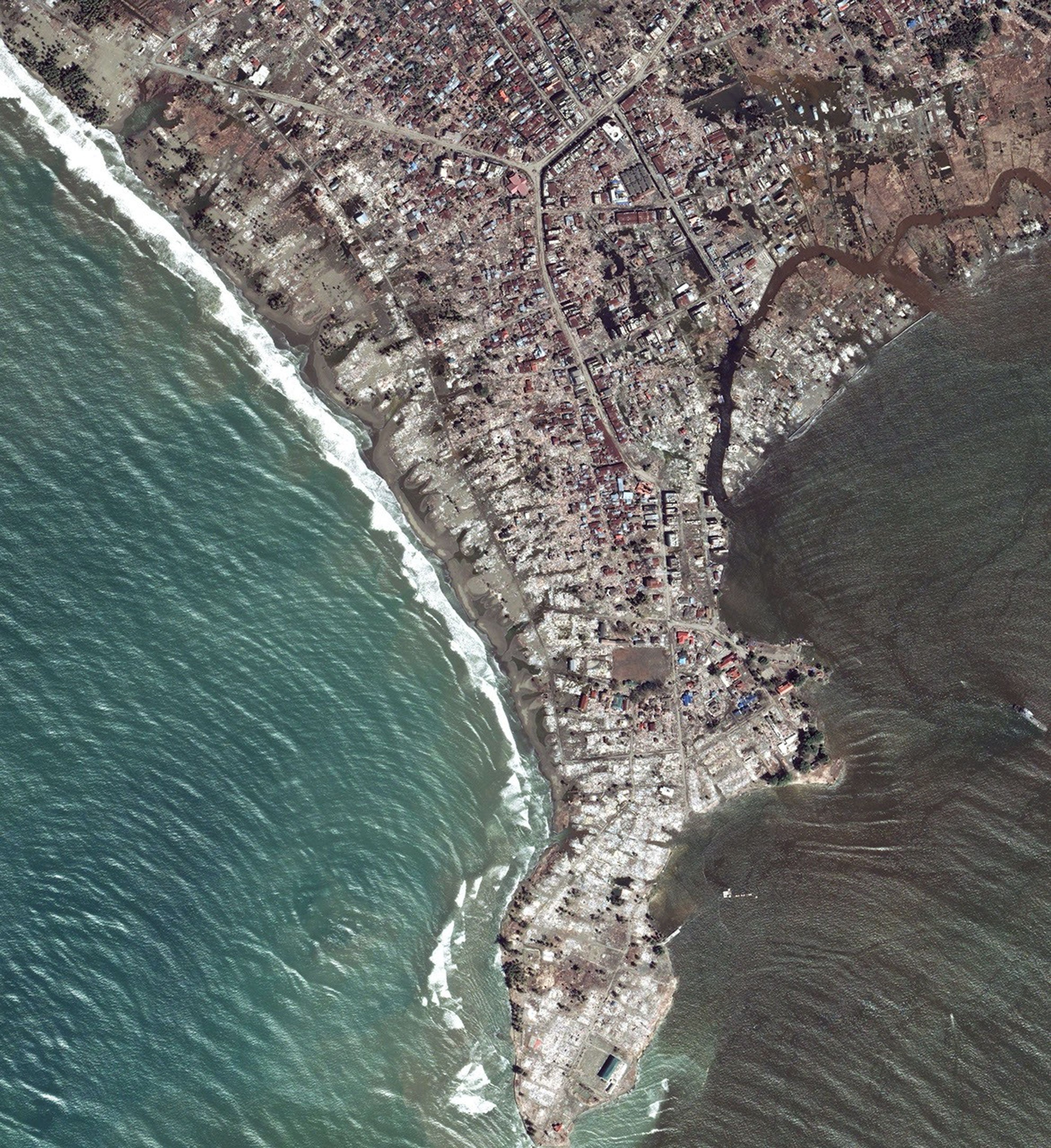
Satellites continue to acquire imagery of areas severely damaged by the tsunami of December 26, 2004. This image of Meulaboh, Indonesia, was collected on January 7, 2005, by DigitalGlobeâs QuickBird satellite. Meulaboh is located on the coast of Sumatra, roughly 150 kilometers (93 miles) from the epicenter of the magnitude 9.0 earthqukae that generated the tsunami. The image shows where the tsunami washed over a narrow peninsula, eroding the beach and destroying many of the townâs buildings.
References & Resources
Image copyright DigitalGlobe


