

Atmospheric scientists regularly take note when satellites detect thunderheads rising above columns of wildfire smoke. These “fire clouds”—experts call them pyrocumulonimbus (pyroCb) or cumulonimbus flammagenitus—are caused when fires loft enough heat and moisture into the atmosphere to produce thunderstorms.
On August 8, 2019, a team of atmospheric scientists got an exceedingly rare look at these clouds as they were forming. NASA’s DC-8 flying laboratory passed directly through a large pyrocumulonimbus that day as it was rising from a fire in eastern Washington. The flight was part of a joint NOAA and NASA field campaign called FIREX-AQ. Scientists are studying the composition and chemistry of smoke to better understand its impact on air quality and climate.
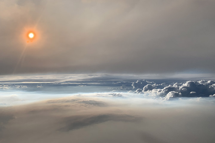
David Peterson, lead forecaster for FIREX-AQ, was in the cockpit of NASA’s DC-8. “The views were absolutely stunning,” said Peterson. “Very few photographs of large pyroCbs are available, especially from the air.”
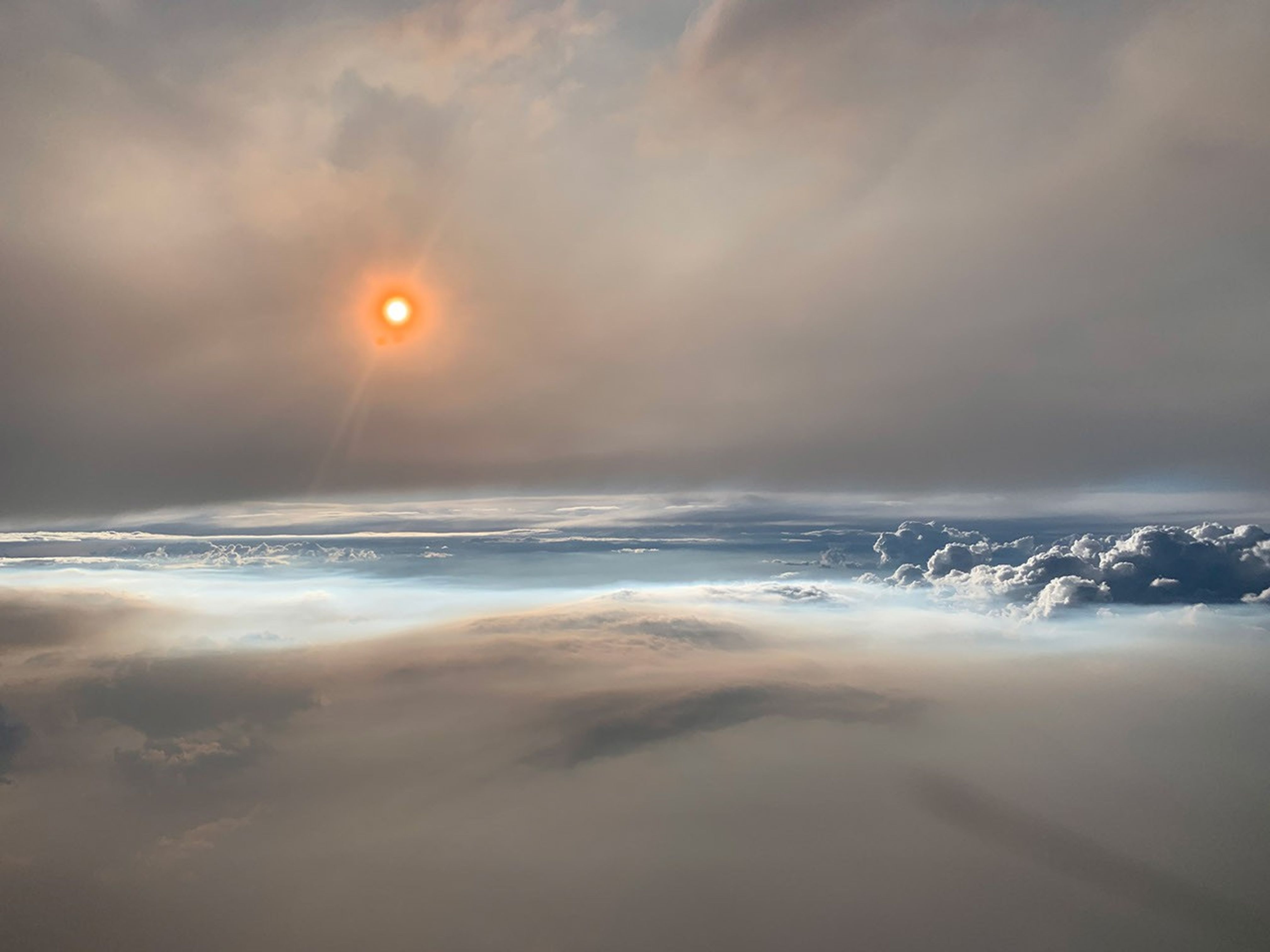
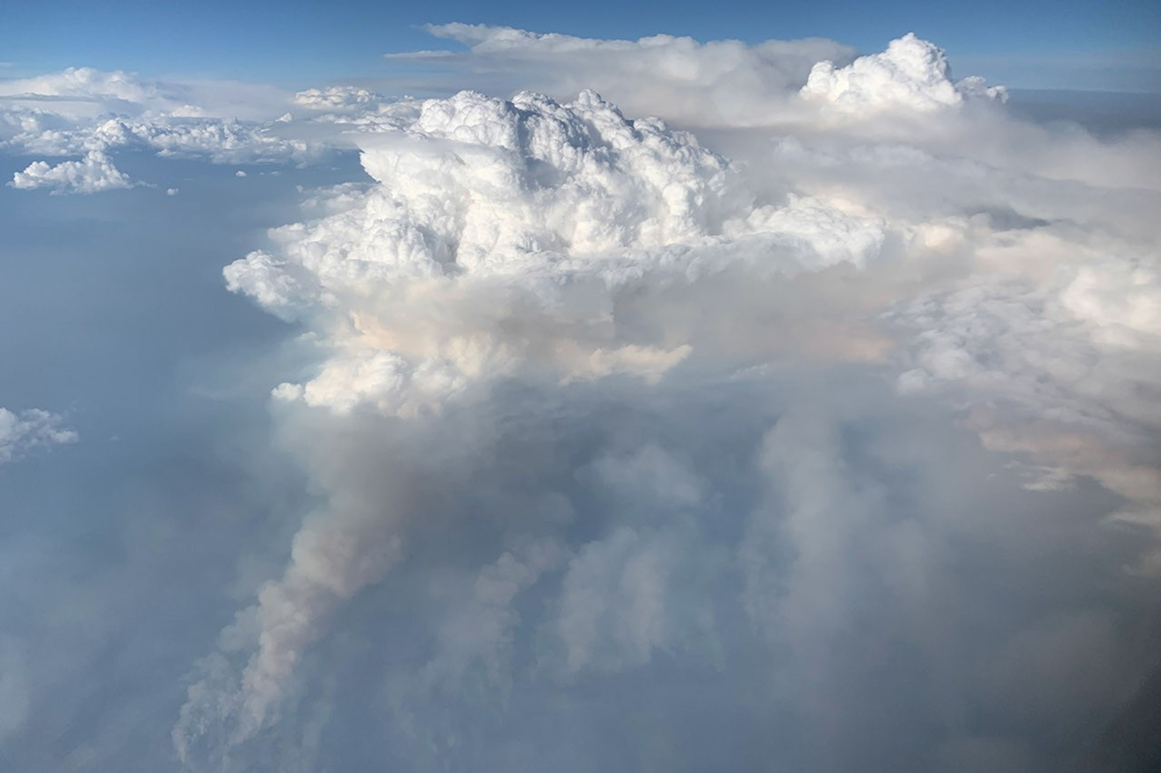
The photograph above, shot from roughly 30,000 feet (9 kilometers), shows the setting Sun shining through thick smoke at 8 p.m. Mountain Time. Particles in the smoke reflect light in ways that make the Sun appear orange. The photograph below shows the smoke plume (gray) that fed the pyrocumulonimbus cloud (white).
The flight was the most detailed sampling of a pyrocumulonimbus in history, explained Peterson. A second research aircraft flew over the plume a few hours earlier in the day, and mobile labs on the ground also made detailed measurements.

“PyroCb are like large chimneys, transporting a large quantity of smoke into the lower stratosphere,” explained Peterson.
When smoke does reach the stratosphere, it tends to spread globally and remain high in the atmosphere for longer periods—months or even years—than smoke that stays in the lower troposphere. One recent study concluded that the largest fire clouds can even lift quantities of smoke aerosols into the lower stratosphere that are comparable to a moderate-sized volcanic eruption.
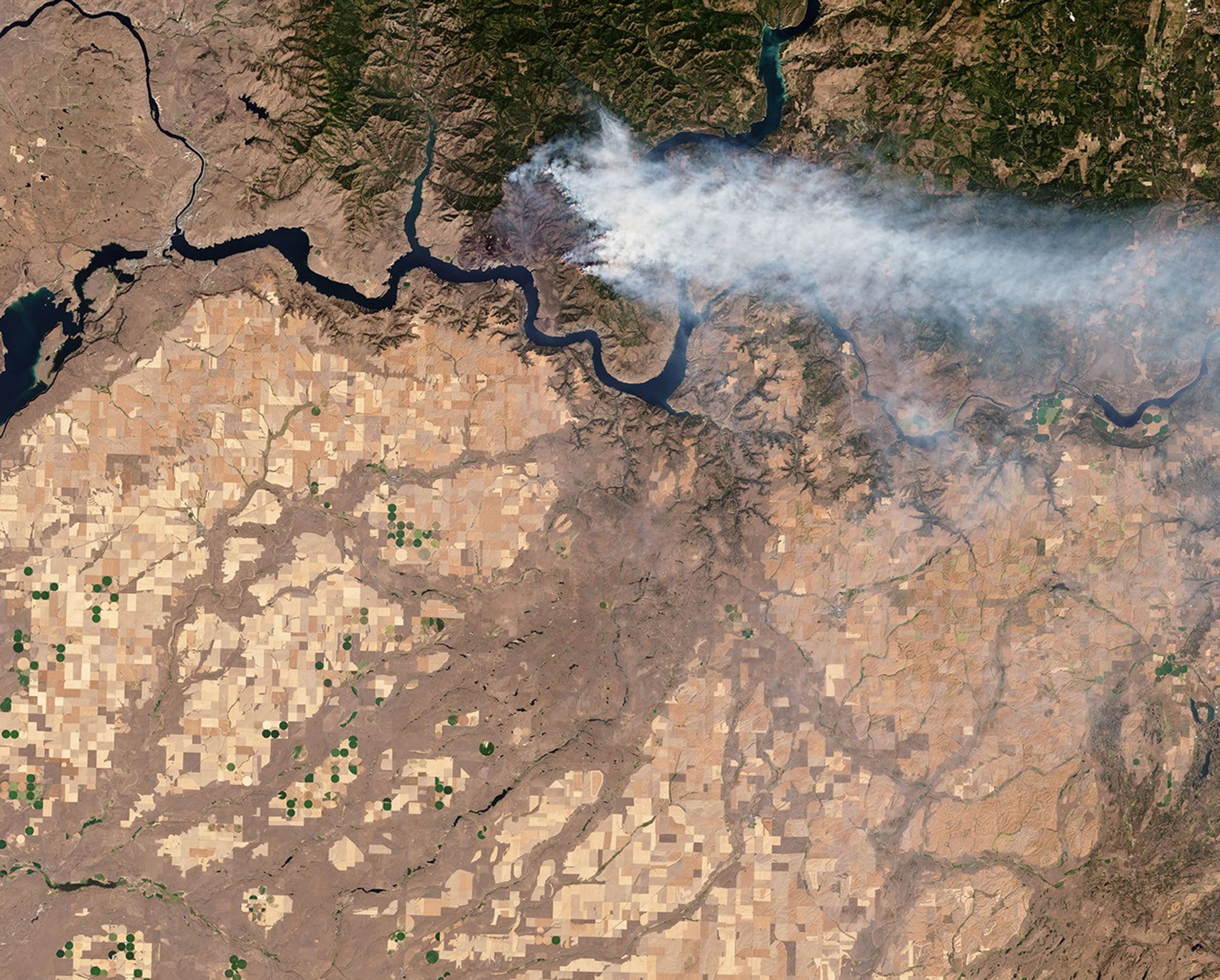
An early morning thunderstorm ignited the Williams Flats fire on August 2, 2019. The Operational Land Imager (OLI) on Landsat 8 acquired a natural-color image of the blaze (at the top of the page) as it approached the north bank of the Columbia River on August 7, 2019. The image is natural color (OLI bands 4-3-2), overlaid with the infrared and shortwave infrared signature of actively burning fires.
References & Resources
- Inciweb (2019, August 12) Williams Flats Fire. Accessed August 9, 2019.
- NASA Earth Observatory (2019) When Wildfire Smoke and Thunderstorms Collide.
- NASA Earth Observatory (2012, May 26) The Anatomy of a Thunderstorm.
- NASA Earth Observatory (2014, August 6) Evolution of Pyrocumulus over California.
- NASA Earth Expeditions (2019) FIREX-AQ. Accessed August 9, 2019.
- National Interagency Fire Center (2019, August 9) Fire Info. Accessed August 9, 2019.
- NOAA FIREX-AQ. Accessed August 9, 2019.
- Peterson, D. et al. (2017) A Conceptual Model for Development of Intense Pyrocumulonimbus in Western North America. Monthly Weather Review, 144, 2235-2255.
- Peterson, D. et al. (2018) Wildfire-driven thunderstorms cause a volcano-like stratospheric injection of smoke. Climate and Atmospheric Science, 1, 30.
- Spokane-Review (2019, August 11) Rain slows spread of Stevens County wildfires, also triggers flooding. Accessed August 9, 2019.
- The Seattle Times (2019, August 11) Washington wildfire smoke triggered a thunderstormâand NASA researchers flew through it. Accessed August 9, 2019.
NASA Earth Observatory image by Joshua Stevens, using Landsat data from the U.S. Geological Survey. Photographs by David Peterson (U.S. Naval Research Laboratory). Story by Adam Voiland.