July 24, 2019-January 1, 2020
Thick Smoke Blankets Southeastern Australia
The record-setting and deadly fire season in Australia took a dramatic turn in the last week of December and first week of January. Residents of southeastern Australia told news media about the daytime seeming to turn to night, as thick smoke filled the skies and intense fires drove people from their homes.
In the coastal tourist town of Mallacoota, fire blocked the main road out of the area. Seeking safety, residents, tourists, and firefighters huddled on beaches and the wharf as wind-driven fires advanced. Firefighters and government officials have been urging tourists to leave coastal regions of Victoria and New South Wales, and a seven-day state of emergency was set to begin on January 3. The declaration will include some forced evacuations as severe fire danger is predicted for the coming days.
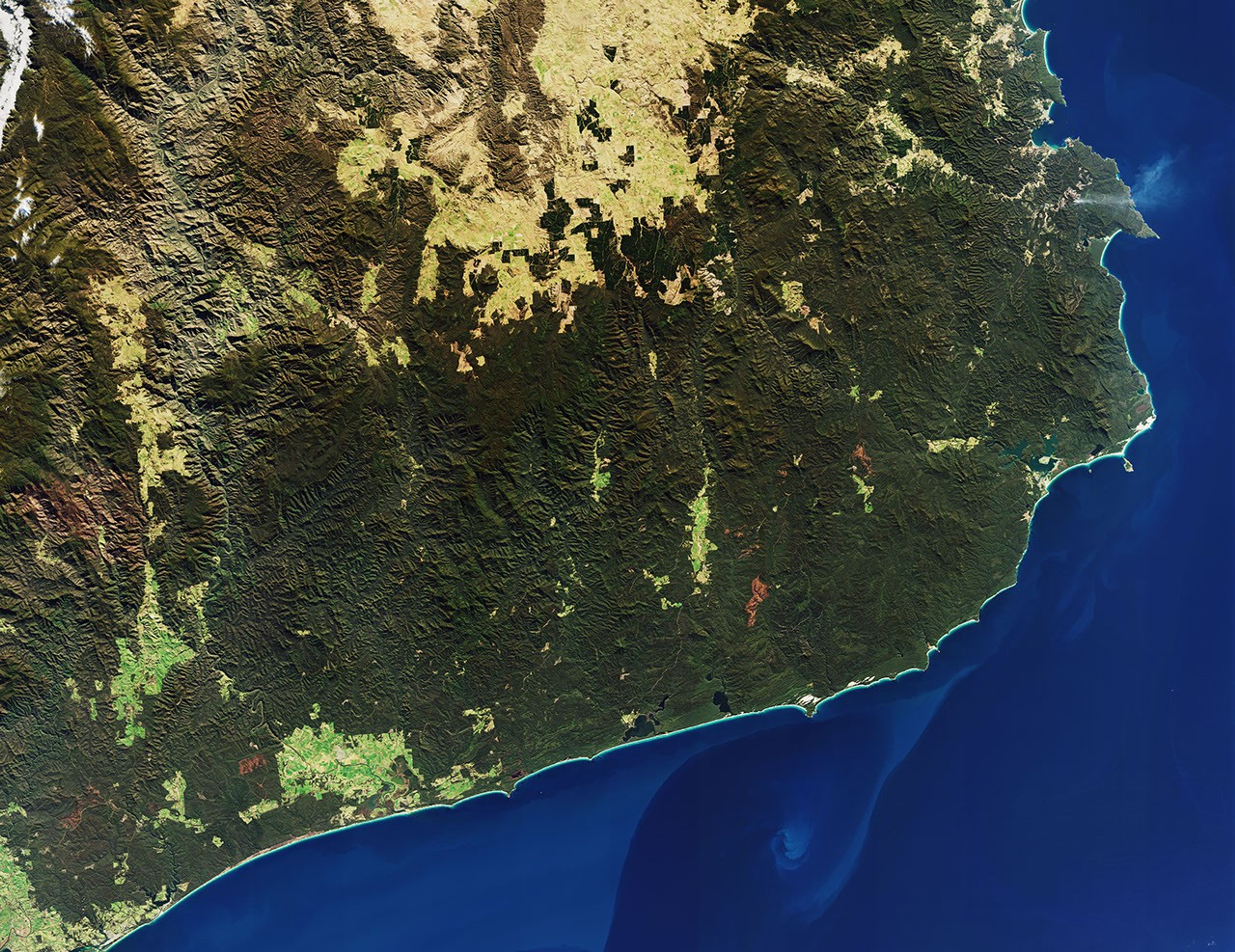
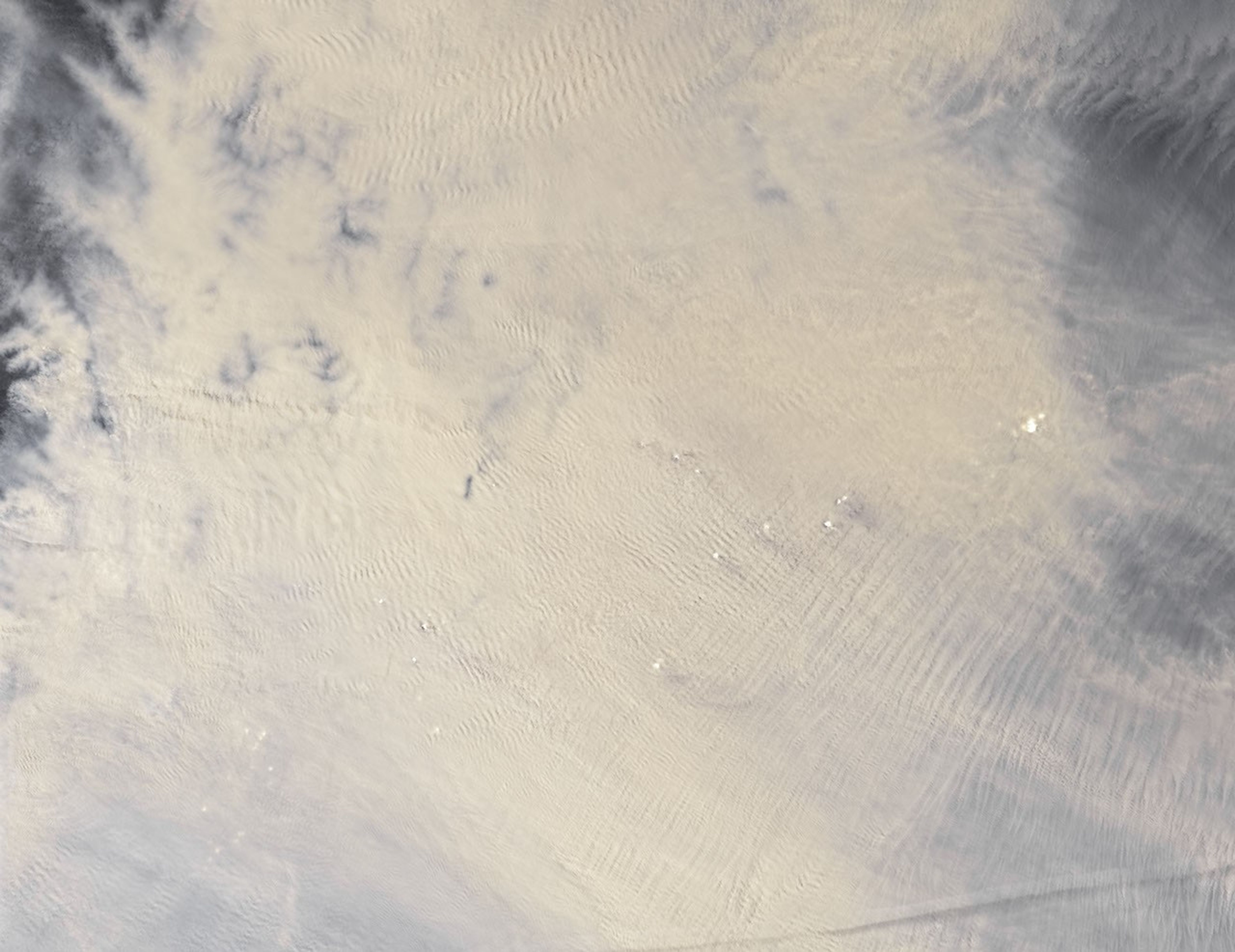
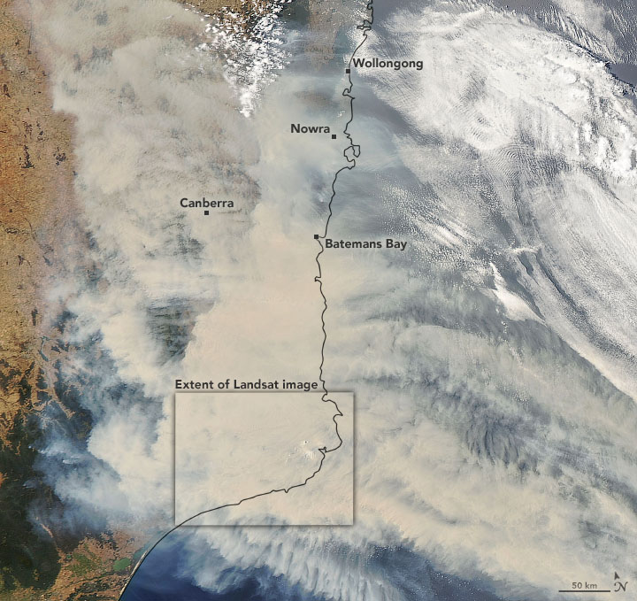
On January 1, 2020, the Operational Land Imager (OLI) on Landsat 8 acquired a natural-color image (above) of thick smoke blanketing southeastern Australia along the border of Victoria and New South Wales. For comparison, the second image shows what the same area looked like under cloud- and smoke-free conditions on July 24, 2019.
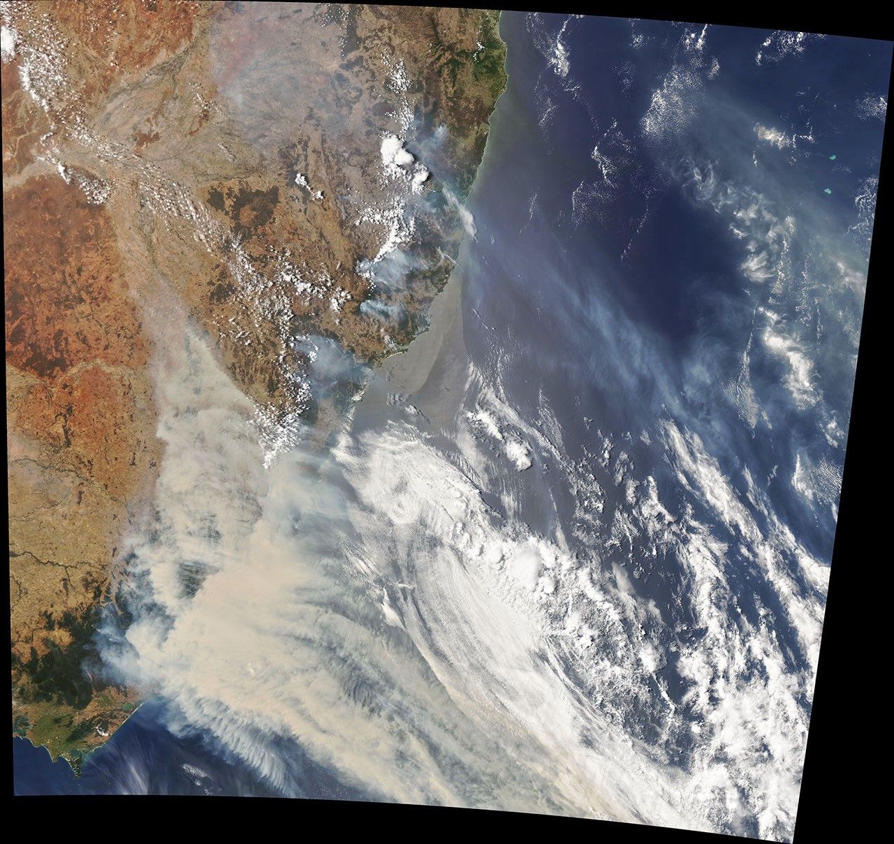
The wider view below was acquired on January 1, 2020, by the Moderate Resolution Imaging Spectroradiometer (MODIS) on NASA’s Aqua satellite. Smoke has a tan color, while clouds are bright white.
According to international and Australian media sources, at least 1,200 homes in Victoria and New South Wales have been destroyed by fires this season, which began early in the spring and has not subsided. Media have reported that at least 18 people have died and more than 5.9 million hectares (14.6 million acres) have burned. Air quality indices in southeastern Australia and as far east as New Zealand have been near or above the highest reportable levels.
In a late December 2019 report, the Australian Bureau of Meteorology reported that its Forest Fire Danger Index (FFDI)—which blends data on air temperatures, humidity, precipitation, winds, and other factors—has been well above average for 95 percent of the nation. More than 60 percent of Australia set record highs for fire danger this season, and the summer is only just underway.
References & Resources
- ABC News Australia (2020, January 2) NSW Premier Gladys Berejiklian declares state of emergency, as thousands flee South Coast ahead of horror fire weekend. Accessed January 2, 2020.
- ABC News Australia (2020, January 2) BOM weather forecast for NSW, Vic, SA, and ACT grim as cold front approaches WA. Accessed January 2, 2020.
- Australian Bureau of Meteorology (2019, December 19) Special Climate Statement 72âdangerous bushfire weather in spring 2019. Accessed January 2, 2020.
- BBC (2019, December 31) Mallacoota: Where Australiaâs bushfires turned day to night. Accessed January 2, 2020.
- BBC (2020, January 2) Latest photos of the devastating Australian bushfires. Accessed January 2, 2020.
- CNN International (2020, January 2) Australiaâ deadly wildfires are showing no signs of stopping. Hereâs what you need to know. Accessed January 2, 2020.
- New South Wales Government (2020) Air quality index data. Accessed January 2, 2020.
- The Washington Post (2020, January 2) Ash-covered Glaciers and Toxic Amber Skies: Australia Bushfire Smoke Spills Over New Zealand. Accessed January 2, 2020.
NASA Earth Observatory images by Joshua Stevens, using Landsat data from the U.S. Geological Survey and MODIS data from NASA EOSDIS/LANCE and GIBS/Worldview. Story by Mike Carlowicz.