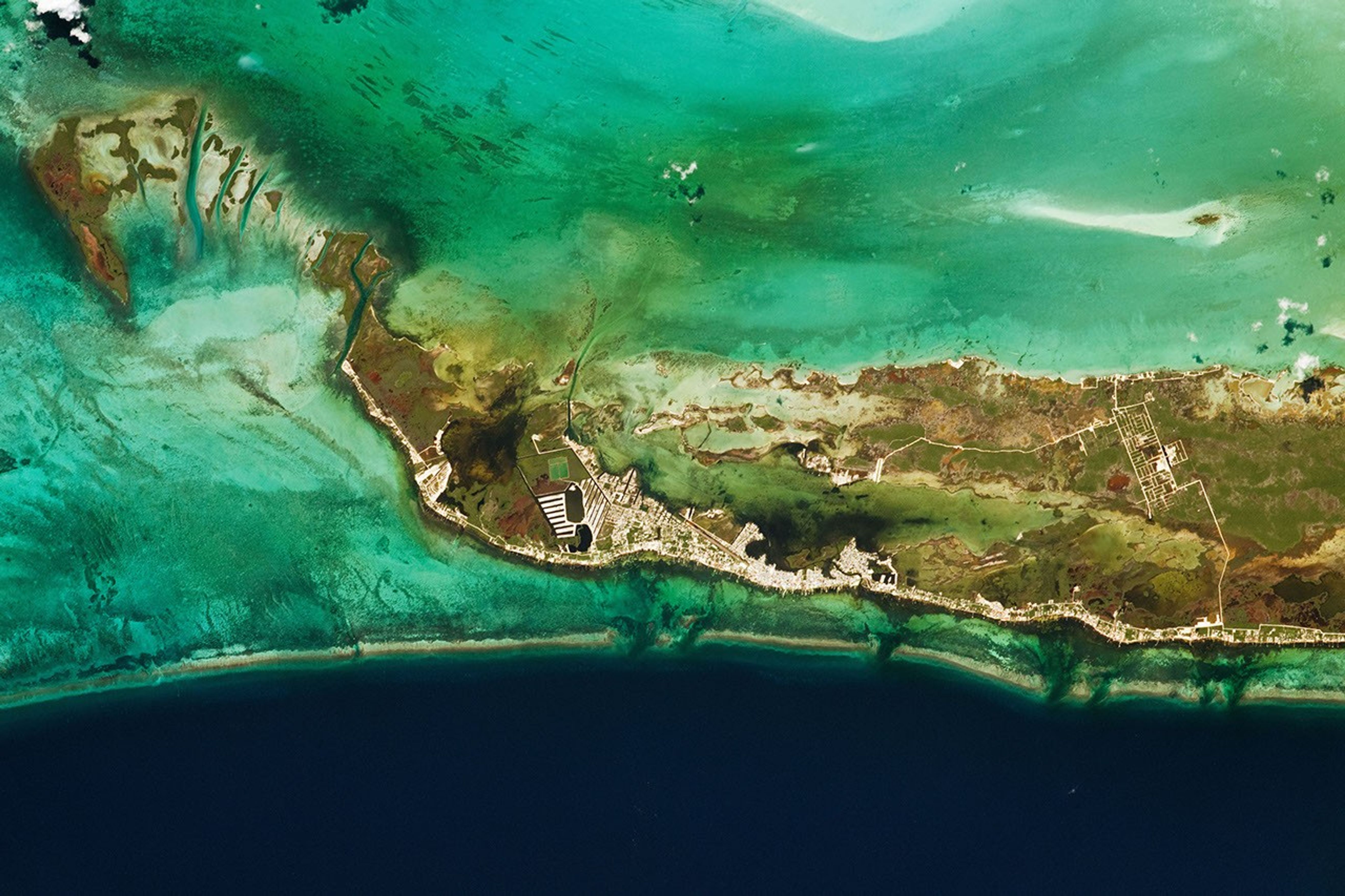


San Pedró, Belize, forms the center of this photograph taken by an astronaut from the International Space Station (ISS). Ambergris Cay, along with the reef system that surrounds it, separates the deep, darker blue of the Caribbean Sea from the shallower, multicolored waters of Chetumal Bay. The variation of water coloration is due to changes in water depth and the mixture of sand and coral that make up the reef system.
Ambergris Cay is Belize’s largest island, and it is encircled by the protected areas of the Belize Barrier Reef Reserve System. The cay and reserve are home to many mangrove species, among other abundant tropical flora and fauna.
The city of San Pedró often finds itself in the path of hurricanes and other extreme tropical weather systems, but the mangrove forests provide a strong natural defense against the winds and waves. Land development on the cay has increased over the past decade to serve visitors to Belize’s Secret Beach.
Belize’s barrier reef system is the second longest in the world and longest in the Northern Hemisphere. It forms a narrow demarcation between the cay and the deeper sea, and natural breaks—called quebradas (Spanish for “broken” or “ravine”)—provide mixing interfaces between shallow and deep water ecosystems. The reef system, including the nearby Great Blue Hole, has made the area popular with divers and camera-wielding astronauts.
References & Resources
Astronaut photograph ISS063-E-76408 was acquired on August 20, 2020, with a Nikon D5 digital camera using a focal length of 800 millimeters. It is provided by the ISS Crew Earth Observations Facility and the Earth Science and Remote Sensing Unit, Johnson Space Center. The image was taken by a member of the Expedition 63 crew. The image has been cropped and enhanced to improve contrast, and lens artifacts have been removed. The International Space Station Program supports the laboratory as part of the ISS National Lab to help astronauts take pictures of Earth that will be of the greatest value to scientists and the public, and to make those images freely available on the Internet. Additional images taken by astronauts and cosmonauts can be viewed at the NASA/JSC Gateway to Astronaut Photography of Earth. Caption by Alex Stoken, Jacobs, JETS Contract at NASA-JSC.