


- March 12, 2006 (3.94 MB)
- February 20, 2006 (3.02 MB)
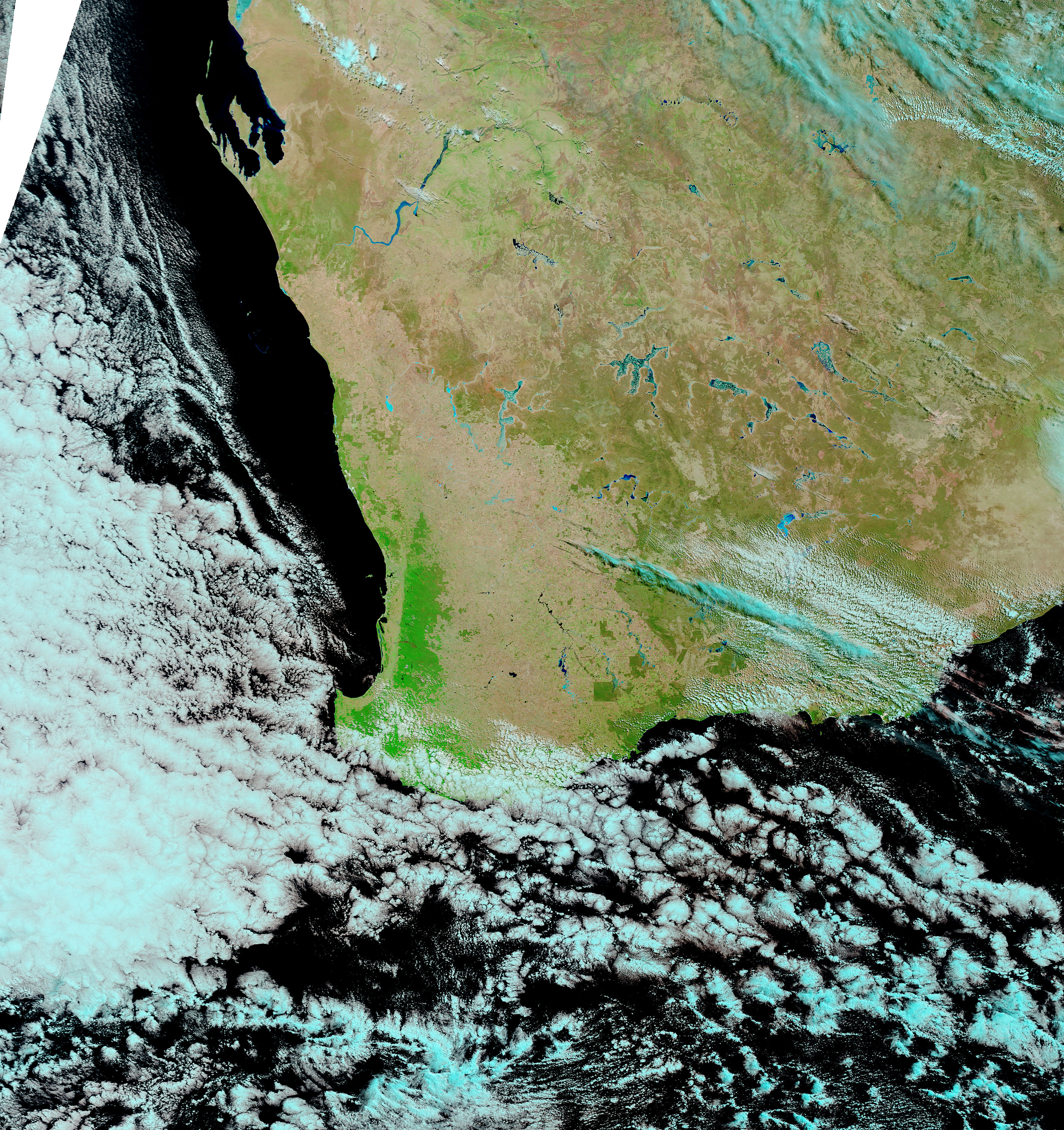
The Murchison River of central Western Australia was still grossly swollen on March 12, 2006, when the Moderate Resolution Imaging Spectroradiometer (MODIS) on NASA’s Terra satellite captured the top image. The flooding started when Cyclone Emma dumped heavy rain over the river basin on March 1. Since then, the glut of flood water has steadily made its way downstream, making the river bulge as it went. On March 9, the Australian Broadcasting Corporation reported that the river was at its highest level on record, expanding to more than ten kilometers wide in places. In the days following March 12, the flood water was expected to drain into the Indian Ocean through Kalbarri National Park and the city of Kalbarri.
In the image, the flood-widened river is a ribbon of blue, particularly in the southwestern reaches of the river. In these areas, the river had been a barely discernable blue line on February 20, lower image, before the cyclone hit. The large images have a resolution of 500 meters per pixel. They are available in additional resolutions, including MODIS’ maximum resolution of 250 meters per pixel, from the MODIS Rapid Response Team.
References & Resources
NASA images courtesy the MODIS Rapid Response Team at NASA GSFC.


