



























- August 22, 2007 (4.44 MB JPG)
- June 24, 2007 (3.57 MB JPG)
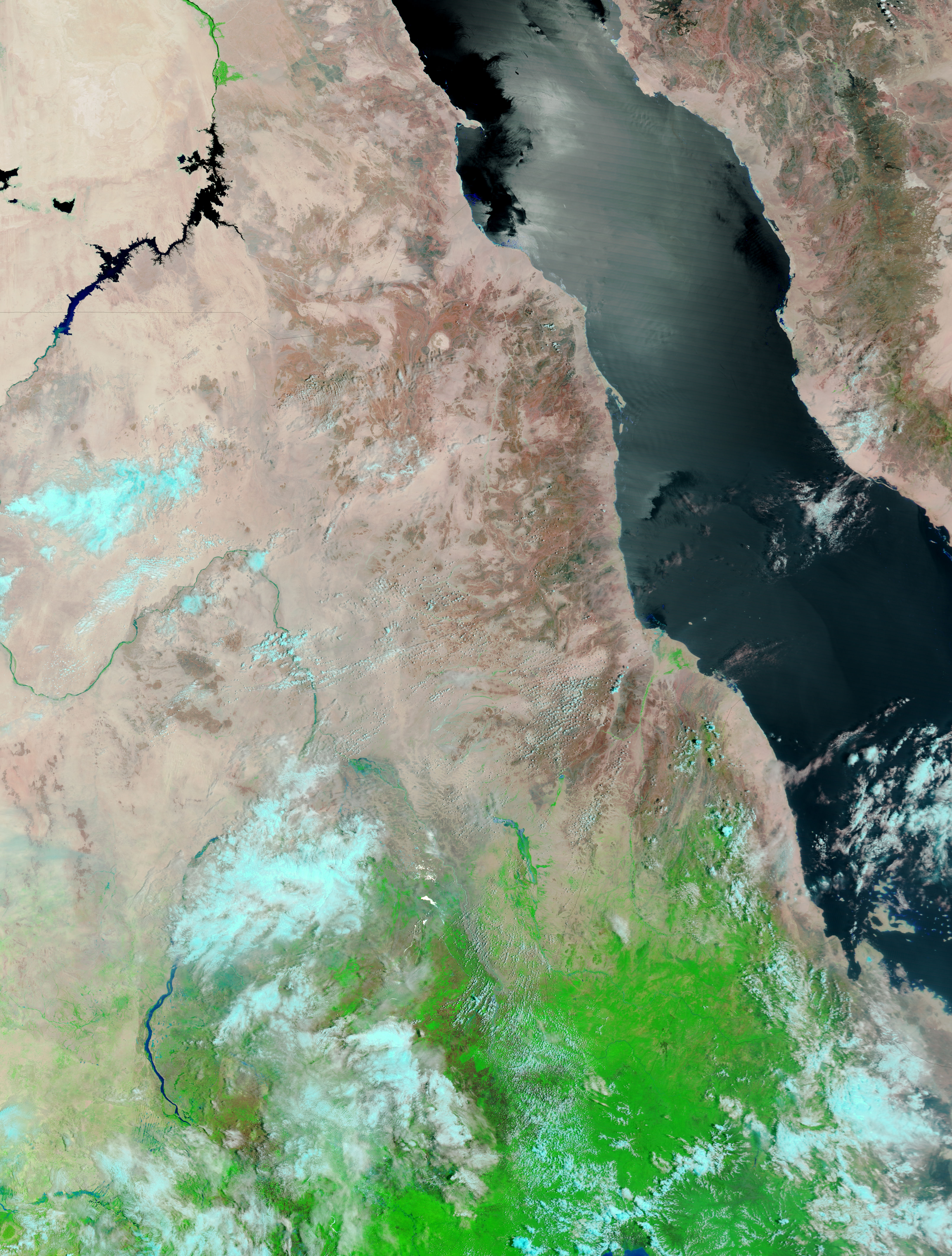
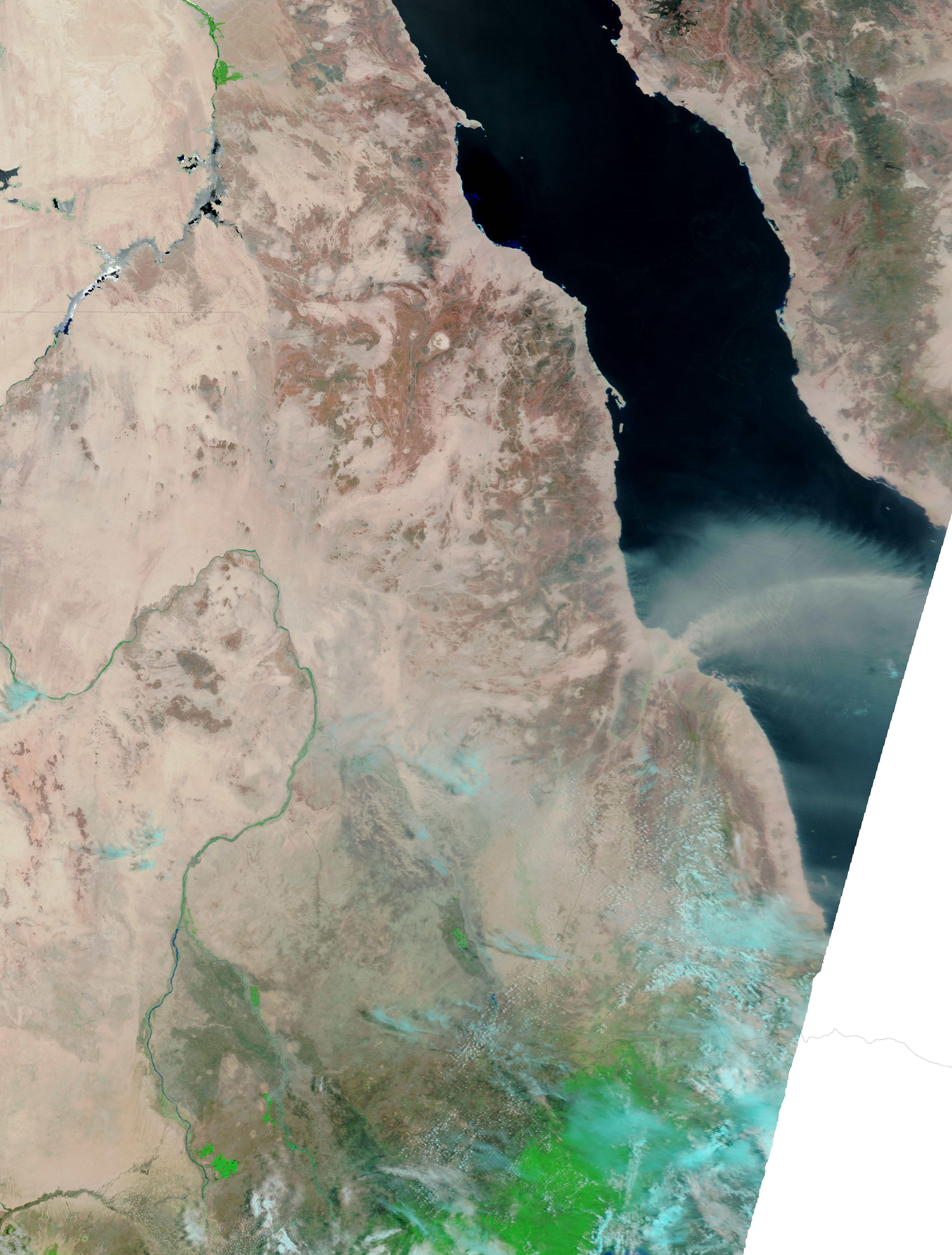
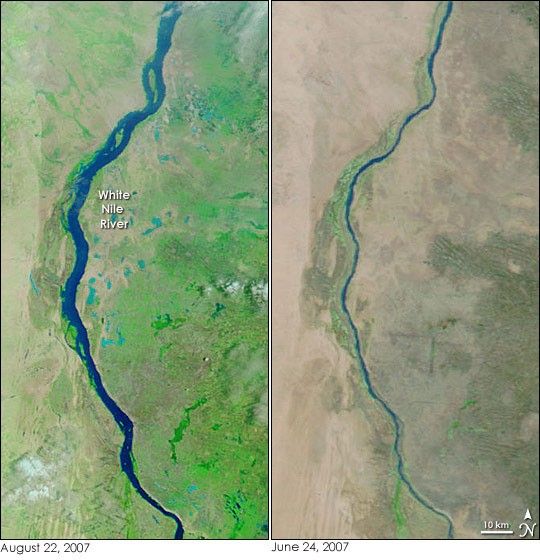
Unusually heavy wet-season rains triggered destructive floods throughout Sudan in July and August 2007. As of August 22, the floods had killed 89, affected at least 365,000 people, and destroyed more than 70,000 homes, reported Reuters. The Moderate Resolution Imaging Spectroradiometer (MODIS) flying on NASA’s Terra satellite observed high water levels on the White Nile River south of Khartoum on August 22. In the two months that passed between June 24, when the right image was taken, and August 22, when the left image was taken, the river had swollen considerably.
In these false-color images, water is dark blue. Lighter blue puddles surrounding the White Nile in the left image are probably patches of muddy soil or shallow pools of sediment-saturated water. In addition to causing floods, the rain has nourished plants. The landscape has gone from arid tan-pink to brilliant green. Daily images tracking the change through July and August are available from the MODIS Rapid Response System.
References & Resources
NASA images courtesy the MODIS Rapid Response Team at NASA GSFC.