


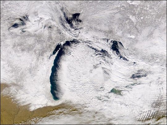
This Sea-viewing Wide Field-of-view Sensor (SeaWiFS) true-color image of Lake Michigan showsa lake effect where clear dry air moves eastwardfrom Wisconsin, picking up moisture as it traverses the lake and forming dense clouds by the time it reaches Lake Michigan's eastern shore. The scene was acquired on January 17, 2002.
Note the newly-fallen snow that covers Wisconsin, Michigan, and northern Illinois. The southern edge of the snow line extends to just south of the Chicago area. Chicago sits on the southwestern shore of Lake Michigan.
Except for cloudy areas in the west and east and around Lake Superior, the entire Canadian portion of the broader image can be seen to be snow covered as well. Lake Winnipeg (upper left) and James Bay (upper right of center) are frozen over.
References & Resources
Image courtesy the SeaWiFS Project, NASA/Goddard Space Flight Center, and ORBIMAGE


