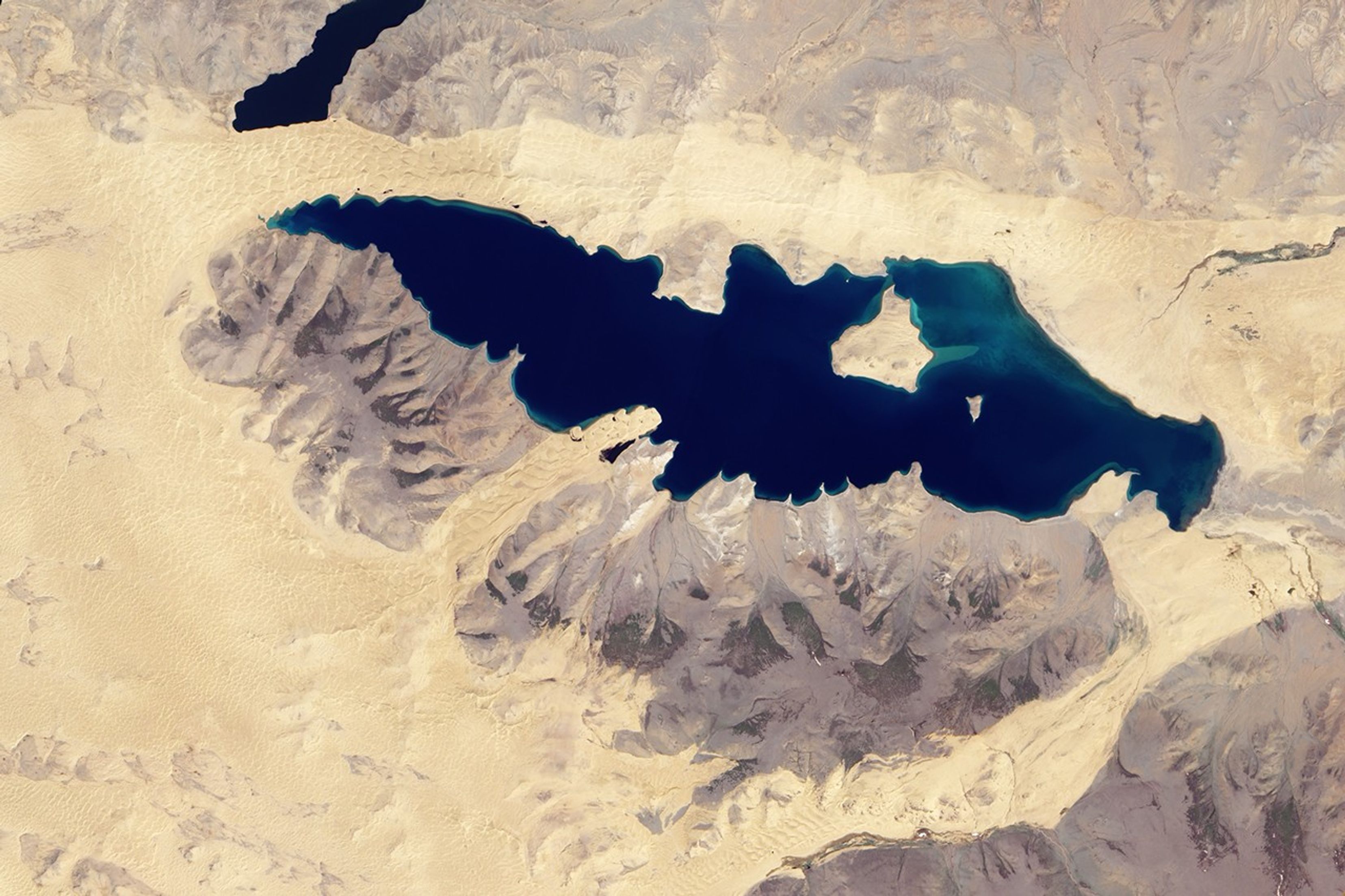


In western Mongolia, braided streams of sand dunes stretch east-westacross the arid landscape. One ribbon of sand, spanning roughly 200kilometers, extends from an area south of KhyargasLake in the west to a smaller lake, Telmen Nuur, in the east. Inbetween, sand dunes march past Har Nuur, or “Black Lake.”
The Advanced Land Imager (ALI) onNASA’s Earth Observing-1 (EO-1) satellite captured thisnatural-color image of Har Nuur on June 12, 2010. Camel-colored sanddunes ripple along the lake’s northern shore. Along the southernshore, sand dunes approach the lake in just two locations. Atriangle-shaped expanse of sand borders Har Nuur in the east, and atongue of sand intrudes into the lake in the west, pushing through a gapin the nearby mountains. All of the sand dunes, however, form part of alarger dune field nearly encircling the lake.
Har Nuur sits in the Valleyof Lakes of western Mongolia. Bordered by multiplemountain ranges, the Valley of Lakes hosts remnant basins of largerancient lakes, dune fields, and salt marshes. Har Nuur, like other lakesin the region, is a closed-basin lake fed by precipitation.
Hot, dry summers prevail in this part of the word, with frequent, hotwinds blowing from the northwest. Winds push the sand dunes eastwardpast Har Nuur and the nearby mountains. The long, skinny dune fieldpushing into the lake is a persistent feature. It was equally obviouswhen astronauts on the International Space Station photographed Har Nuur in 2006.
References & Resources
NASA Earth Observatory image created by Jesse Allen, using EO-1 ALI data provided courtesy of the NASA EO-1 team. Caption by Michon Scott.