


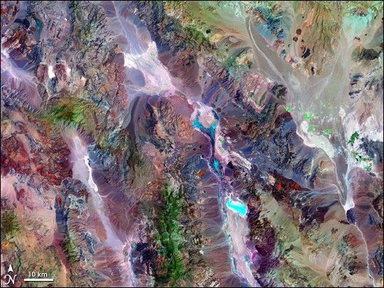
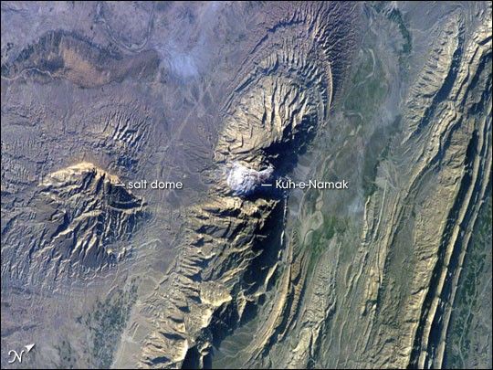
The Zagros Mountains in southwestern Iran present an impressive landscape of long linear ridges and valleys. Formed by collision of the Eurasian and Arabian tectonic plates, the ridges and valleys extend hundreds of kilometers. Stresses induced in the Earth’s crust by the collision caused extensive folding of the preexisting layered sedimentary rocks. Subsequent erosion removed softer rocks, such as mudstone (rock formed by consolidated mud) and siltstone (a slightly coarser-grained mudstone) while leaving harder rocks, such as limestone (calcium-rich rock consisting of the remains of marine organisms) and dolomite (rocks similar to limestone containing calcium and magnesium). This differential erosion formed the linear ridges of the Zagros Mountains. The depositional environment and tectonic history of the rocks were conducive to the formation and trapping of petroleum, and the Zagros region is an important part of Persian Gulf production.
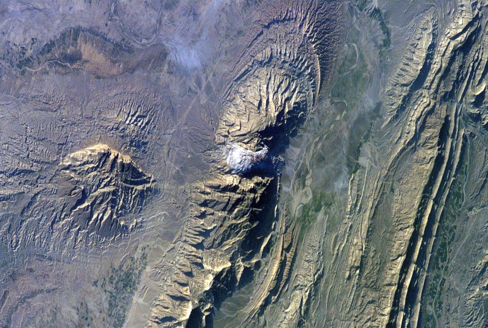
This astronaut photograph of the southwestern edge of the Zagros mountain belt includes another common feature of the region—a salt dome (Kuh-e-Namak or “mountain of salt” in Farsi). Thick layers of minerals such as halite (common table salt) typically accumulate in closed basins during alternating wet and dry climatic conditions. Over geologic time, these layers of salt are buried under younger layers of rock. The pressure from overlying rock layers causes the lower-density salt to flow upwards, bending the overlying rock layers and creating a dome-like structure. Erosion has spectacularly revealed the uplifted tan and brown rock layers surrounding the white Kuh-e-Namak to the northwest and southeast (center of image). Radial drainage patterns indicate another salt dome is located to the southwest (image left center). If the rising plug of salt (called a salt diapir) breaches the surface, it can become a flowing salt glacier. Salt domes are an important target for oil exploration, as the impermeable salt frequently traps petroleum beneath other rock layers.
References & Resources
Astronaut photograph ISS012-E-18774 was acquired February 28, 2006, with a Kodak 760C digital camera using a 180 mm lens, and is provided by the ISS Crew Earth Observations experiment and the Image Science & Analysis Group, Johnson Space Center. The image in this article has been cropped and enhanced to improve contrast, and lens artifacts have been removed. The International Space Station Program supports the laboratory to help astronauts take pictures of Earth that will be of the greatest value to scientists and the public, and to make those images freely available on the Internet. Additional images taken by astronauts and cosmonauts can be viewed at the NASA/JSC Gateway to Astronaut Photography of Earth.