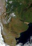
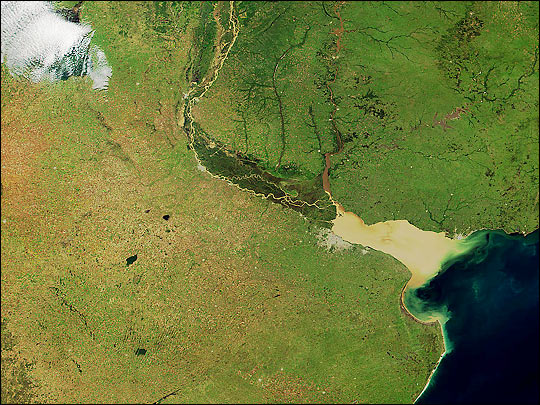
This Moderate-resolution Imaging Spectroradiometer (MODIS) image over Argentina was acquired on April 24, 2000, andwas produced using a combination of the sensor's 250-m and 500-mresolution "true color" bands. This image was presented on June 13, 2000 as a giftto Argentinian President Fernando de la Rua by NASA Administrator DanGoldin.
Note the Parana River which runs due south from the top of the imagebefore turning east to empty into the Atlantic Ocean. Note the yellowishsediment from the Parana River mixing with the redish sediment from theUruguay River as it empties into the Rio de la Plata. The water levelof the Parana seems high, which could explain the high sedimentdischarge.
A variety of land surface features are visible in this image. To thenorth, the greenish pixels show forest regions, as well ascharacteristic clusters of rectangular patterns of agricultural fields.In the lower left of the image, the lighter green pixels showarable regions where there is grazing and farming.
References & Resources
(Image courtesy Jacques Descloitres, MODIS Land Group, NASA GSFC)