Mangrove forests are one of the Earth’s most rapidly disappearing ecosystems. These coastal forests, with trees adapted to growing in salty soil and water, protect coastlines from erosion and are a natural barrier to strong coastal storms like hurricanes. The tangled root systems are a nursery for shrimp and many species of fish that go on to live their adult lives in the open ocean.
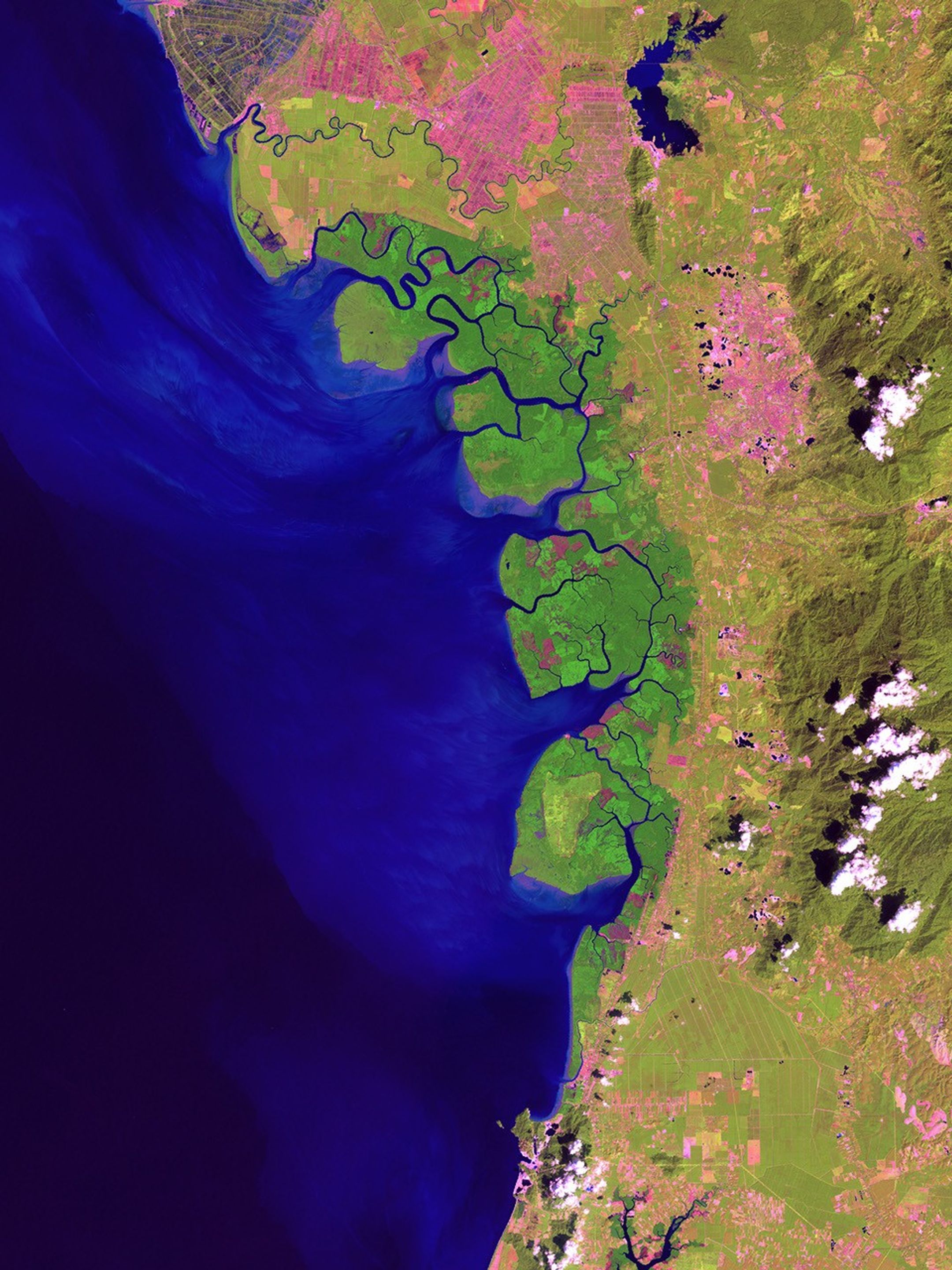
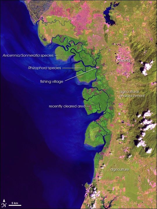
In some parts of the world, conservationists are working with local residents to develop sustainably managed mangroves forests that provide income and natural resources. Matang Mangrove Forest located in Perak State in peninsular Malaysia is one of the best examples of a sustainably managed mangrove forest. With an area of about 40,000 hectares (about 154 square miles), the reserve is the largest tract of mangrove forests in peninsular Malaysia. This image from NASA’s Landsat 7 satellite on December 27, 1999, shows the reserve and surrounding area.
The thick vegetation of the reserve stands out clearly from surrounding land that has been cleared for agriculture and towns. Five small fishing villages appear inside the forest reserve; the remaining areas are uninhabited. Seven major estuaries (wide river mouths) divide the mangrove areas, which are further dissected by numerous other rivers and waterways. A recently harvested area in the center of the reserve appears deep pink. Parts of the forest in different stages of regrowth appear in various shades of green. Cleared or developed areas are pink.
Between the most seaward parts of the mangrove forest and the most inland parts are zones of different vegetation, with trees and plants that are better adapted to high water and salt levels nearer the shore. Avicennia and Sonneratia tree species are closest to the open sea, followed by areas dominated by the mangrove forest’s most common species, Rhizophora apiculata. Subtle differences in color distinguish different species zones in the image.
The Matang Forest was designated as a Permanent Forest Reserve in 1906, and it has been intensively managed by the Forestry Department since 1908. Approximately 80 percent of the area is managed through a sustainable-yield production system, with a 30-year rotation cycle to produce charcoal and poles. The reserve is an important site for coastal migratory water birds and migrant forest birds. Some islands have permanently inundated lakes that are feeding grounds for herons, storks, and shorebirds. The reserve is also a resting place for migratory birds like the Milky Stork, which comes from as far away as Siberia. The Matang Mangrove Reserve are becoming one of the major tourist attractions of the region.
- Matang Forest Reserve Webpage, from the ASEAN Regional Center for Biodiversity.
- Mangrove Forests, featured article on World Wildlife Fund Website.
- Mangrove forests described on Wikipedia.
References & Resources
NASA image by Jesse Allen. Data and image interpretation provided by Chandra Giri, U.S. Geological Survey, Center for Earth Resources Observation and Science.