August 30, 2013
Flooding in Northeastern China
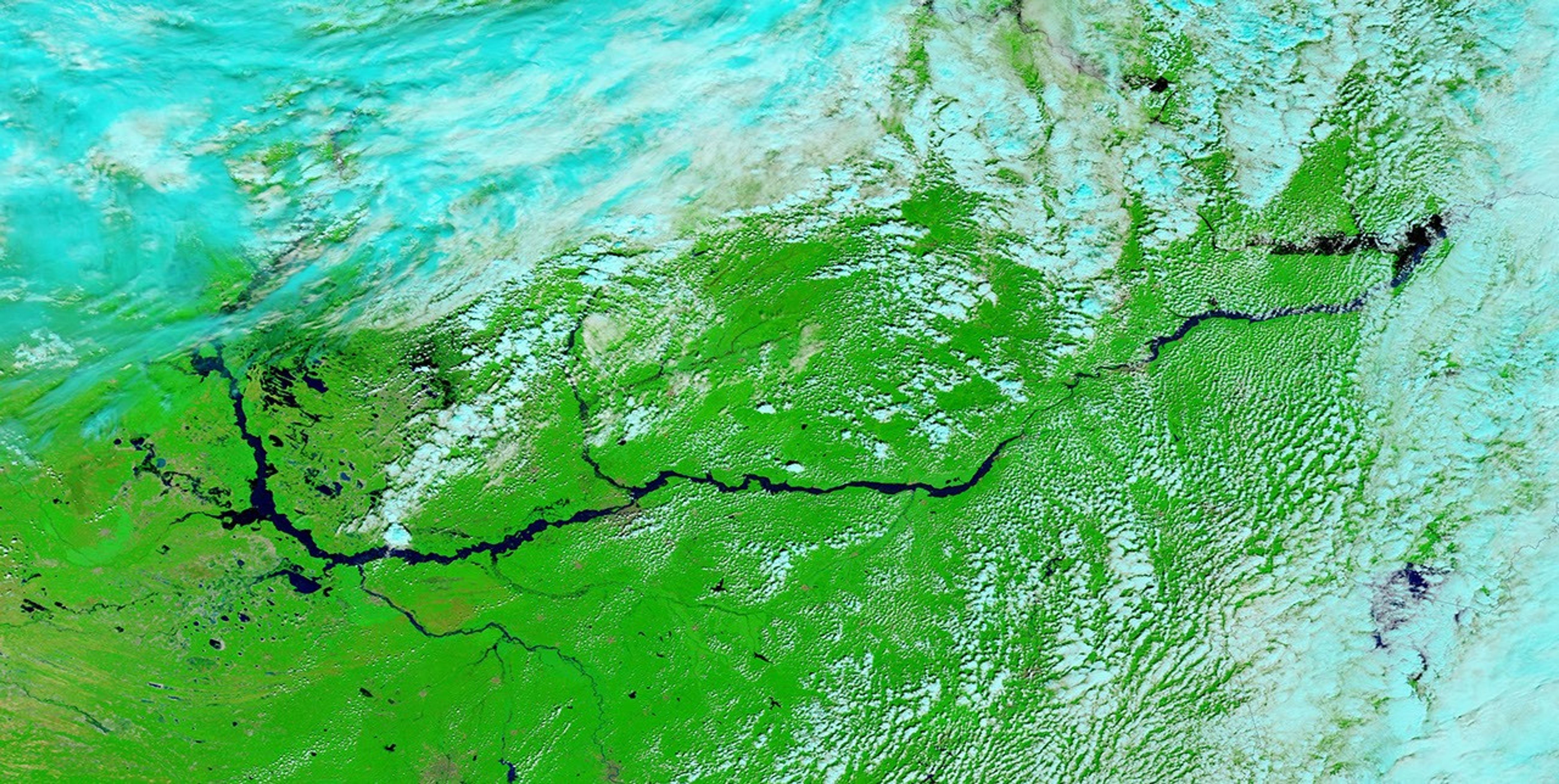
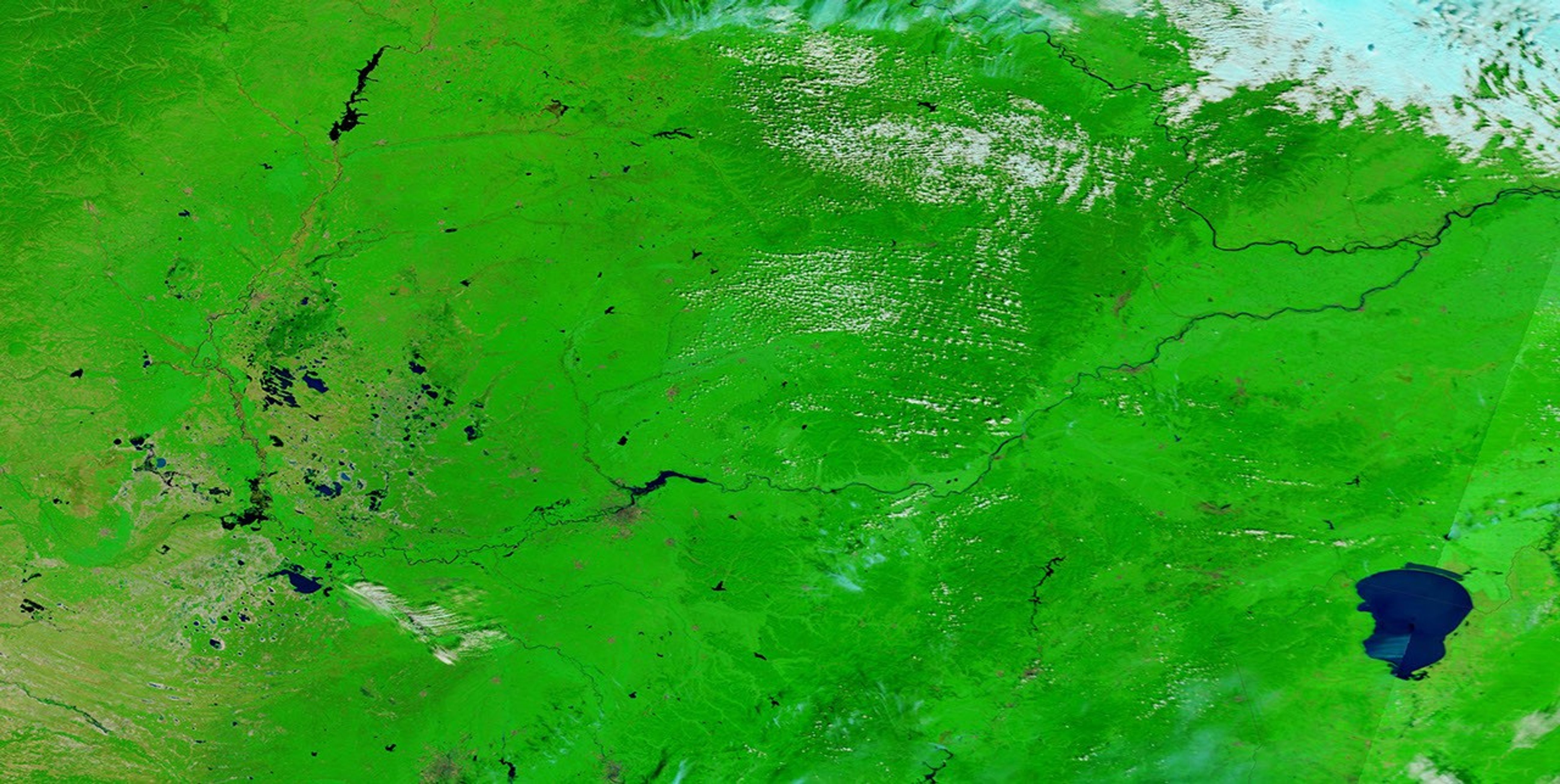
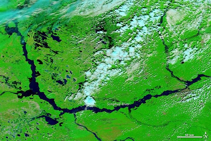
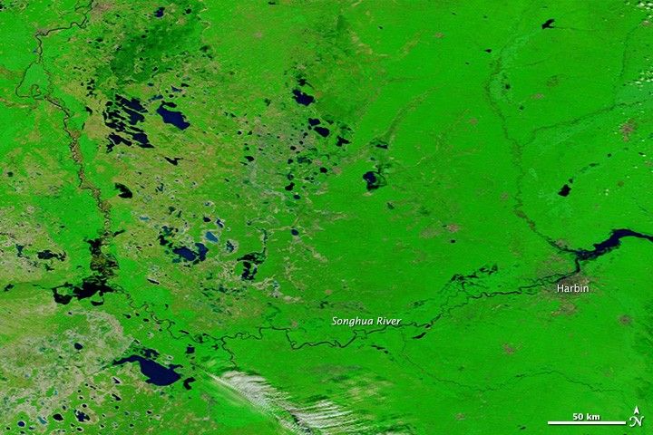
Summer rains have swollen rivers throughout northeastern China, including the Songhua River. Water levels peaked in Harbin on August 27, 2013, and have remained high. The Songhua River is one of many tributaries of the Amur (Heilongjiang) River, which is experiencing its most severe floods in a century.
The Moderate Resolution Imaging Spectroradiometer (MODIS) on NASA’s Terra satellite acquired these images of the river exactly one year apart, on August 30, 2013 (top) and August 30, 2012 (bottom). The images include infrared and visible light so that plant covered land is bright green and water is black. Blue and white clouds are scattered across the 2013 image.
References & Resources
- CCTV (2013, August 28) NE China floods threaten more people as peak reaches Harbin. Accessed August 30, 2013.
NASA image courtesy LANCE/EOSDIS MODIS Rapid Response Team at NASA GSFC. Caption by Holli Riebeek.