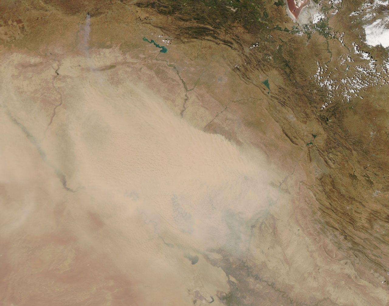
Thick dust clogged the skies over Syria and Iraq on June 18, 2012. The Moderate Resolution Imaging Spectroradiometer (MODIS) on NASA’s Aqua satellite captured this natural-color image in the afternoon on the same day. MODIS on the Terra satellite viewed the same location in the morning, when the dust storm was not as intense.
By the time MODIS acquired this image, the satellite sensor could barely detect Buhayrat ath Tharthar or large stretches of the Tigris and Euphrates Rivers. Fine sediments around these water bodies are frequently stirred up by dust storms. A network of temporary rivers in northern Iraq and Syria also provide material for dust plumes.
Arid regions like Syria and Iraq often experience severe daytime heat. This causes air near the ground to become unstable, enabling even light winds to loft dust particles into the air. The Weather Channel forecast temperatures above 100 degrees Fahrenheit (40 degrees Celsius) for Baghdad in late June 2012, which suggests that dust activity might continue.
References & Resources
- University Corporation for Atmospheric Research. Forecasting Dust Storms. (Registration required).
- The Weather Channel. (2012, June 19) Baghdad, Iraq Weather. Accessed June 19, 2012.
NASA image courtesy Jeff Schmaltz, LANCE MODIS Rapid Response. Caption by Michon Scott.