The combination of a wet spring that bulked up grasslands and a hot summer that left forests in the Blue Mountains parched set the stage for a wave of aggressive wildfires in October 2013. One of the larger fires in New South Wales raged outside of Sydney, near the communities of Balmoral, Yanderra, Wilton, and Yerrinbool.
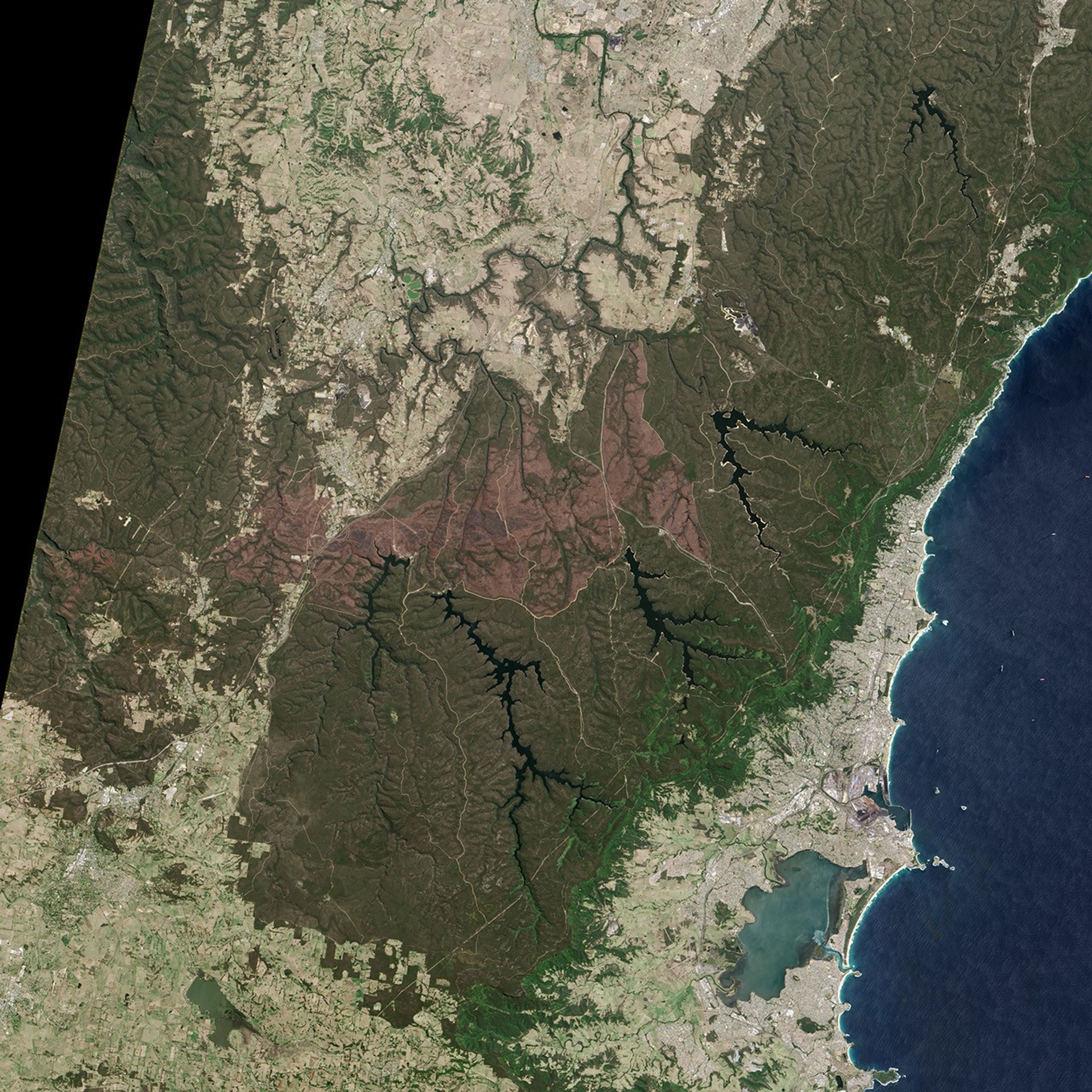
On November, 5, 2013, the Operational Land Imager (OLI) on Landsat 8 captured this natural-color view of the burn scar left by the fire. Areas with charred vegetation are brown. Forested areas that were not affected by the fire are green. The combination of buildings, roads, and fields appears white to pale brown.
The fire started on October 17 near Balmoral, then spread south and east toward Yanderra and Yerrinbool. After jumping Hume Highway, it moved farther east into the hills surrounding Lake Neapean, Lake Avon, and Lake Cordeaux. The blaze forced thousands of people to evacuate their homes. While firefighters prevented it from causing serious damage to property, a nearby blaze around the same time destroyed nearly 200 homes.
References & Resources
- Australian Broadcasting Corporation News (2013, September 2) Large areas of southern Australia at higher risk of bushfires this summer. Accessed November 8, 2013.
- Australian Broadcasting Corporation Rural (2013, September 2) Inland grass growth increases bushfire risk. Accessed November 8, 2013.
- Bushfire Cooperative Research Center and Australasian Fire and Emergency Service Authorities Council (2013, September) Southern Australia seasonal bushfire outlook 2013-14. Accessed September 9, 2013.
- Daily Telegraph (2013, October 21) Bargo and Yanderra townships unite as Balmoral bushfire burns on. Accessed November 8, 2013.
- Wollondilly Advertiser (2013, October 17) Fire burning in Balmoral, heading to Yanderra. Accessed November 8, 2013.
- Illawarra Mercury (2013, October 18) Gallery: Eerie scenes at Picton Road, Balmoral. Accessed November 8, 2013.
NASA Earth Observatory image by Jesse Allen and Robert Simmon, using Landsat data from the U.S. Geological Survey. Caption by Adam Voiland.