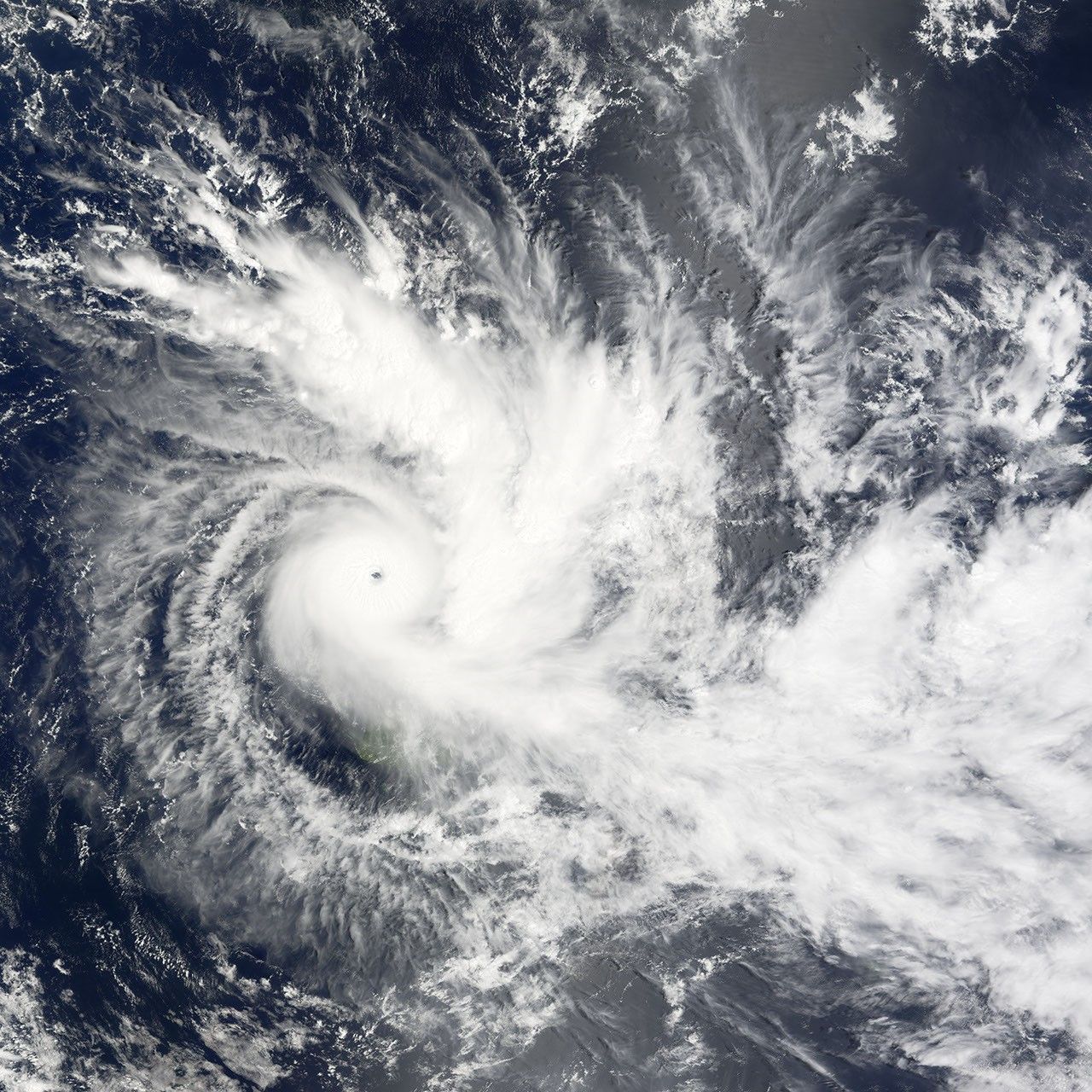


Tropical Cyclone Daman was powering up as it moved southeast towards the Fiji Islands on December 7, 2007. The Moderate Resolution Imaging Spectroradiometer (MODIS) on NASA’s Terra satellite captured this photo-like image of the storm over the South Pacific Ocean on December 7 at 10:20 a.m., local time (22:20 UTC, December 6). Daman has a clear, well-defined eye through which the dark blue ocean is visible. A faint circular shadow surrounds the eye where the towering clouds of the powerful thunderstorms that make up the eyewall cast shadows on the surrounding clouds. Tight bands of clouds spiral out from the eye. Daman’s distinct shape and well-defined eye reveal that it is a strong, well-formed storm. Despite that, the storm is relatively small; the north-south diameter of the core stretches roughly 350 kilometers (200 miles) in this image.
A few hours after the Moderate Resolution Imaging Spectroradiometer (MODIS) captured this image, the Joint Typhoon Warning Center estimated the storm’s winds to be 195 kilometers per hour (120 miles per hour or 105 knots) with gusts to 240 km/hr (150 mph or 130 knots), making it a strong Category 3 storm.
Daman was moving east-southeast and was expected to cross Vanua Levu, the easternmost of the two large islands shown here, late on December 7 and early on December 8, according to the Joint Typhoon Warning Center. Though the center of the storm was still far from the islands, the outermost bands of rain were already covering many of the Fiji Islands, including Vanua Levu and its western neighbor, Viti Levu, early on December 7 when MODIS captured this image. The storm could be one of the most destructive cyclones to strike Fiji in recent years, reported CNN on December 7.
You can download a 250-meter-resolution KMZ file of Cyclone Daman suitable for use with Google Earth.
References & Resources
NASA image created by Jesse Allen, using data provided courtesy of the MODIS Rapid Response team.