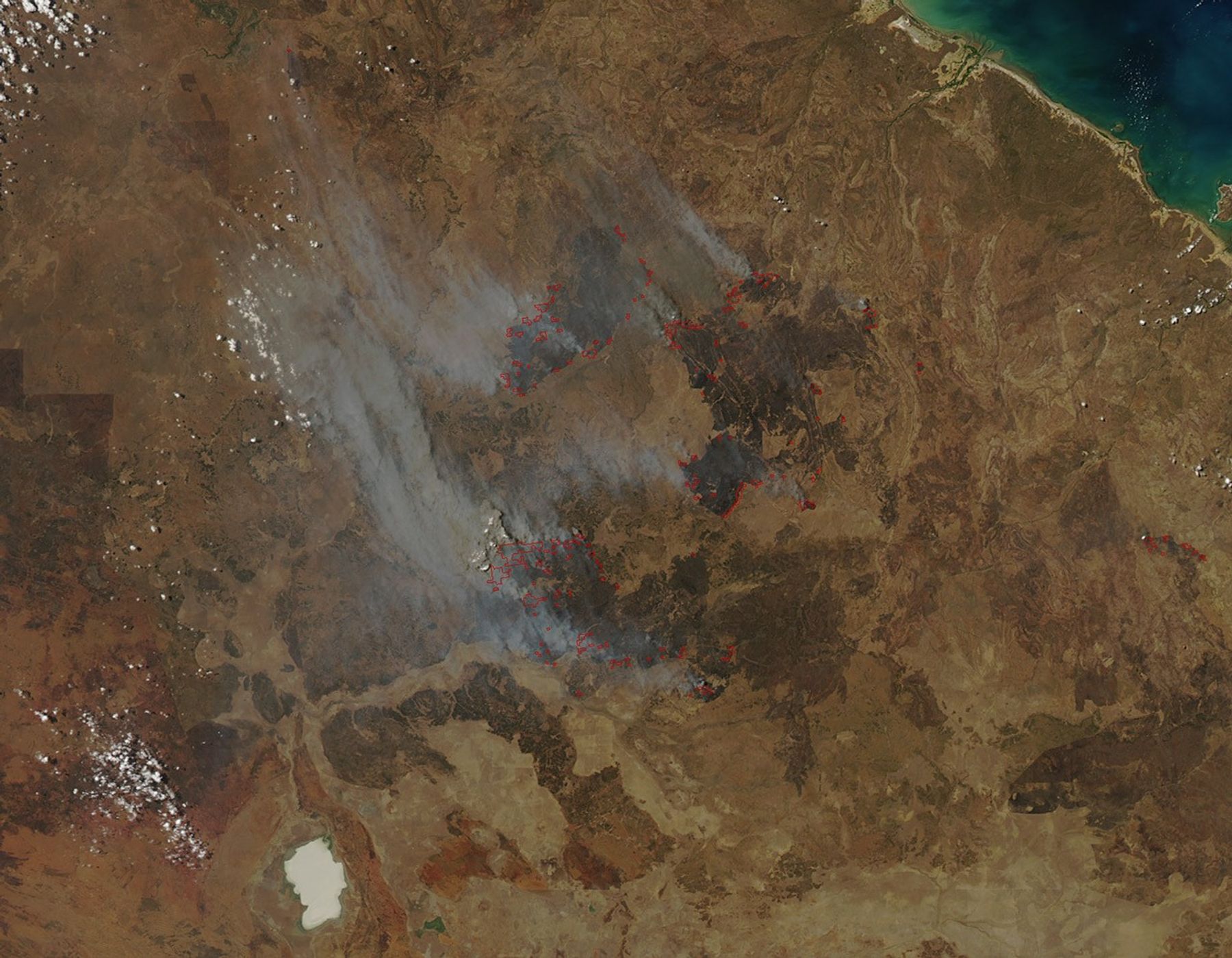
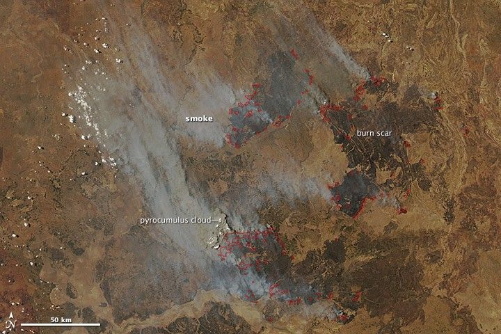
In early October 2012, intense bushfires blazed in Australia’s Northern Territory, in a remote area northeast of Elliott. The Moderate Resolution Imaging Spectroradiometer (MODIS) on NASA’s Aqua satellite captured this image of smoke from the fires streaming northeast on October 6, 2012. Red outlines indicate hot spots where MODIS detected unusually warm surface temperatures associated with fires.
The bright spots within the largest smoke plume are the tops of pyrocumulus clouds. Such clouds form when intense heat from a fire pushes air rapidly upward, causing water vapor in the air to cool and condense into clouds. Pyrocumulus clouds sometimes generate intense thunderstorms that can either dampen the flames with drenching rains or propel the fire with strong winds.
Wildfires are quite common in this part of Australia. Some areas, such as the savanna woodlands in the northern part of Northern Territory, burn nearly every year.
References & Resources
- Earth Observatory. (2010, August 31). Russian firestorm: Finding a fire cloud from space.
- Geosciences Australia. (2008, January). Understanding bushfire: trends in deliberate vegetation fires in Australia: Northern Territory. Accessed October 9, 2012.
NASA image courtesy Jeff Schmaltz, LANCE MODIS Rapid Response Team at NASA GSFC. Caption by Adam Voiland.