


Rain continues to fall in the United Kingdom, bringing more water to analready water-logged landscape. Some rivers there are experiencingtheir worst flooding in more than 50 years. Of particular note,Britain's River Ouse reached its highest levels on record since 1625.
Thousands of people have been evacuated from their homes since October30, when a large low-pressure system brought torrential rains andhurricane-force winds, placing regions around more than 40 rivers acrossthe country on flood alert. Since then, the rains have persisted,keeping water levels high and causing additional rivers to overrun theirbanks. In all, at least 12 people have been killed and more than 5,000properties flooded. Some officials estimate damages could reach 500million pounds (roughly $715 million).
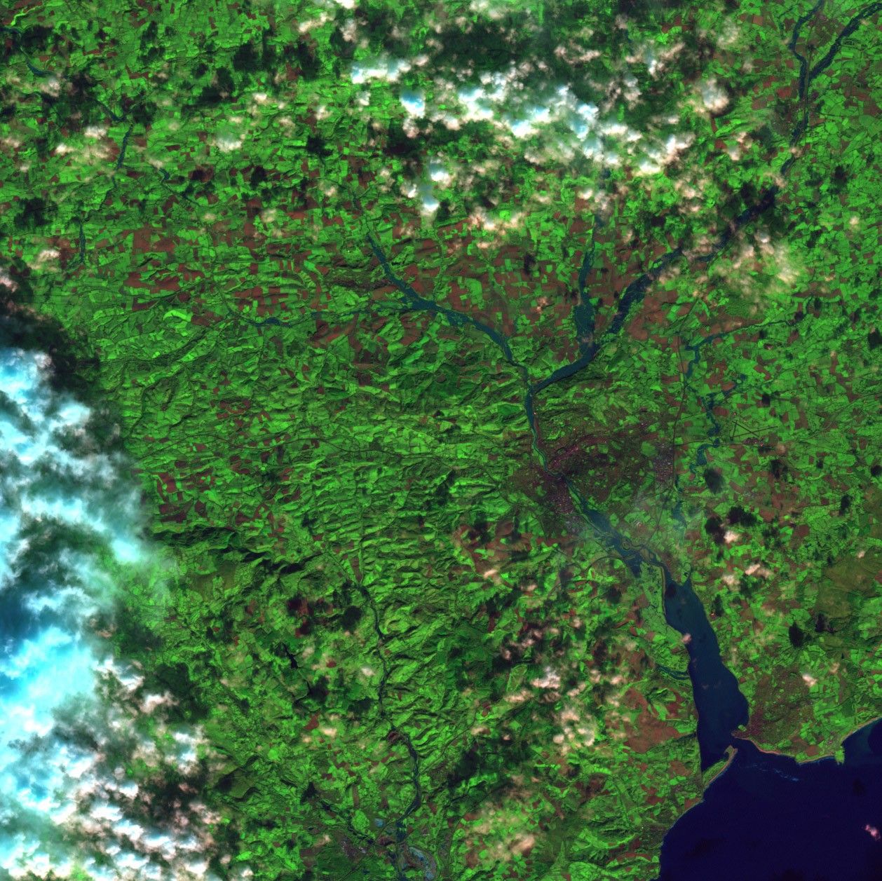
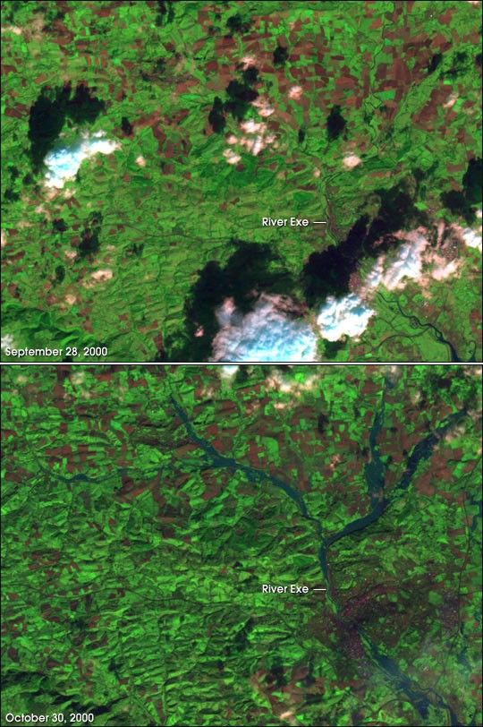
These Landsat 7 scenes show a comparison of the region surroundingExeter, England, before and after the floods. The top image wasacquired September 28 and the bottom image was acquired October 30,2000. Note the extensive flooding along the River Exe in the bottomimage (blue pixels). The light bluish-white pixels in the top image areclouds, and the black splotches on the landscape are the clouds'shadows. The reddish-brown shapes are agricultural fields.
References & Resources
Image by Robert Simmon and Brian Montgomery, NASA GSFC. Data provided by Ron Beck, USGS EROS Data Center.