


![Request for Information – Potential [Placeholder for Prize]](https://assets.science.nasa.gov/dynamicimage/assets/science/psd/solar/2023/09/s/solarsystem_0.jpg?w=1024)


- August 25, 2008 (2.70 MB JPG)
- July 20, 2008 (2.59 MB JPG)
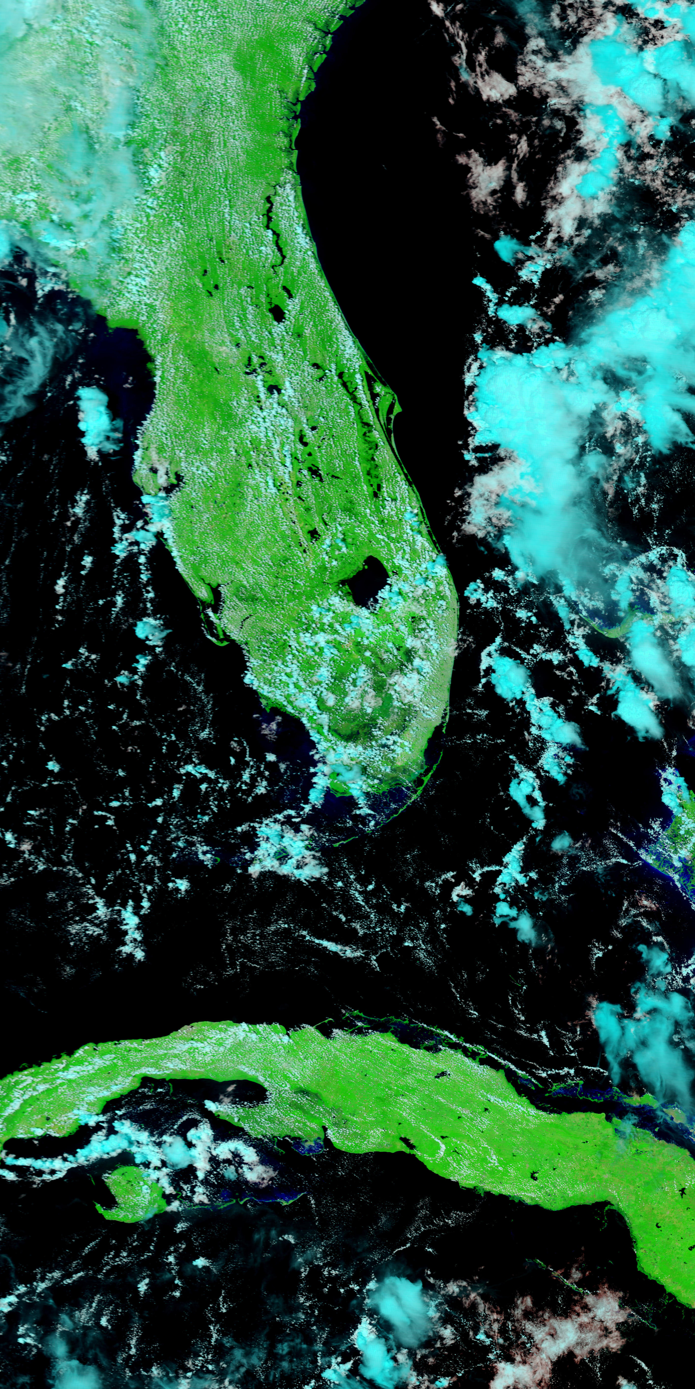
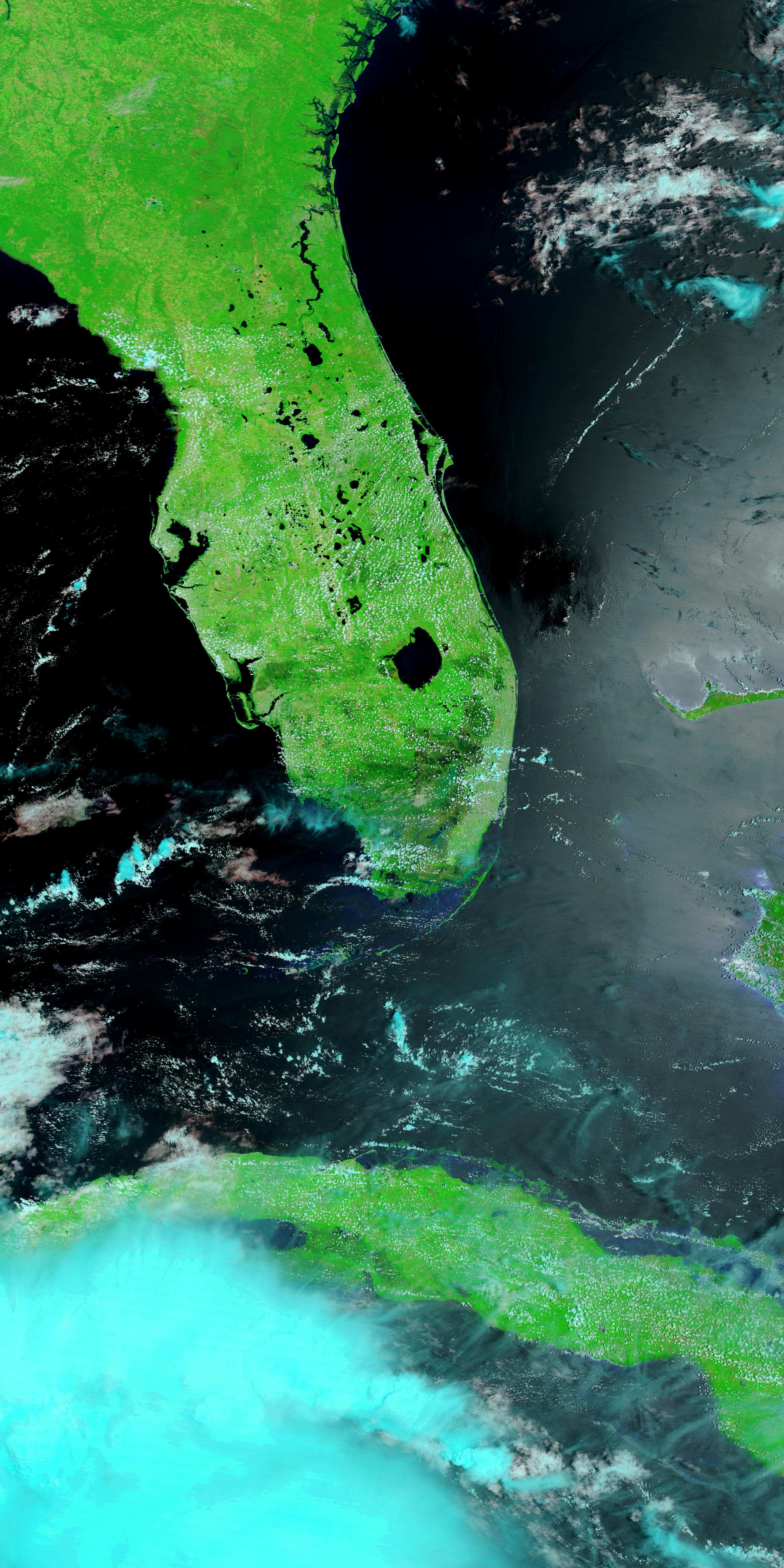
Tropical Storm Fay spent six days zig-zagging across Florida and dumping heavy rain (more than 2 feet in places) on the entire state between August 19 and August 24, 2008. By August 25, when the Moderate Resolution Imaging Spectroradiometer (MODIS) on NASA’s Terra satellite captured the top image, floods inundated much of Florida. The worst of the flooding was along the St. Johns River in central Florida, which reached 10.95 feet near Lake Harney on August 26, and water levels were still rising, said the National Weather Service. The river floods when water levels reach 8.5 feet.
Too small to be visible the previous month, the swollen river paints a wide black ribbon down the bright green plant-covered landscape in the top image. Tiny clouds, pale blue and white in this type of image, dot the skies in both images. The large image, which includes a broader area, shows additional flooding around Lake Okeechobee.
The St. Johns River lines the east coast of Florida near Cape Canaveral, home to NASA’s Kennedy Space Center. Tropical Storm Fay closed the center between August 19 and August 21, but caused only minor damage to the facilities and no damage to space hardware, according to initial assessments.
- References
- Advanced Hydrologic Prediction Service. (2008, August 26). St. Johns River. NOAA National Weather Service. Accessed August 26, 2008.
- Kennedy Space Center. (2008, August 21). NASA Kennedy to reopen for normal operations Friday. NASA. Accessed August 26, 2008.
- Unisys. (2008, August 26). 2008 hurricane/tropical data for Atlantic. Accessed August 26, 2008.
References & Resources
- References
- Advanced Hydrologic Prediction Service. (2008, August 26). St. Johns River. NOAA National Weather Service. Accessed August 26, 2008.
- Kennedy Space Center. (2008, August 21). NASA Kennedy to reopen for normal operations Friday. NASA. Accessed August 26, 2008.
- Unisys. (2008, August 26). 2008 hurricane/tropical data for Atlantic. Accessed August 26, 2008.
NASA images courtesy the MODIS Rapid Response Team at NASA GSFC. Caption by Holli Riebeek.
None


