Suggested Searches

1 min read

Rodeo and Chediski Fires in Arizona

Instruments:
Topics:
2024-07-07 12:00:00
July 7, 2002

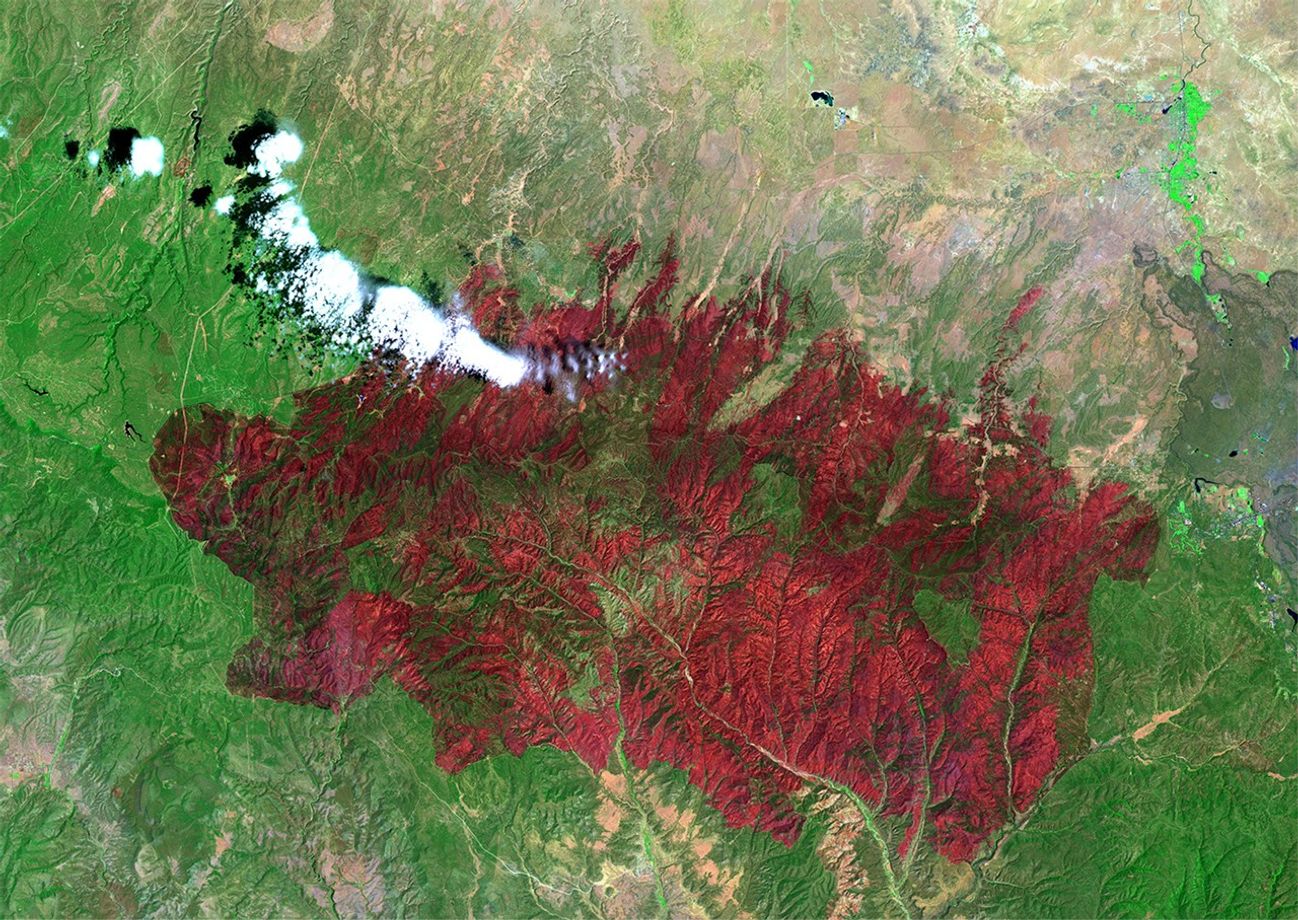
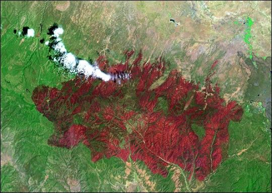
This image from the Landsat Enhanced Thematic Mapper Plus (ETM+) shows the Rodeo-Chediski Fire on July 7, 2002. The result of two large fires that combined into a single blaze, the fire consumed almost half a million acres, and was the largest and most expensive fire in Arizona’s known history, costing more than $30 million before it was contained.

In this false-color image, vegetation appears bright green and burned areas are deep red. Landsat ETM+ captured the fires? succession over three weeks (see links below.)
June 21, 2002
June 29, 2002

References & Resources

Image provided by the USGS EROS Data Center Satellite Systems Branch.

You may also be interested in:

Stay up-to-date with the latest content from NASA as we explore the universe and discover more about our home planet.

Fires on the Rise in the Far North
3 min read

Satellite-based maps show northern wildland fires becoming more frequent and widespread as temperatures rise and lightning reaches higher latitudes.

Article
Smoke Rises Over Big Cypress National Preserve
2 min read

The National fire has burned tens of thousands of acres within the Florida preserve, fueled by vegetation dried by prolonged…

Article
Winds Whip Up Fires and Dust on the Southern Plains
3 min read

Dry, gusty conditions spurred fast-growing fires in Oklahoma and Kansas, along with dangerous dust storms across the region.

Article