


August 29, 2013-August 3, 2015
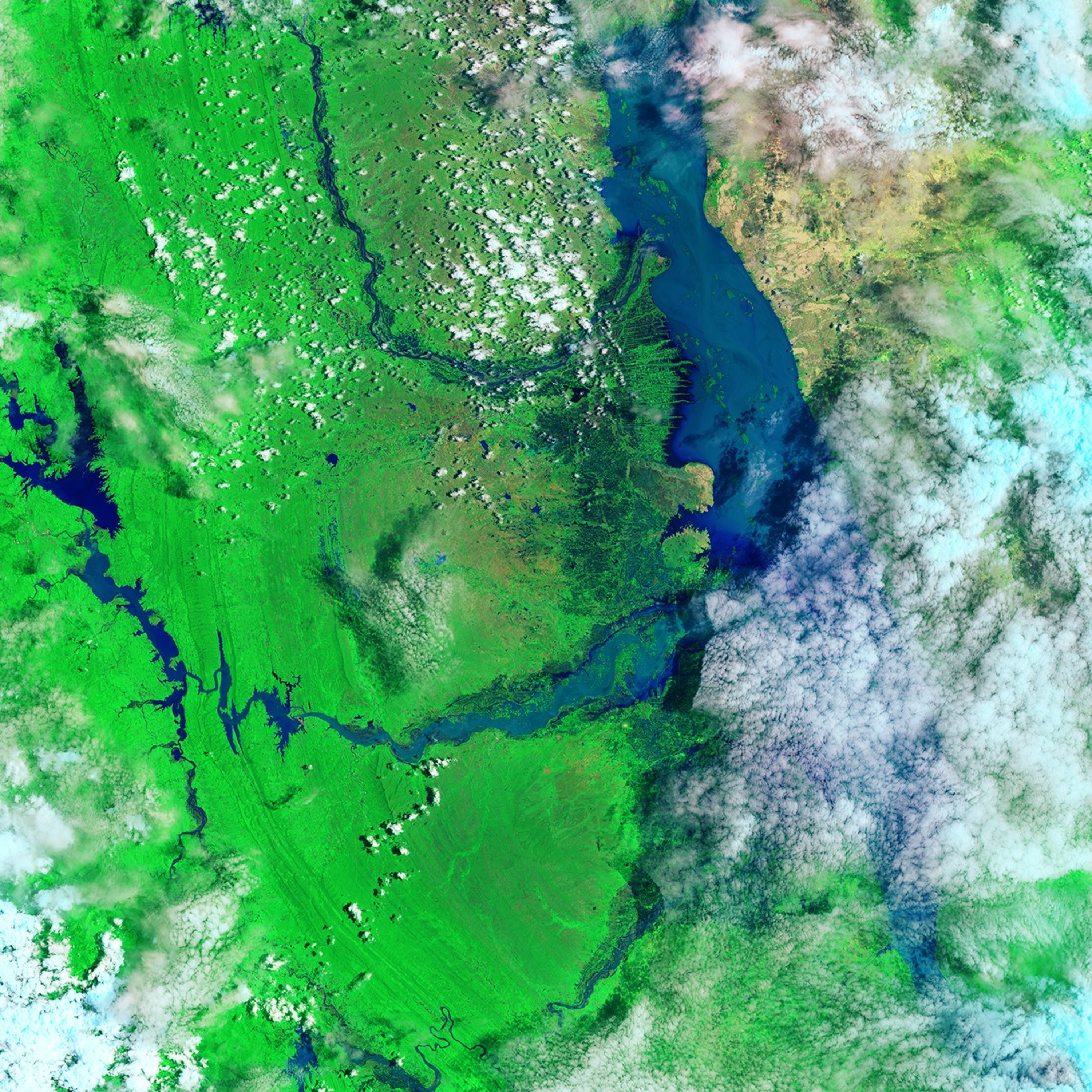
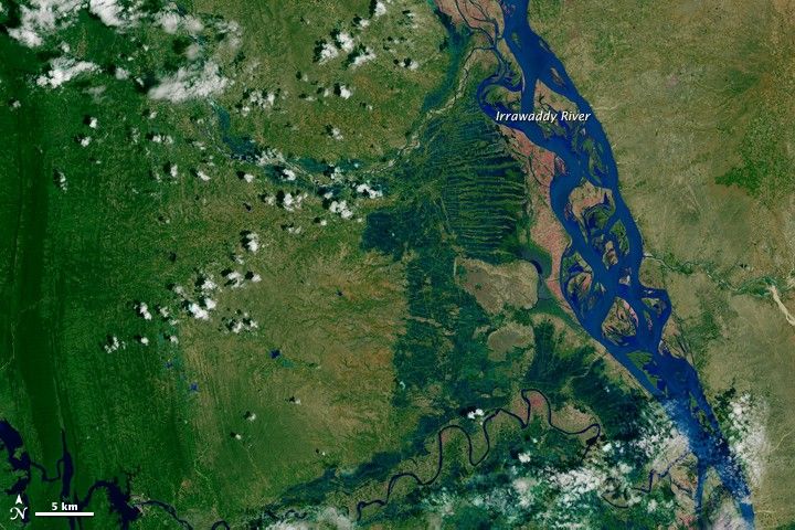
Flood Waters on the Irrawaddy
In May 2015, hot, dry weather was a concern for farmers in the Magway Region of Burma (Myanmar). Just a year before, drought destroyed many of the area’s crops. But dryness in May 2015 gave way to flooding in the monsoon season. Heavy rains have harmed crops, displaced thousands of residents, and lead to numerous deaths across the nation.
The widespread flooding has affected many rivers, including the Irrawaddy (Ayeyarwady). The composites above were made from images acquired by the Operational Land Imager (OLI) on the Landsat 8 satellite. The top image shows the swollen Irrawaddy River on August 3, 2015. The second image shows the river at a more normal level on August 29, 2013. Turn on the image comparison tool to see the river widen with the flood.
The images are composites of natural and false color. Areas of land are shown in natural color and appear brown and green. Areas with water are shown in false-color (including shortwave infrared) and appear bright blue. The artificially blue water makes it easier to see; during floods, disturbed sediment often colors rivers brown, which can make flood waters difficult to distinguish from land. Fully natural-color and false-color versions of both images are available for download.
As of August 10, news reports placed the death toll at more than 100 people. Food security is also a concern in Burma, as about 5,000 square kilometers (2,000 square miles) of rice fields were reported to be submerged.
Flooding during the monsoon season is not unusual in Burma (Myanmar), but the country has not seen this magnitude of flooding in several decades. The flooding was likely worsened by Cyclone Komen, which ravaged parts of the country a week earlier.
References & Resources
- BBC News (2015, August 10) Myanmar flooding affects one million. Accessed August 11, 2015.
- Channel NewsAsia (2015, August 10) Myanmar flood death toll tops 100, one million affected. Accessed August 11, 2015.
- The Nation (2015, May 22) Tug-of-war for early rain. Accessed August 11, 2015.
NASA Earth Observatory images by Joshua Stevens, using Landsat data from the U.S. Geological Survey . Caption by Kathryn Hansen.