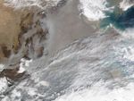
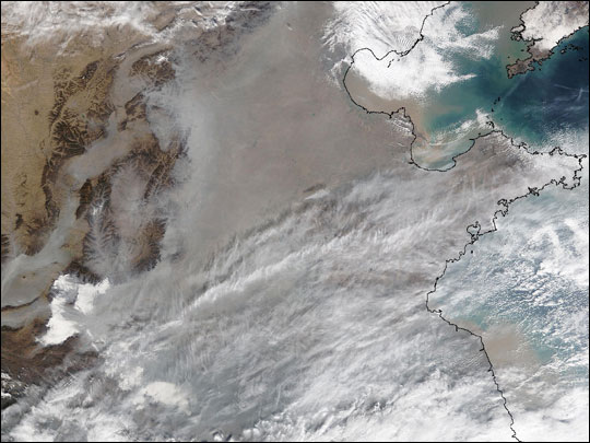
This true-color image over northeastern China was acquired by the Moderate Resolution Imaging Spectroradiometer (MODIS), flying aboard NASA’s Terra satellite, on Nov. 21, 2002. A thick, dark gray layer of smog covers the entire region east of the dark brown hills in the image. The pollution is due to industrial emissions, automobile exhaust, and other human induced emission. Notice how the smog fills the valleys and courses around the contours of the terrain in China’s hilly and mountainous regions. The terrain higher in elevation is less obscured by the smog than the lower lying plains and valleys in the surrounding countryside. Along the coast the pollution can be seen inching out over the ocean.
The scene spans an area from roughly south of Beijing at the top of the image to just north of the Yangtze River at the bottom. The body of water on the right is the Yellow Sea, and the arid region on the upper left is the eastern edge of the great Gobi Desert.
References & Resources
Image courtesy Jeff Schmaltz, MODIS Rapid Response Team, NASA GSFC