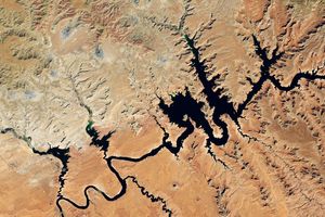
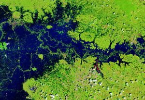
In early May 2003, heavy rains in south central Africa led to flooding along Namibia’s Caprivi Strip. High waters along the Zambezi River and its tributaries displaced 25,000 people. The floodwaters can be seen in this false-color image (right) acquired on May 14, 2003, by the Moderate Resolution Imaging Spectroradiometer (MODIS) aboard NASA’s Terra spacecraft. The floodwaters resemble a lake in the center of the image.
In March, the flooding was much less extensive (left, acquired on March 27, 2003). During the dry season, this lake would be completely absent and the Zambezi River would resemble a barely visible, thin line. In this false-color image, water is black. Clouds appear as pale blue and white, and vegetated land is green and yellow.
References & Resources
Image by Jesse Allen, based on data from the MODIS Rapid Response Team at NASA-GSFC