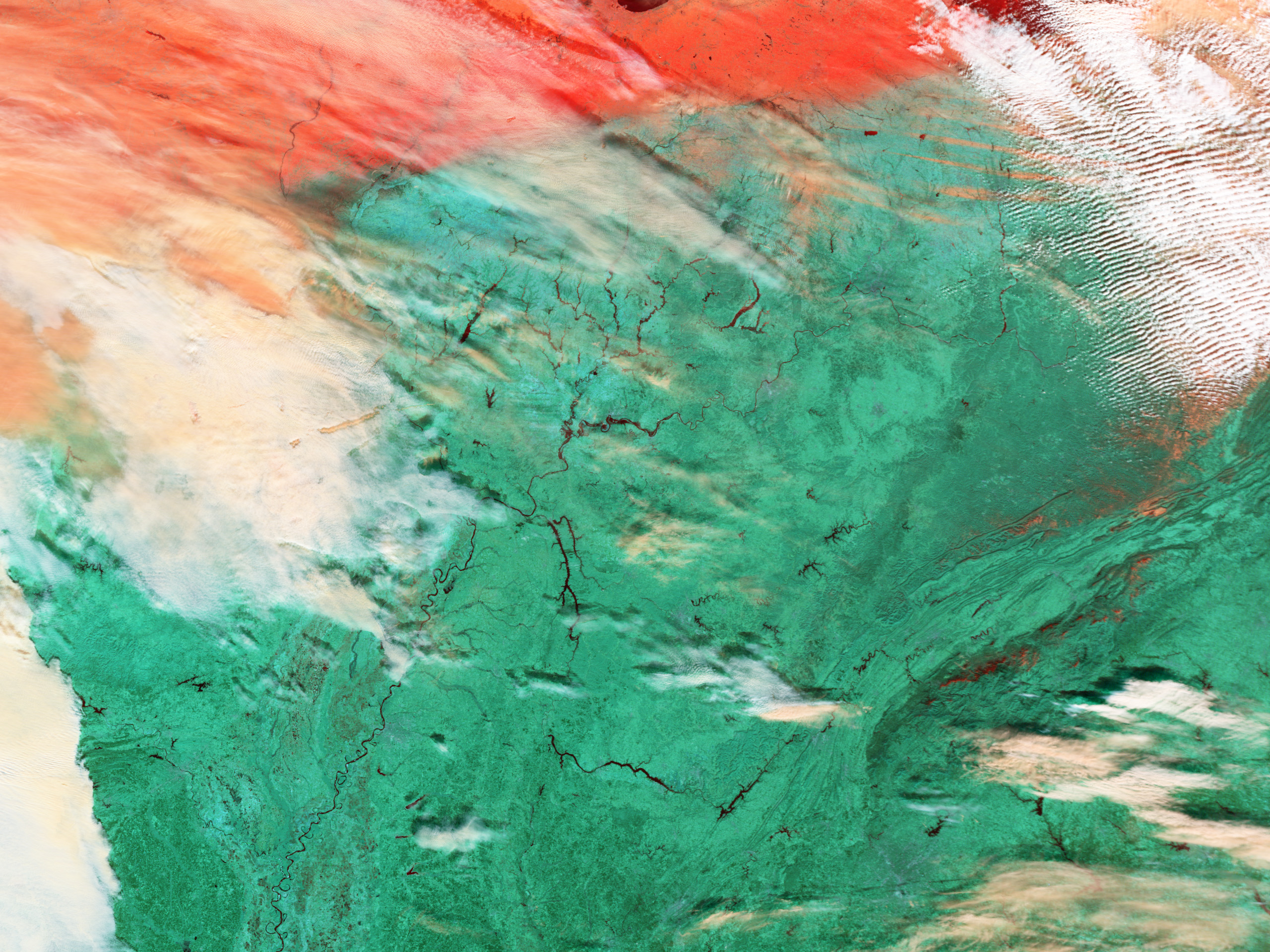

- January 7, 2004 (1.9 Mb JPEG)
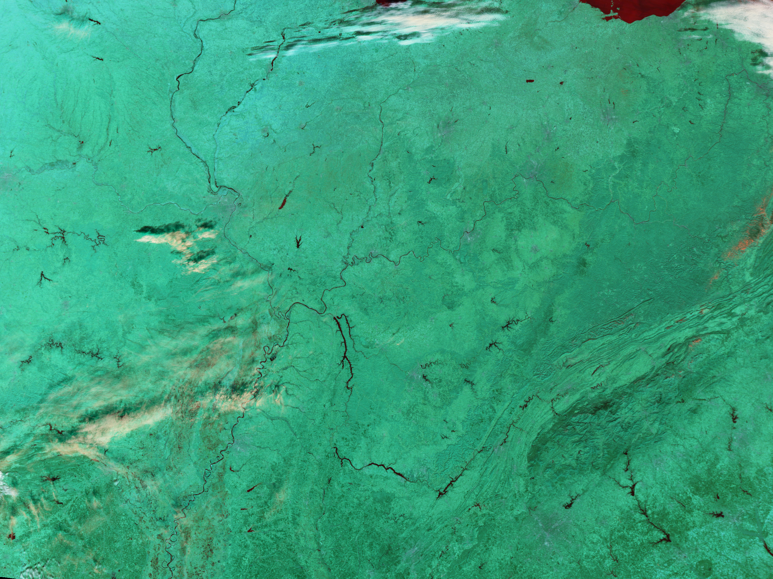
- December 31, 2003(2.0 Mb JPEG)
Heavy rain and snow on January 4 and 5, 2004, have left swollen rivers throughout the U.S. Midwest. Illinois, Indiana, and Kentucky are shown in these false-color Moderate Resolution Imaging Spectroradiometer (MODIS) images where water is black, vegetation is green, and clouds are white and peach. In the top image, taken on January 7, 2004, by the Terra satellite, the Ohio, Wabash, and White Rivers are noticeably wider compared to an image acquired just one week earlier. The Ohio and the Wabash Rivers form a “v” in the center of the image, with the Ohio River on the south. Near the top of the image, the White River branches off of the Wabash River. Other area rivers also appear to be fuller.
The states affected by the floods include Illinois, Indiana, Ohio, Kentucky, and West Virginia. According to news reports, the flood waters are covering mostly farmland, though houses and roads were also flooded. Cold temperatures followed the storm, making clean-up difficult.The high-resolution images provided above have a resolution of 500 meters per pixel.
References & Resources
Image courtesy Jesse Allen, based on data from the MODIS Rapid Response Team at NASA GSFC